
Kanarraville

With many of the national parks closed, and the world feeling the devastating effects of the pandemic, our focus for the remaining weeks we had in Utah was to stay safe and do what we could to avoid contact with other people. We had planned to stay in Kanarraville, a city of less than 400 people and really only 2 blocks of “town” (per the US census, the town has a total area of 0.46 square miles) - certainly one of the easiest places to avoid people. It also meant that we were situated in a rather remote section of Utah that allowed us to continue to explore the beautiful geology of the area in isolation.
While we hiked thru a variety of terrains, there are three major areas that will stand out as true gems: the slot canyons on the edge of the Hurricane Cliffs; Gooseberry Mesa; and the Red Cliff Conservation Area.
Slot Canyons

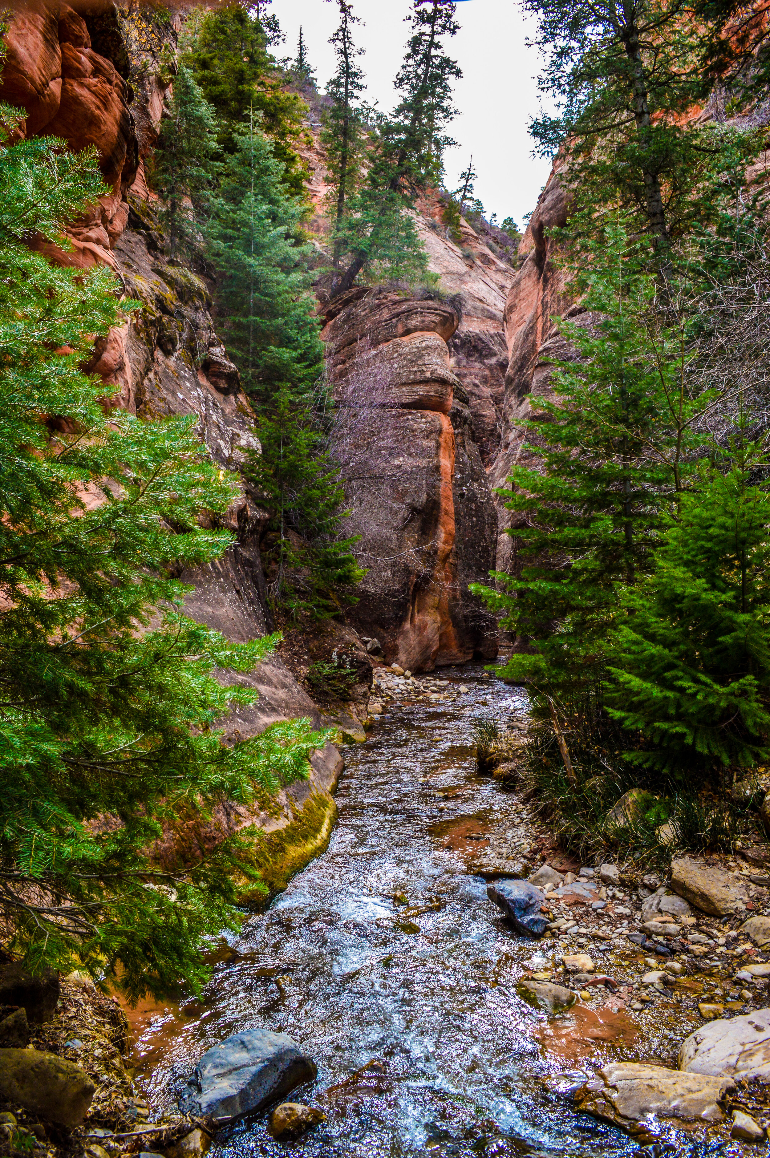
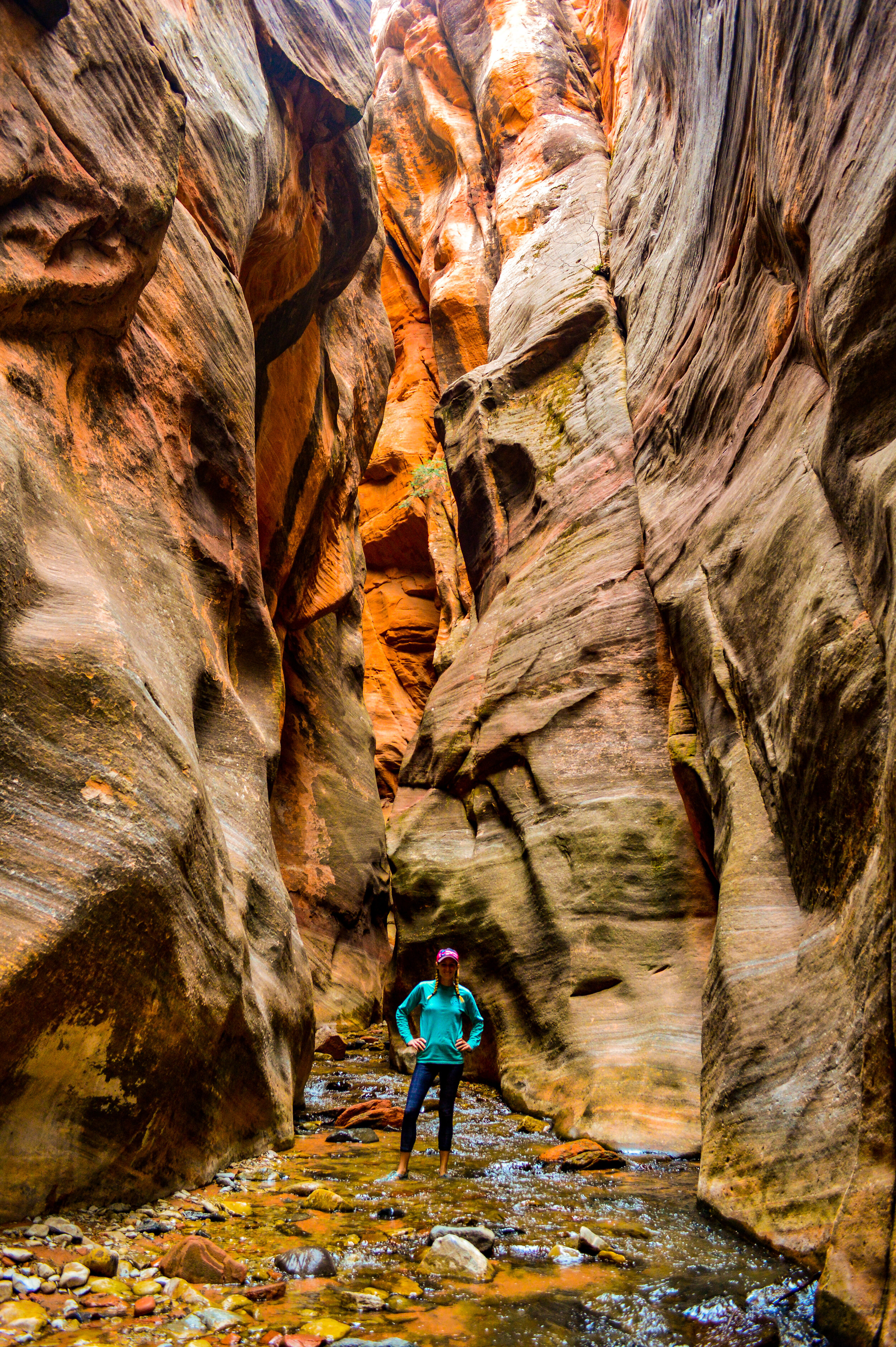
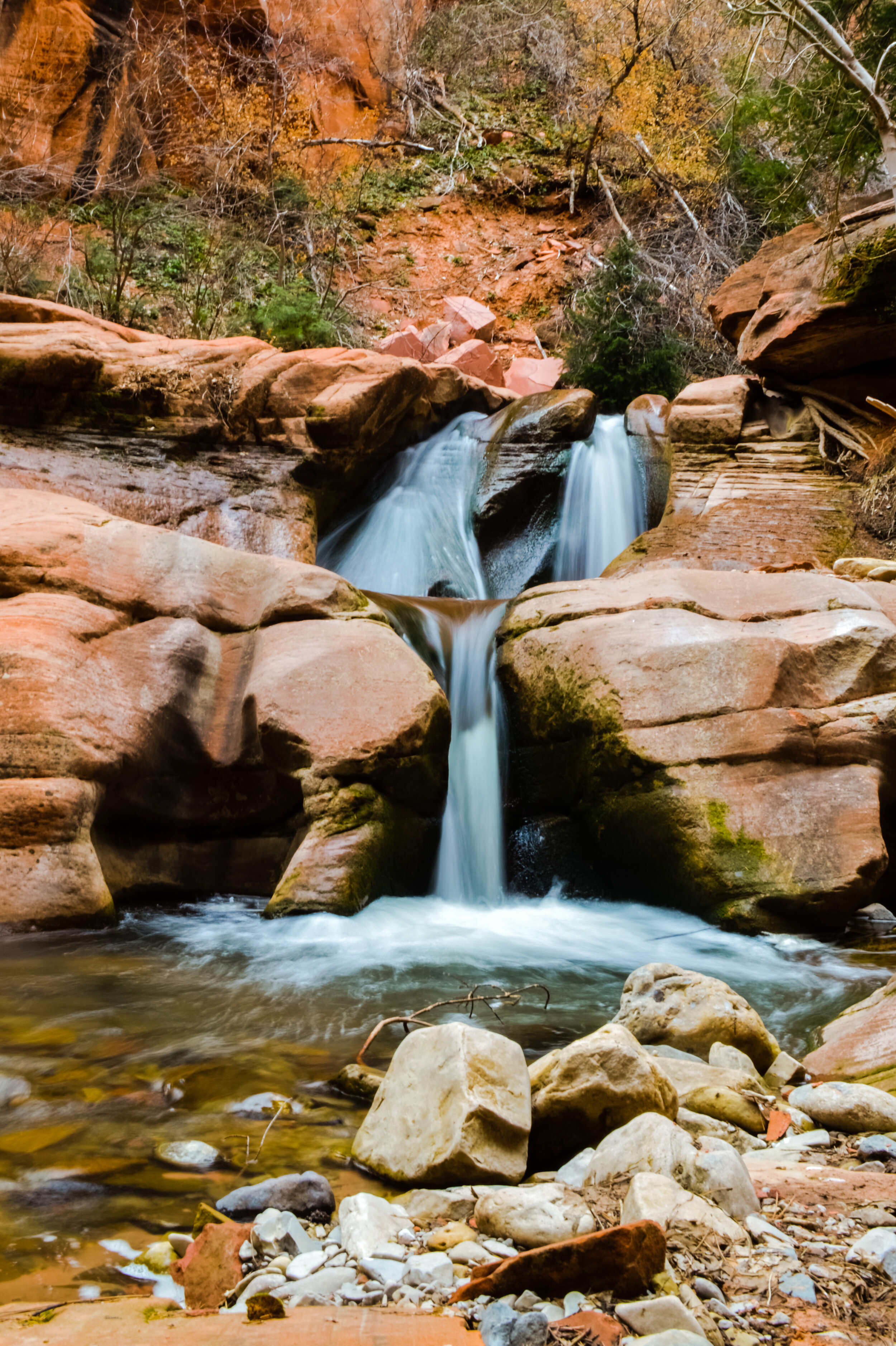
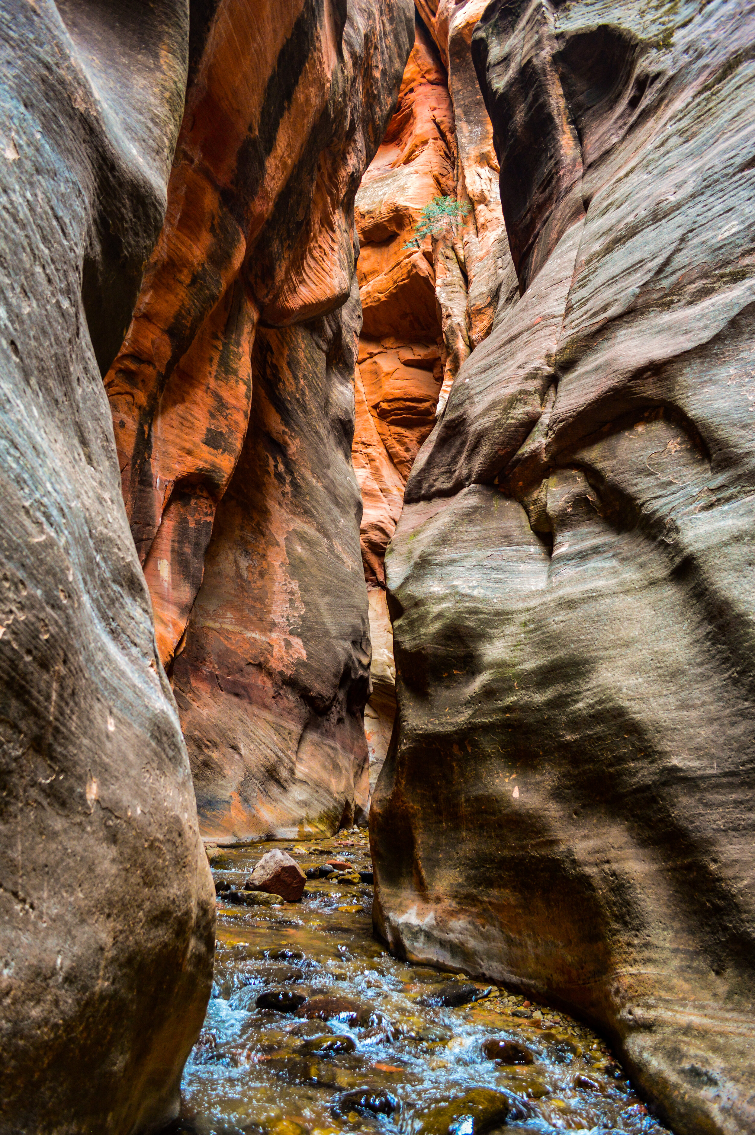
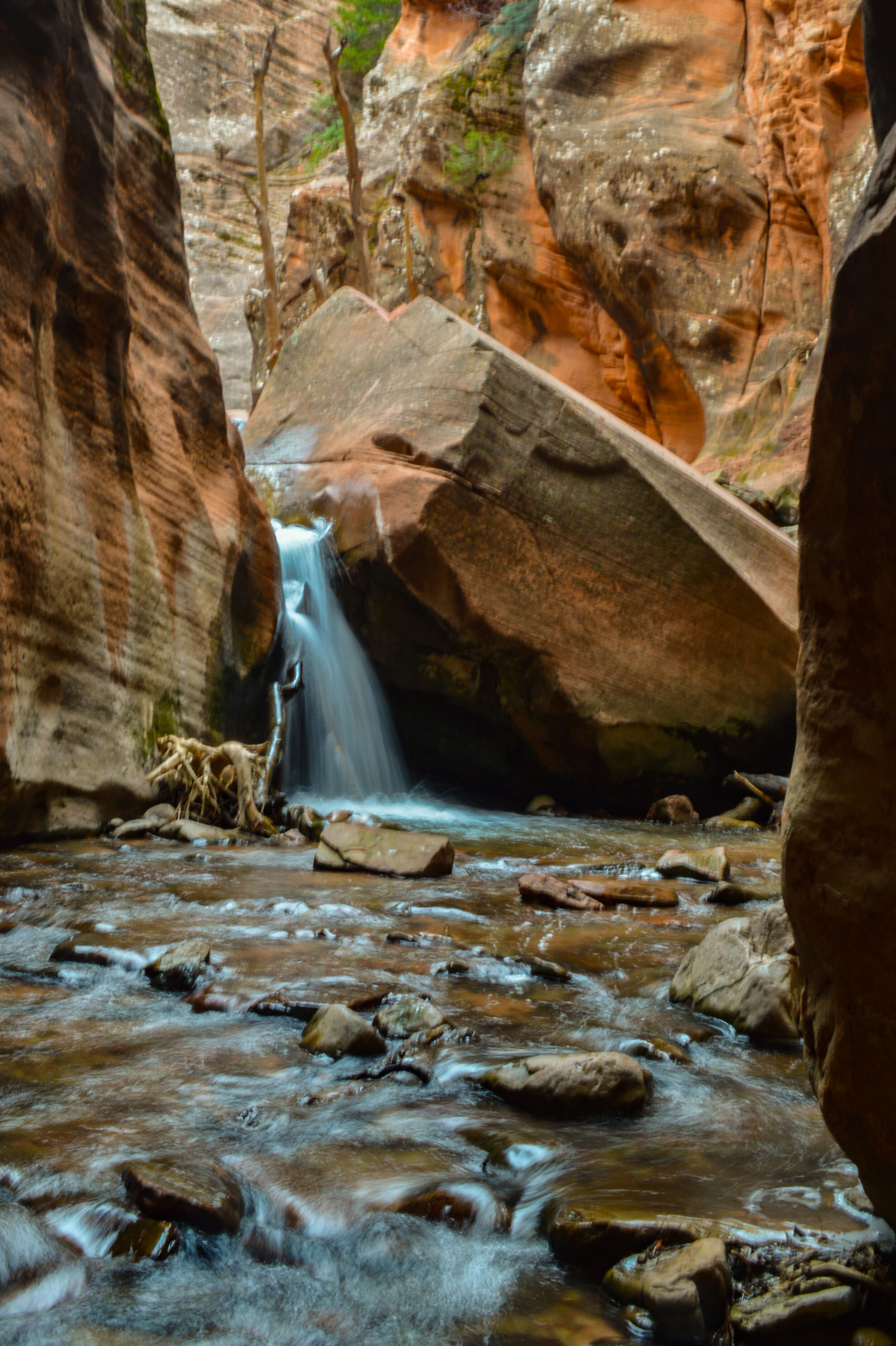
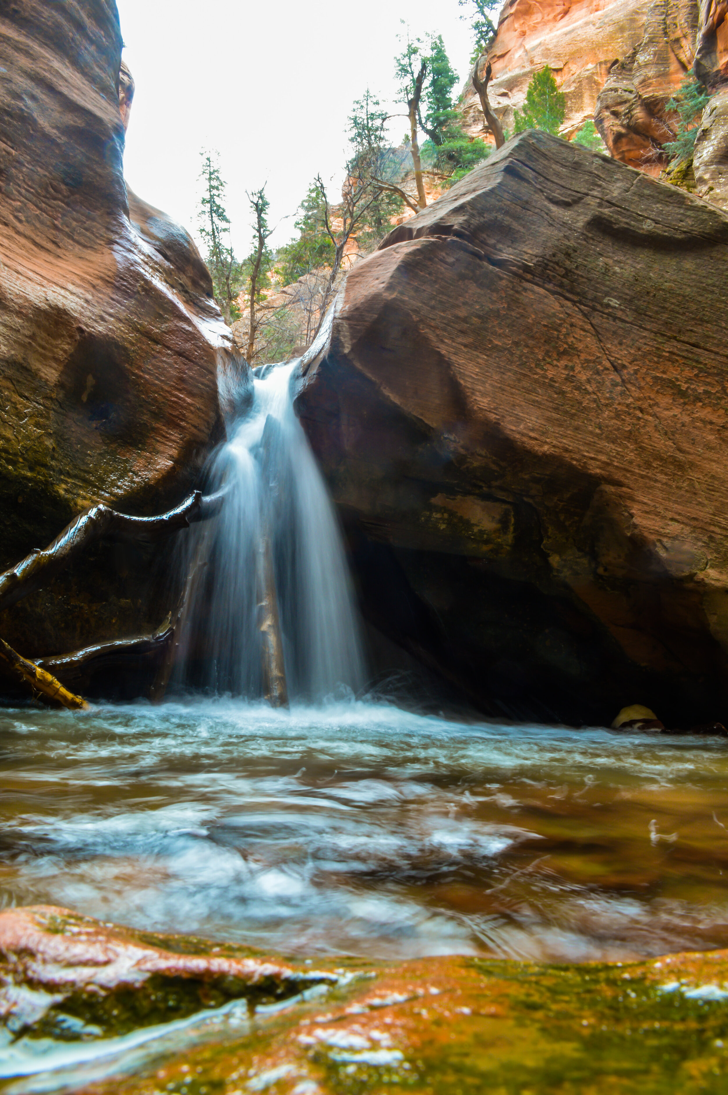
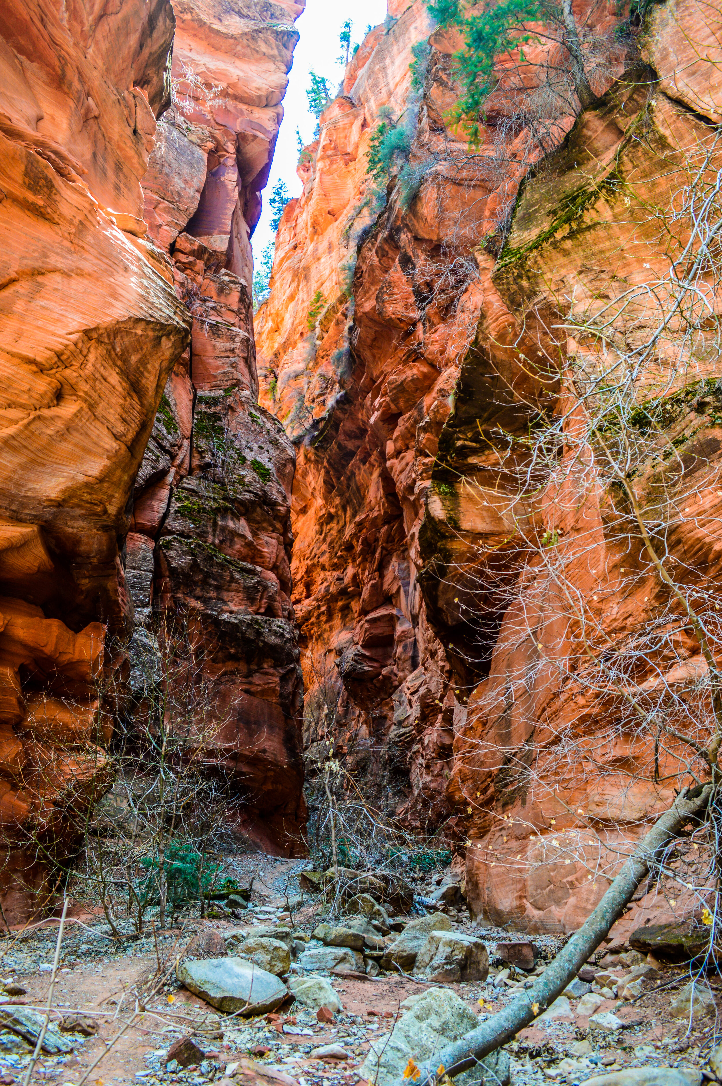
Kanarra Falls slot canyon leads you thru the 200 mile long Hurricane Cliffs on the western edge of the Colorado Plateau. These cliffs span from the Grand Canyon to some distance past Cedar City Utah, and even cross the northwest corner of Zion. This particular slot canyon leads you along a wandering stream before forcing you to hike in the stream to reach the narrows. While the water is cold (you can’t feel your feet after a few min), the views in the narrows leading you to the 15ft high rock-jam waterfall are pretty magical. The light in the afternoon beautifully displays the colorful high walled canyon with intricate rock formations typical of the Zion region. While you do need a permit to hike this canyon, the experience was vastly different than Antelope canyon. There were no people around to herd thru the canyon – I was totally isolated for 95% of the hike. On top of that, you must cross up and over the first waterfall to see the series of additional waterfalls and natural slides that lie beyond. To do so requires that you climb (and trust) handmade wooden ladders and ropes bolted to the canyon. It’s nice not to have to carry your own specialized gear for this hike, but you must also believe that what is provided will hold you, which can be a big ask when the website for this area clearly lists these aids as unstable and not regularly maintained (what are the permit fees being used for?!?!). For those looking for a little adventure, this wasn’t particularly family friendly, but it was fairly easy with big rewards.
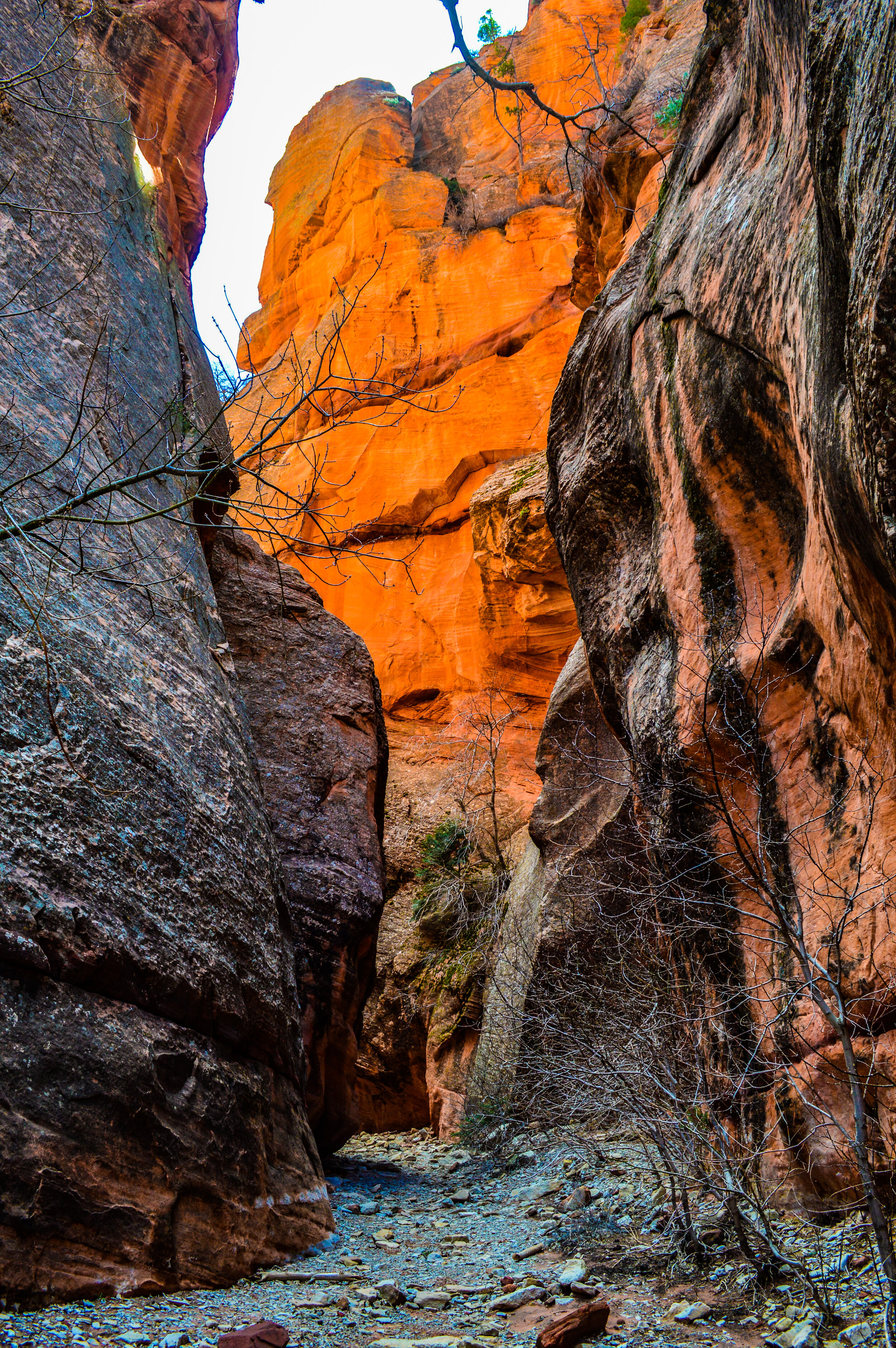
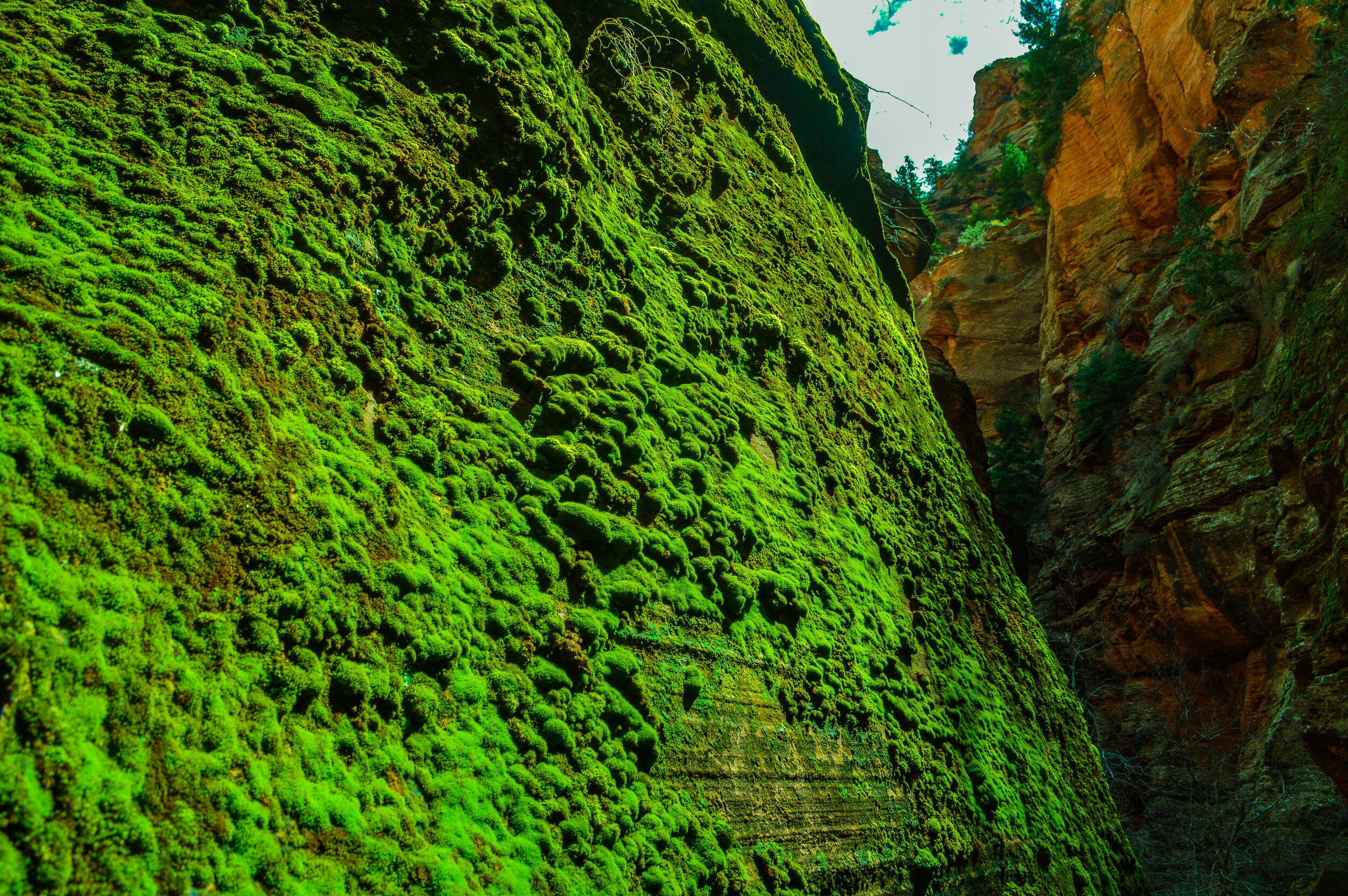
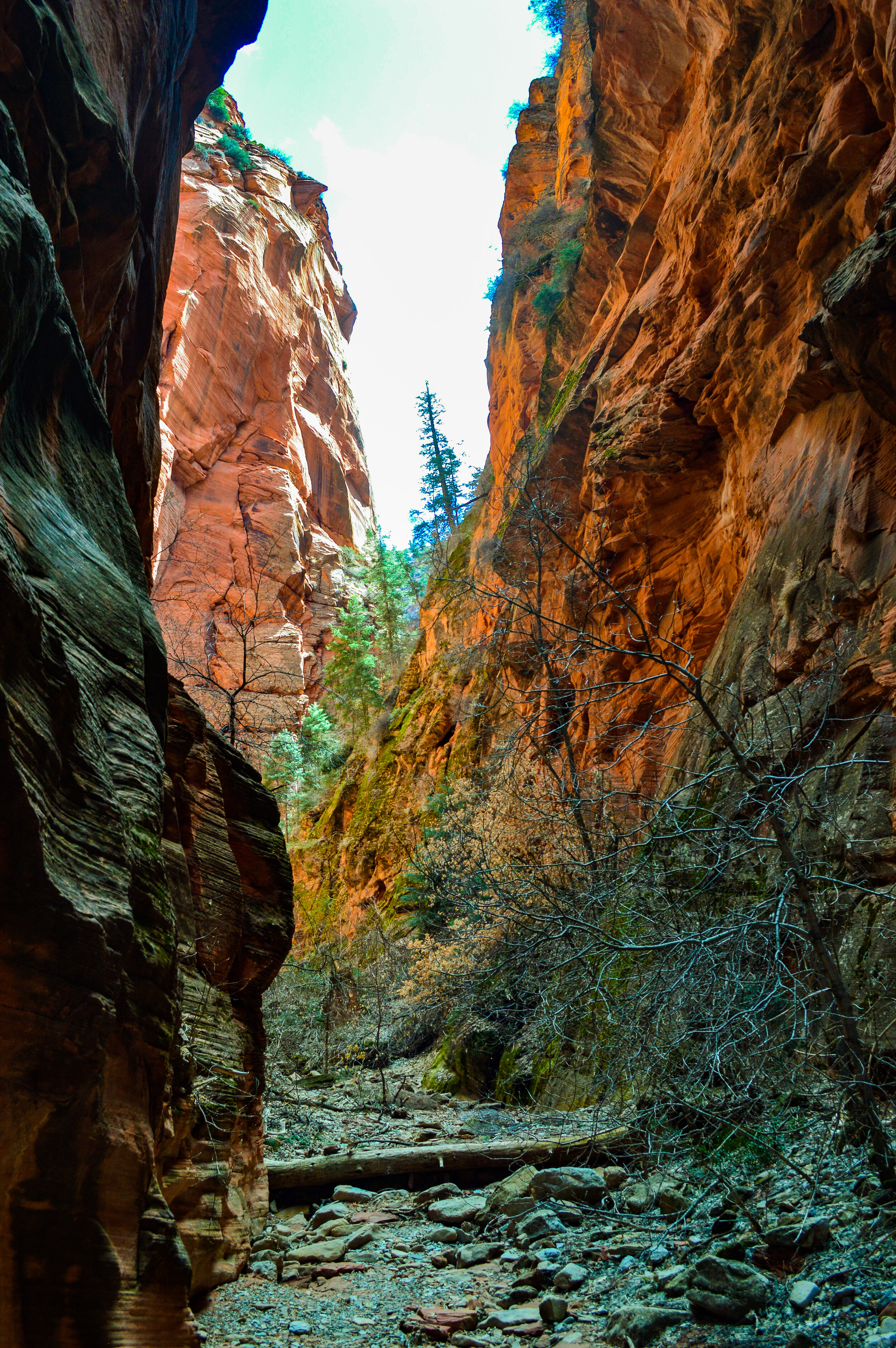
Spring Creek slot canyon is at the mouth of Spring Creek and on the edge of the Hurrican Cliffs. While there was not much water (yay for warm feet!), the many boulders, logjams, and landslides to climb up and over made this a really fun canyon to hike thru. The layered rock of red Navajo Sandstone forms a deep and narrow ravine, similar to those found in the finger canyons of the Kolob section of Zion. While this canyon was not particularly narrow, it was wonderfully lush and provided several short side canyons to explore. It gave us a taste of canyoneering thru a relatively east slot canyon, and while accessible, seemed to be mostly overlooked by hikers, affording us a nice slice of solitude.
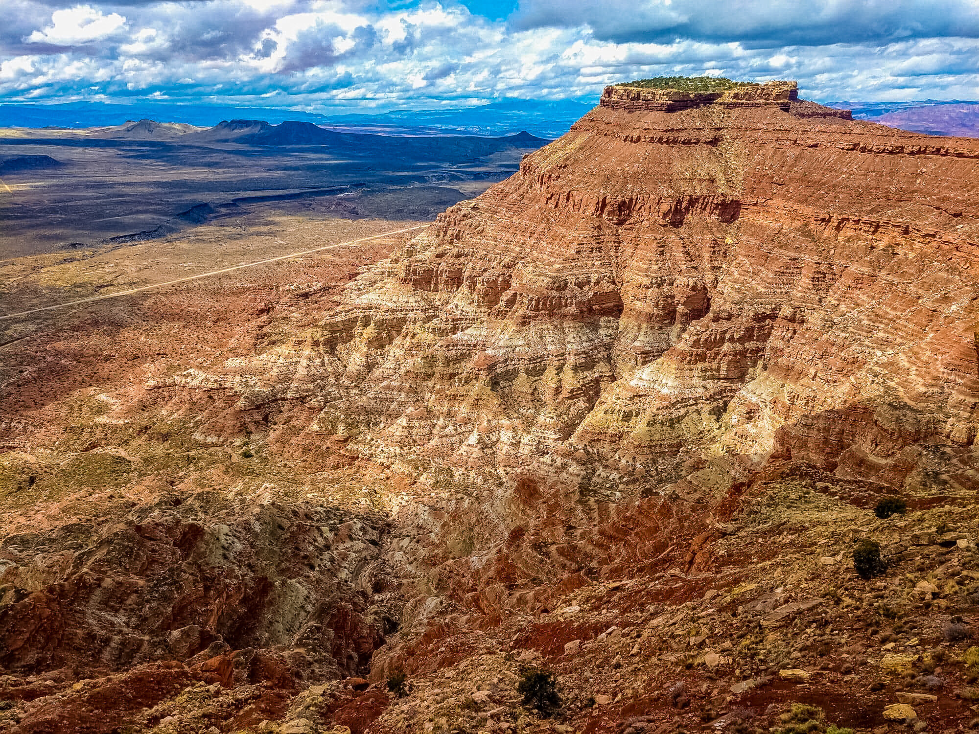
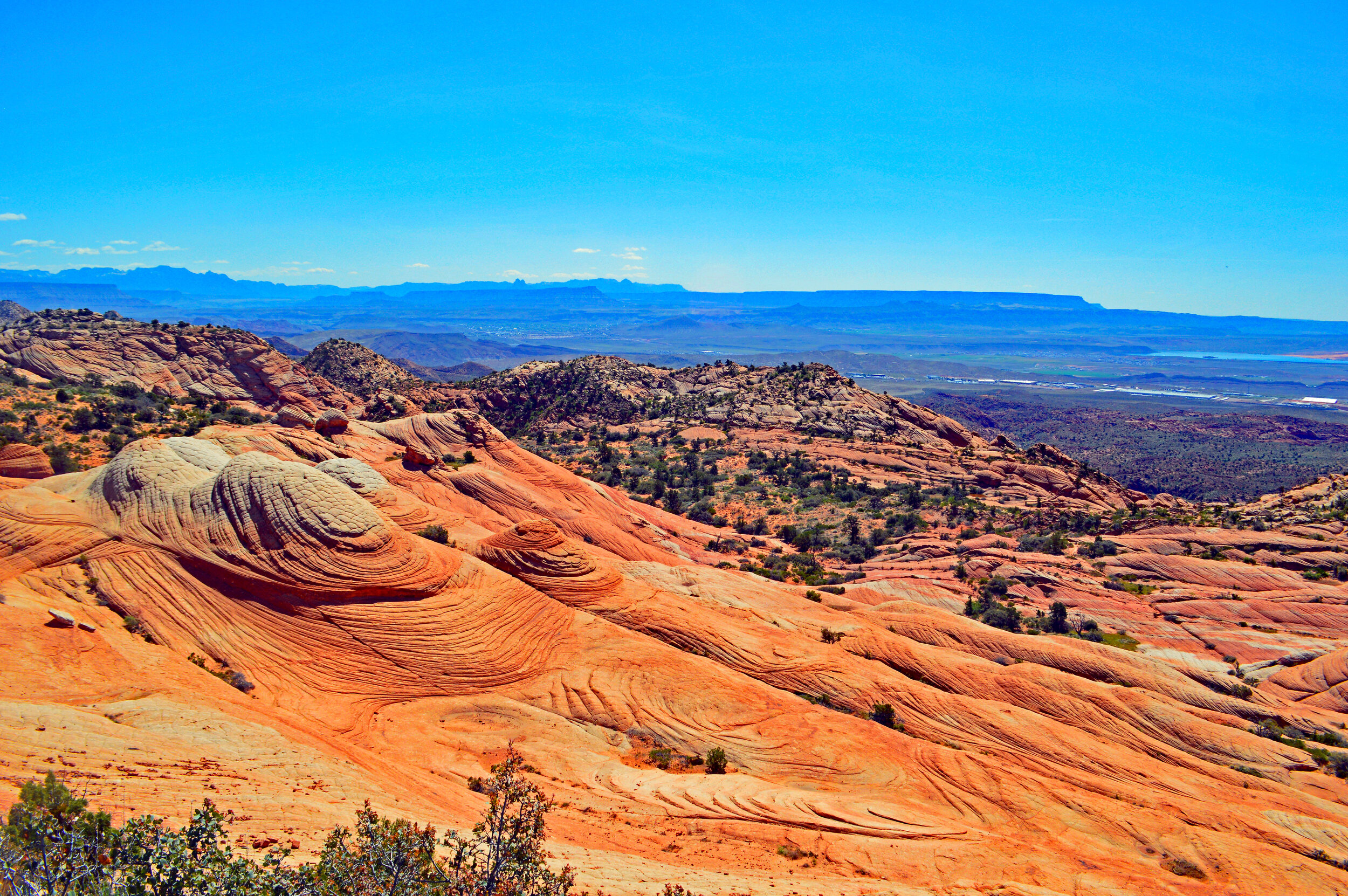
Gooseberry Mesa

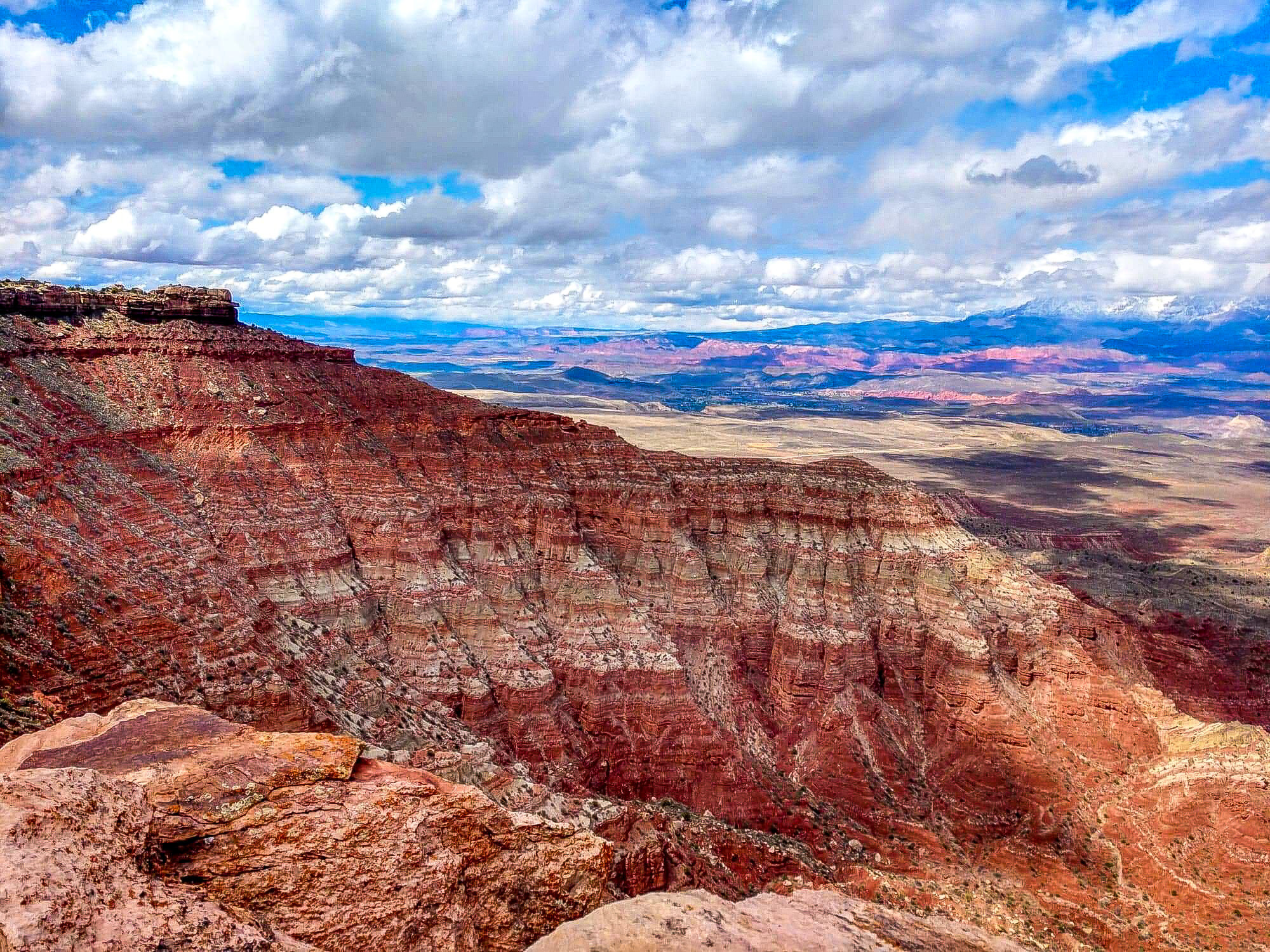
Views of Zion from Gooseberry Mesa
Located 3-miles west of Zion’s main entrance, Gooseberry Mesa offered us incredible views of Zion and the Virgin Valley once the national parks closed. While primarily used for premier mountain biking, we found that hiking the mesa rim and weaving thru juniper, piñons, ponderosa, and manzanita was an enjoyable and isolated way to take in the complexity of the surrounding scenery. Colossal sandstone monuments and gorges can be seen framing Zion from numerous points on the trail. To the north, Temples of the Virgin erupt as a sacred sandstone shrine with Kolob Canyon adding blazes of reds and yellows in the distance. Below the west rim is a panorama of colorful fault-bound mesas separated by deep water carved canyons and vermillion escarpments that form an almost cockscomb-like series of ridges. There are dinosaur tracks along the mesa for those who know what to look for, and petrified wood hidden among the piñons. With miles of interconnecting trails, Gooseberry Mesa offers a “choose your own destiny” hike; just the kind of hiking we like!

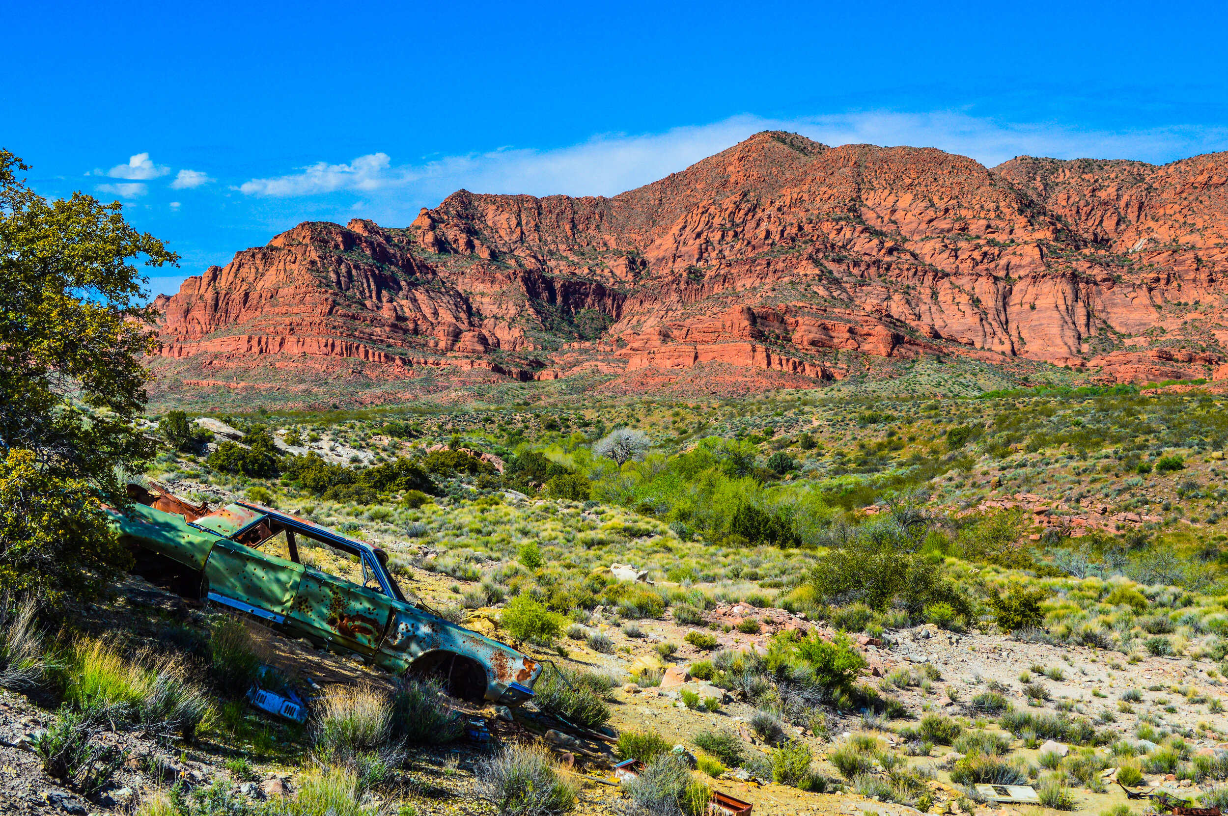
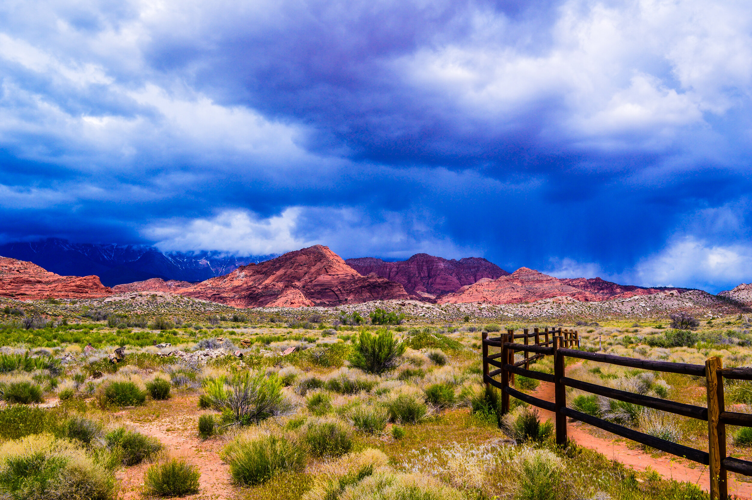
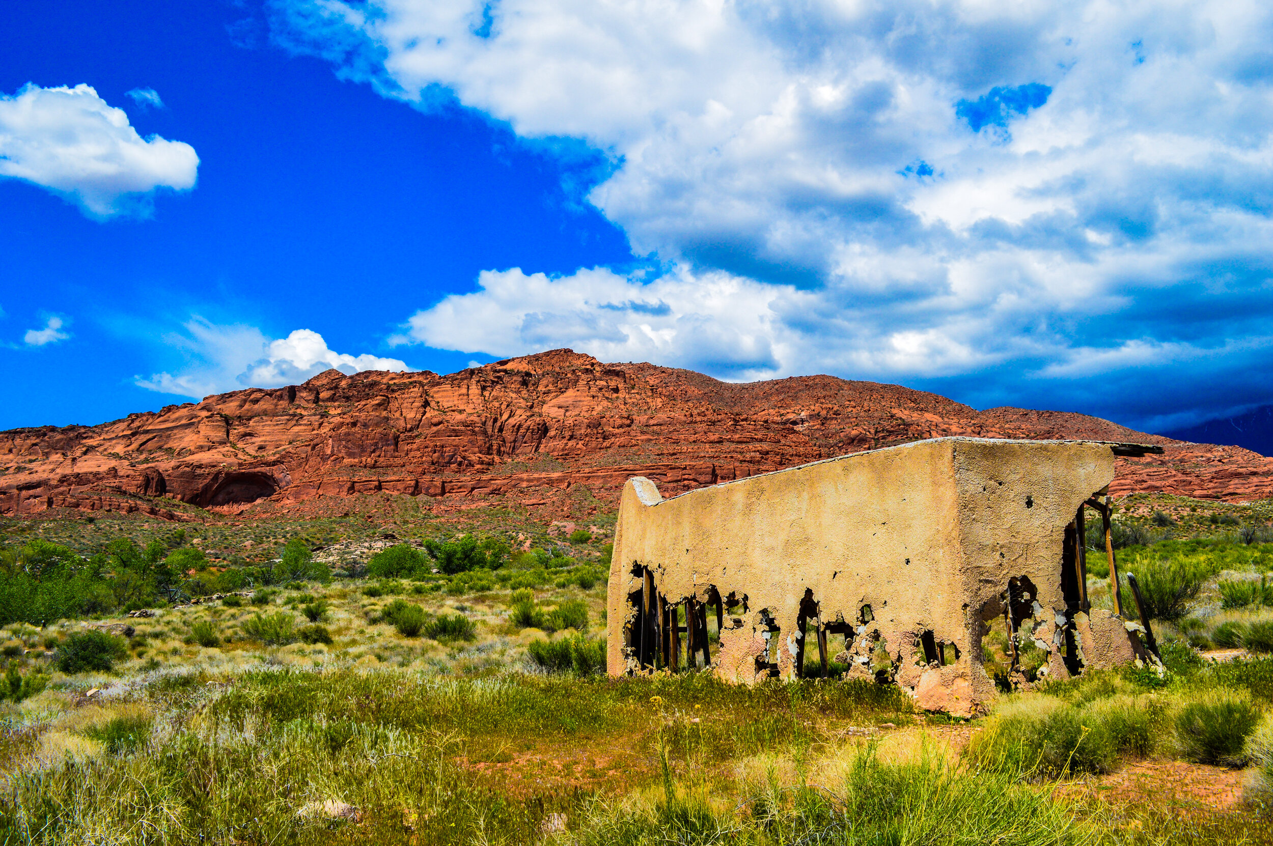
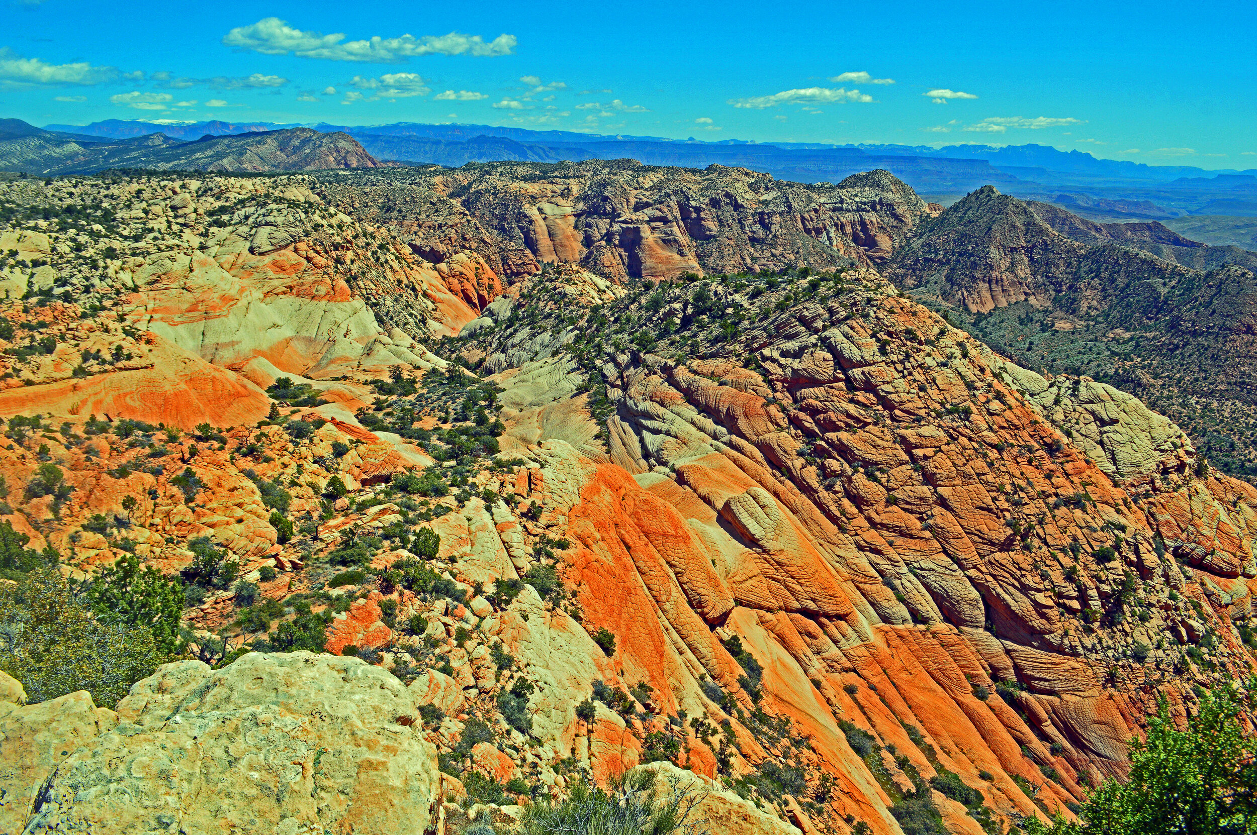
Red Cliff Desert Reserve

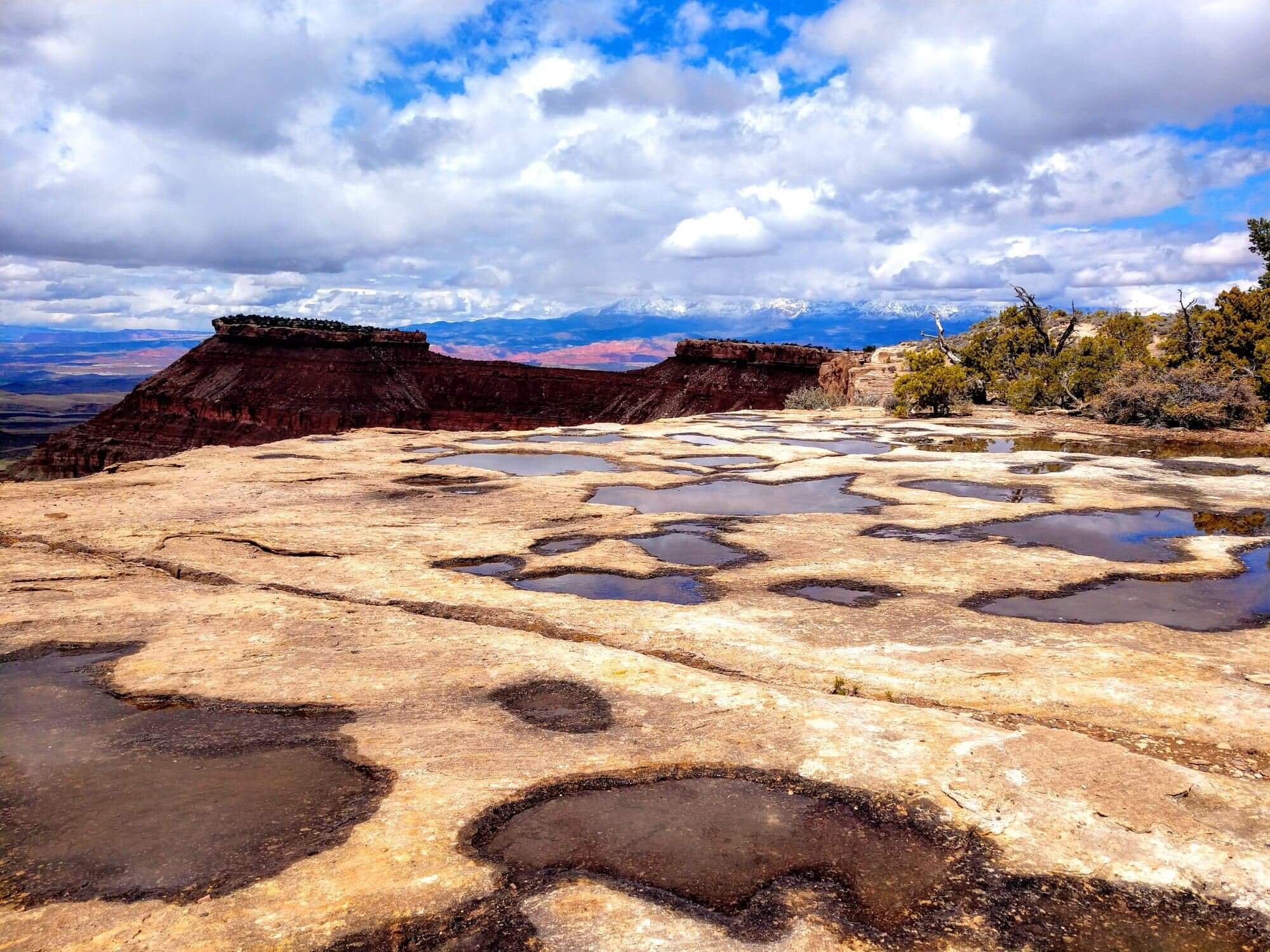
Located just north of St. George, the 60,000-acre Red Cliffs Desert Reserve (which includes a national conservation area) contains a one-of-a-kind ecotone (habitat created where two or more distinctly different ecosystems converge). This transition zone between the Great Basin, the Colorado Plateau, and the Mojave Desert creates a lush biodiversity you likely won't find anywhere else in the world. In particular, this reserve was created to protect the desert tortoise along with other reptiles, birds, and mammals living in this somewhat harsh environment. We spent time exploring the White Reef trail towards Leeds Creek as a family. The north end of this trail takes you by the remnants of the 1954 “They Came to Codura” movie set while the south end takes you to some historic 1860’s homestead ruins. We didn’t see any tortoise, however the stark rock-landscape mixed with soft dunes formed by windblown sand, made for a lovely morning hike and picnic.

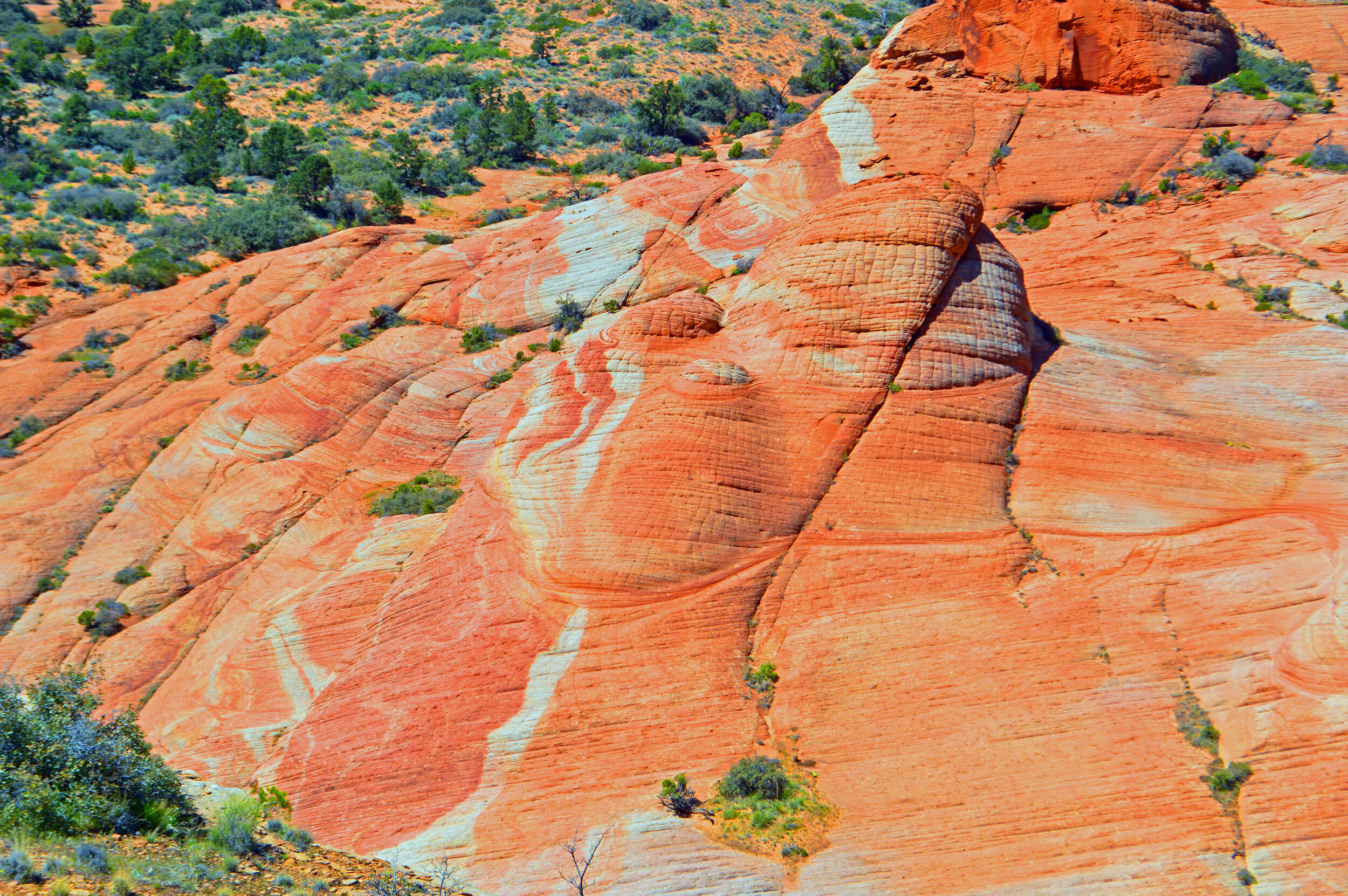
Situated just within the boundaries of this reserve, in the Cottonwood Canyon Wilderness, lies another little-known area that is absolutely worth an extended visit – the Candy Cliffs. Trust me when I tell you that words and photos really do not suffice when trying to explain the beauty of this area. Hiking across the creamy-white-swirled sand of Yates Flat, it’s hard to imagine arriving at some of the most incredible colored sandstone formations in the US. Much easier to access than the famous Wave of Arizona, or the White Pocket of Utah, this gem offers hikers access to otherworldly sandstone formations that some consider to look like ribbons of candy (all I could see was bacon, but that might speak more to my taste in food!). Wave-like formations and checkerboard patterns of sandstone help to form the divide between the Great Basin watershed to the West, and the watershed of the Virgin River (a tributary of the Colorado River) to the East. With no set trail and views of Zion, Sand Hollow Reservoir, the city lights of St. George, and even Signal Peak to the North, this hike was a wonderful way to get lost amongst some of Mother Nature's most fascinating creations.

The People of Kanarraville
This area of Iron County is quite conservative – most of the neighbors we saw were clearly Mormon Fundamentalists. With 40% of the population living below the poverty line and 90% of the population being white, I’m sure we were quite the spectacle as we rode into town with Brian’s dark skin and our tiny home. Upon first arrival, I will admit I was skeptical of how we would be received – many folks were clearly weary of us and at times it felt like some folks wanted to stare us down to the point of being uncomfortable. Little by little, some of the town’s folk came to ask us questions about our travels or strike up conversation about the tiny home. The owner of the RV park we were staying in was wonderfully welcoming, and the staff that helped to maintain the park went out of their way to make us feel comfortable. Many of the folks who were permanent residents of the RV park got to know us and always went out of their way to say hi to the kids and strike up easy conversation.
In total contrast, it was very clear that many folks outside of the RV park saw us as “other” and did not want us there. While these were certainly guarded times with states being shut down and stay at home orders being issued, I can understand small towns not wanting to be further exposed to COVID from folks traveling thru. At one point, we ventured to the playground across the street from our park – with no other children present, and lots of open green space, it seemed like a safe way to let the kids burn some energy. I guess the group of five adults didn’t think my children *should* be playing there as they quickly moved to the playground equipment upon seeing us and remained there, staring us down as we patiently waited for them to leave. Another day, two teenage boys decided the playground was an excellent place to race their dirt bikes. After nearly running my children over several times, I had to threaten to call the police just to get them to ride their dirt bikes on the road instead of thru/on the playground equipment. One day while running around with the kids in a field, a police officer noticed us, came to a stop, and proceeded to again stare us down until we finally left. Any time we saw fundamentalist children, they at least were brave enough to make eye contact with us, but clearly were told not to speak to us and usually ran off home when we tried to utilize part of the park.
This behavior was such a juxtaposition to literally every other place we had been (including just inside the RV park where folks were the most exposed to outsiders!). To date, we had only been met with warm receptions, lots of friendly questions about the traveler lifestyle, and an excitement about our trip. This town illustrated an important lesson: when people treated us with humanity, took the time to converse with us, and see that we are just another American family, it was easy to feel comfortable and welcomed. It’s when folks judged us only upon appearance, refused to treat us with respect, and clearly made assumptions about our intentions in that town, that the ugliness of America came into full view.
This trip is about seeing America; ALL of America. Sometimes this means you experience good and bad. Even with the bad, this trip hammers home the following: BE KIND. Treat others with respect. Know that everyone has something to offer, even if it is different than what you prefer. Lead with love, and see that life is a blessing.


