
Grand Canyon

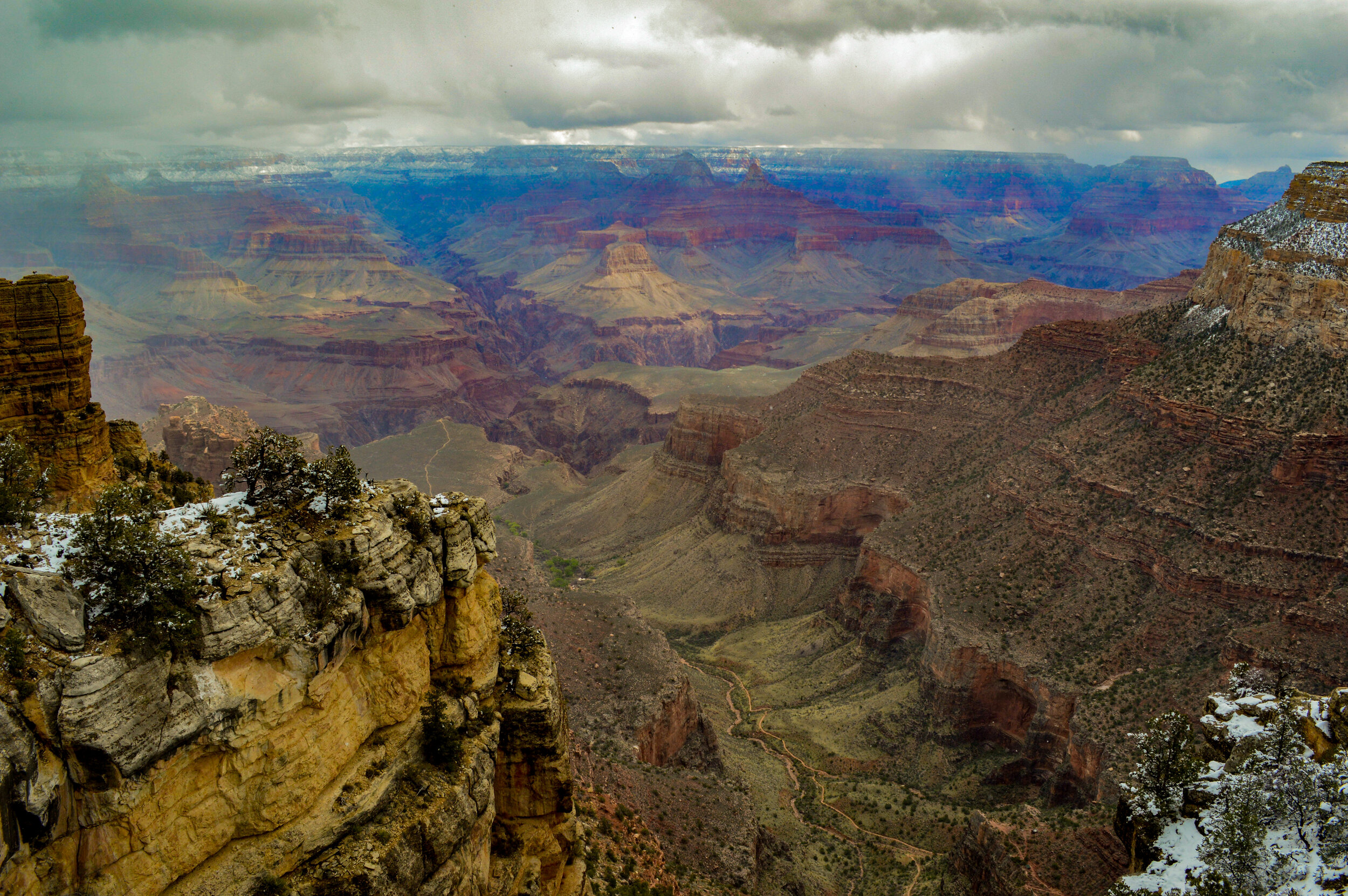
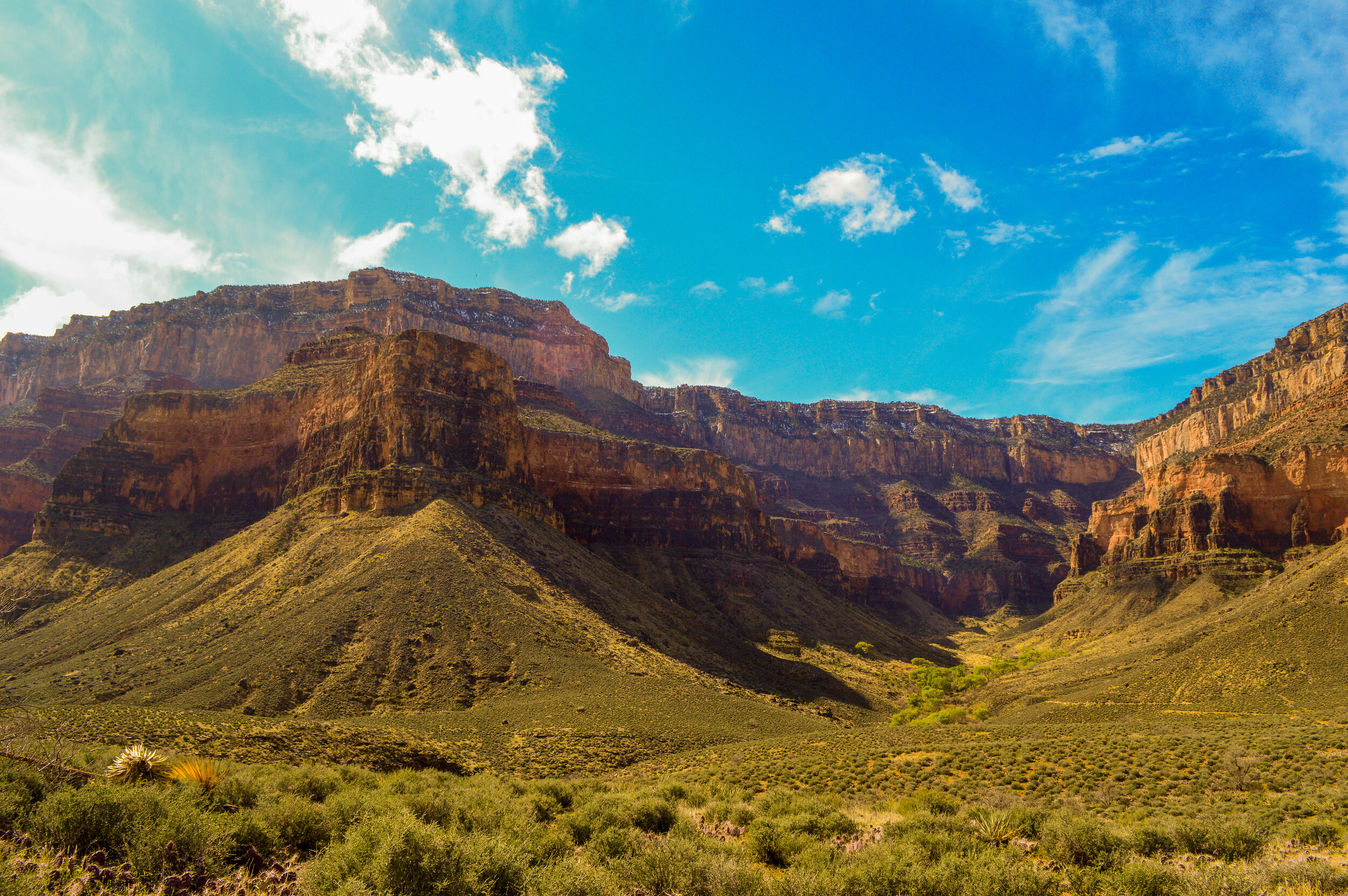
We said goodbye to Flagstaff and headed north to visit one of the seven natural wonders of the world: The Grand Canyon. After spending much of the winter visiting canyons and dessert landscapes, I wondered if seeing the Grand Canyon would feel less, well, grand. Boy was I wrong!! At one mile deep, and up to eighteen miles wide, the immenseness of this canyon is beyond anything I could describe. Our family was lucky enough to stay within the park boundaries and spend our time leisurely exploring the South Rim and surrounding areas via the large interconnected trail system in place. Anytime you can avoid fighting with your toddlers to get in the car is a WIN!
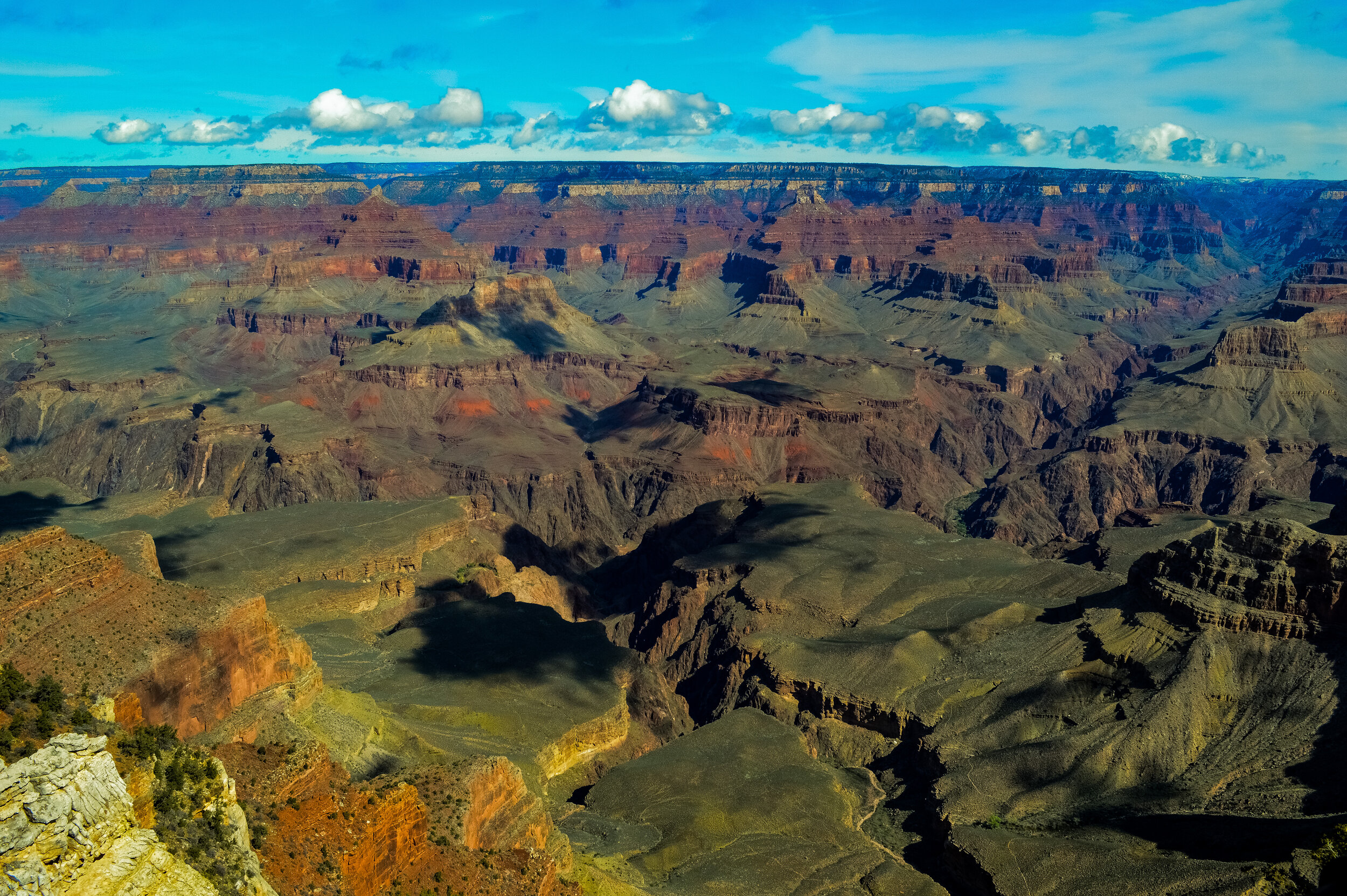
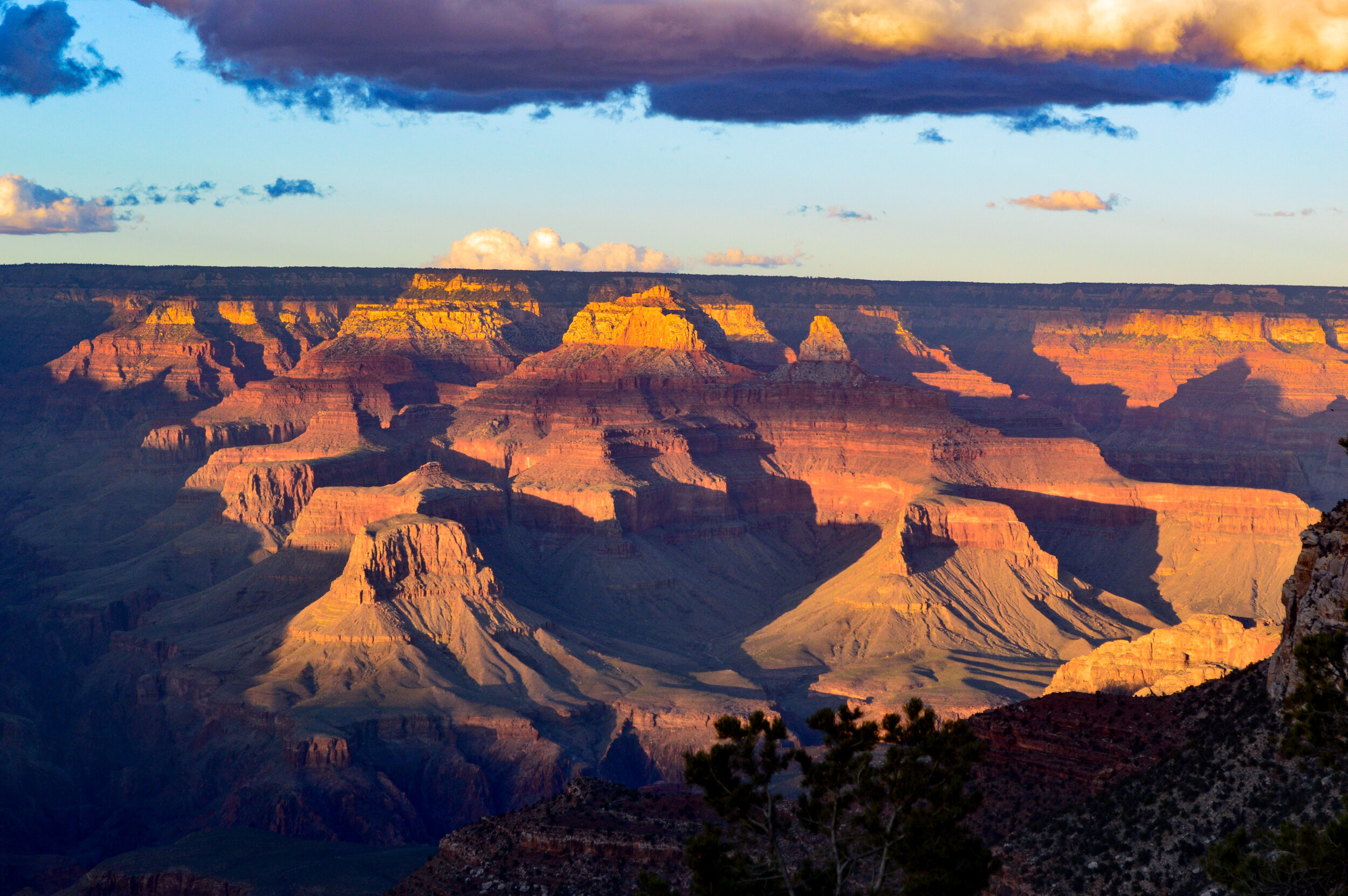
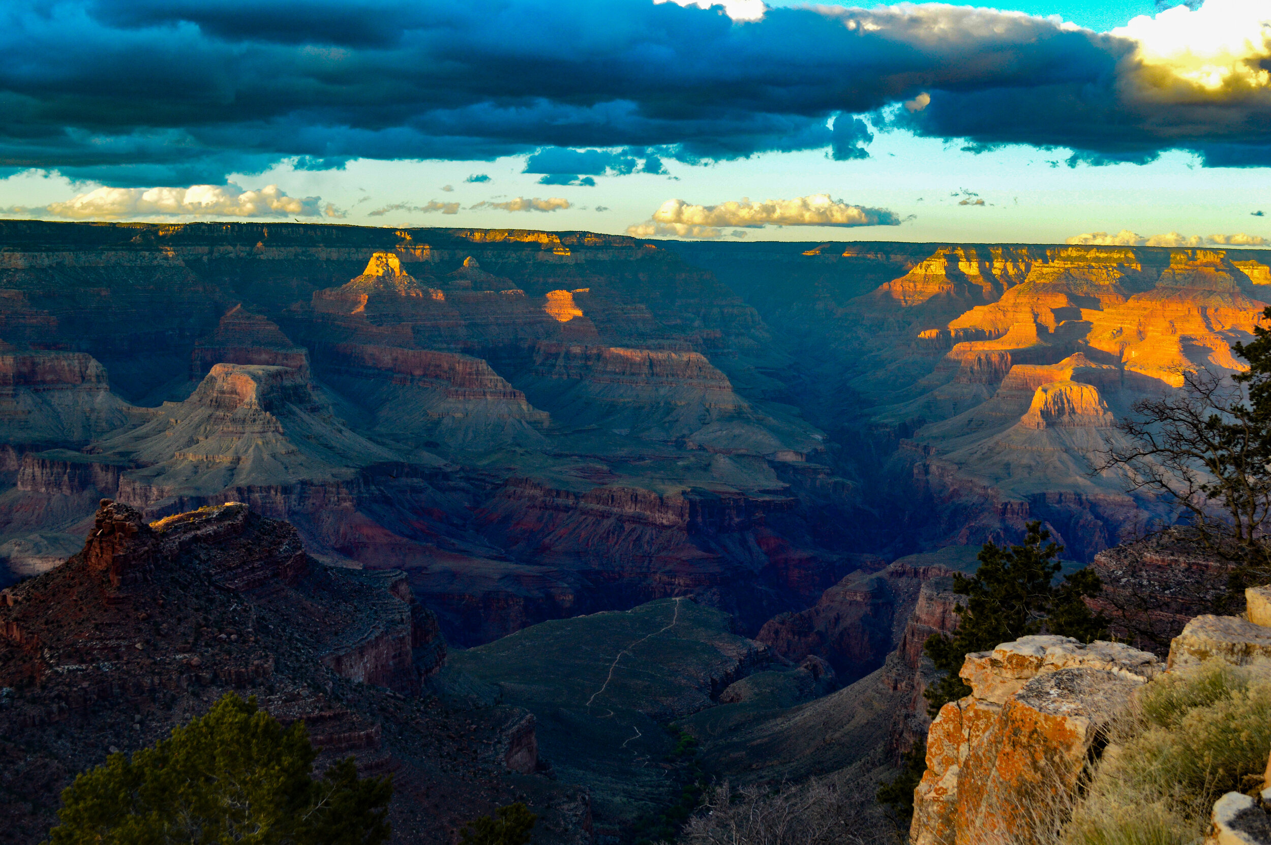
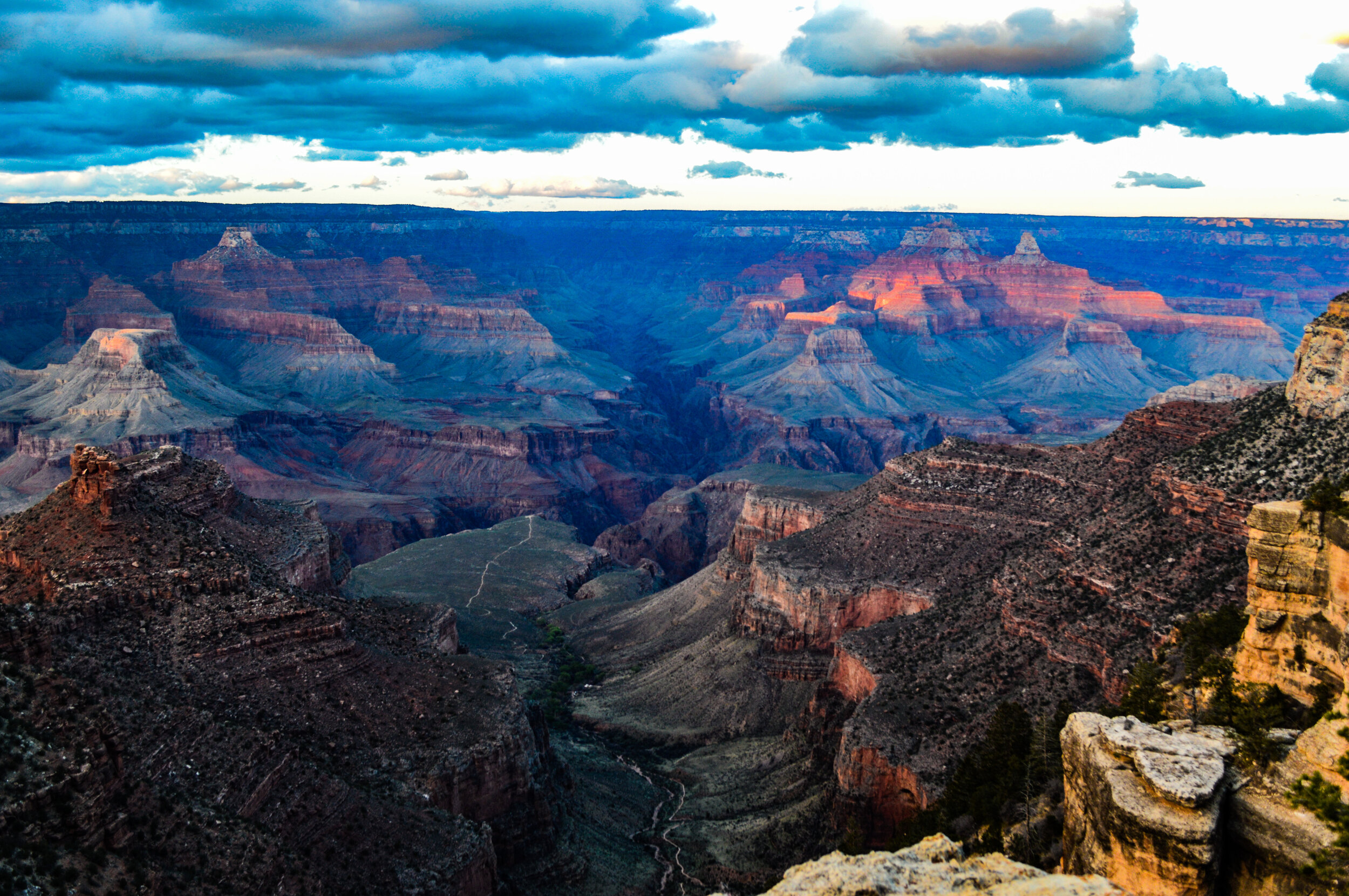
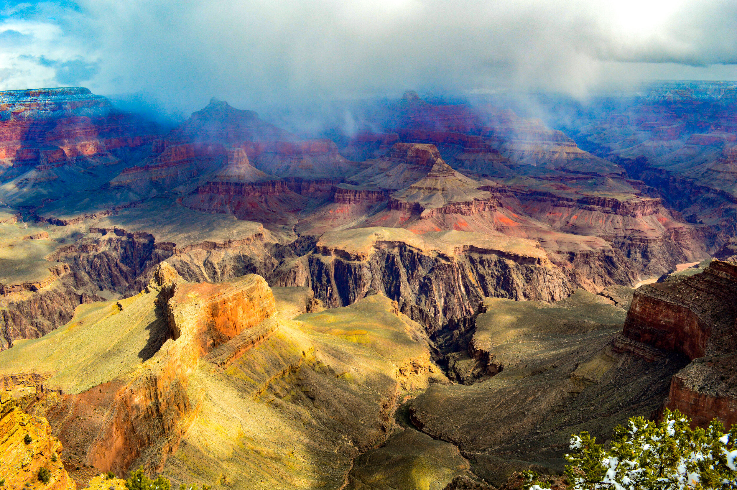
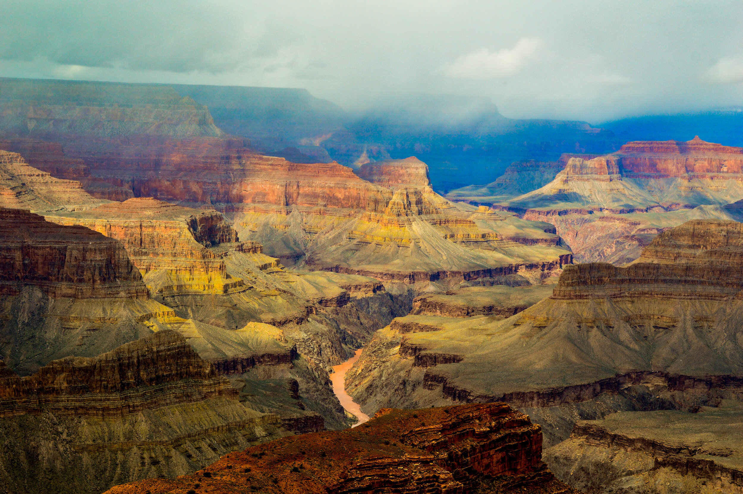
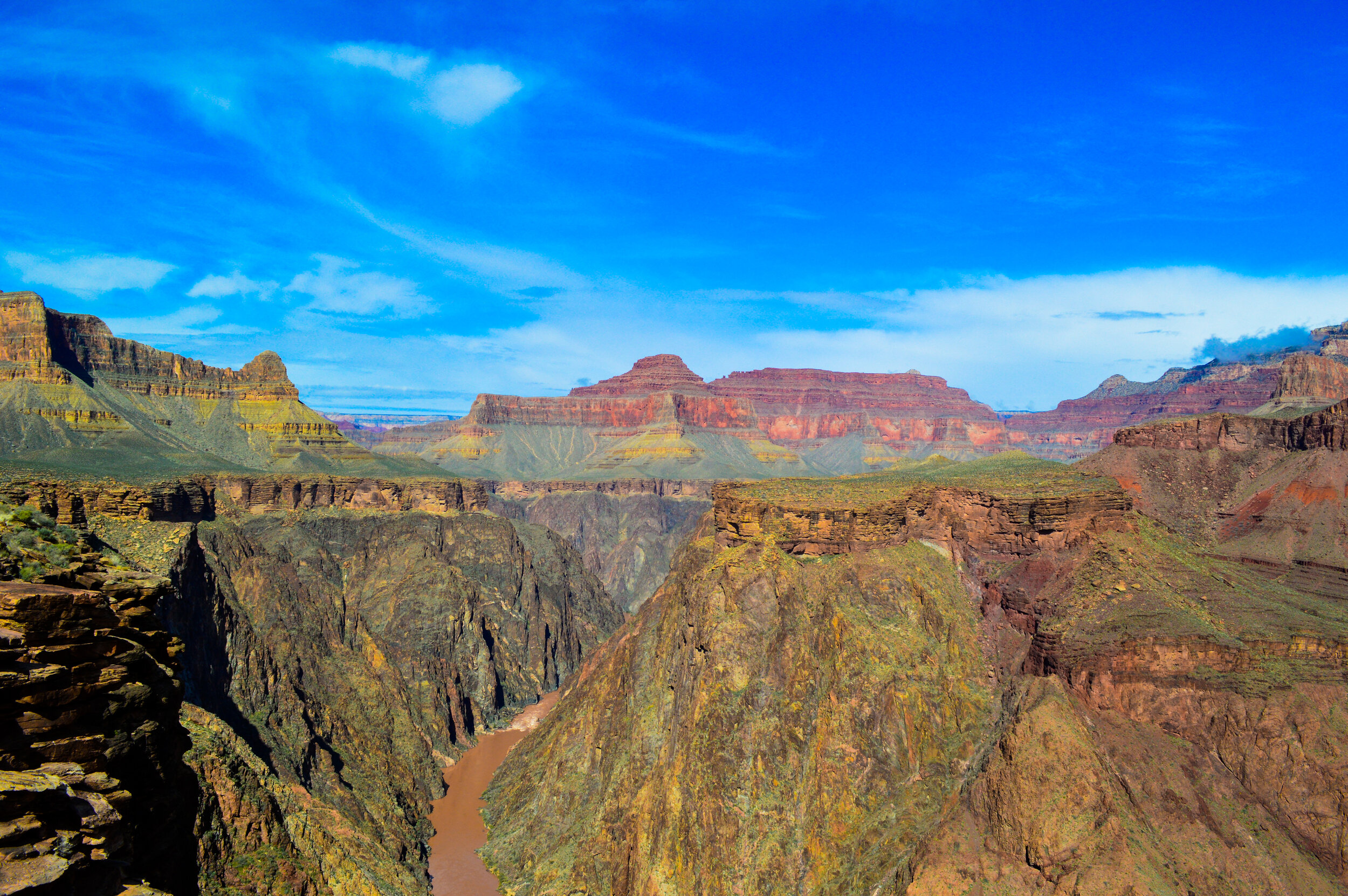
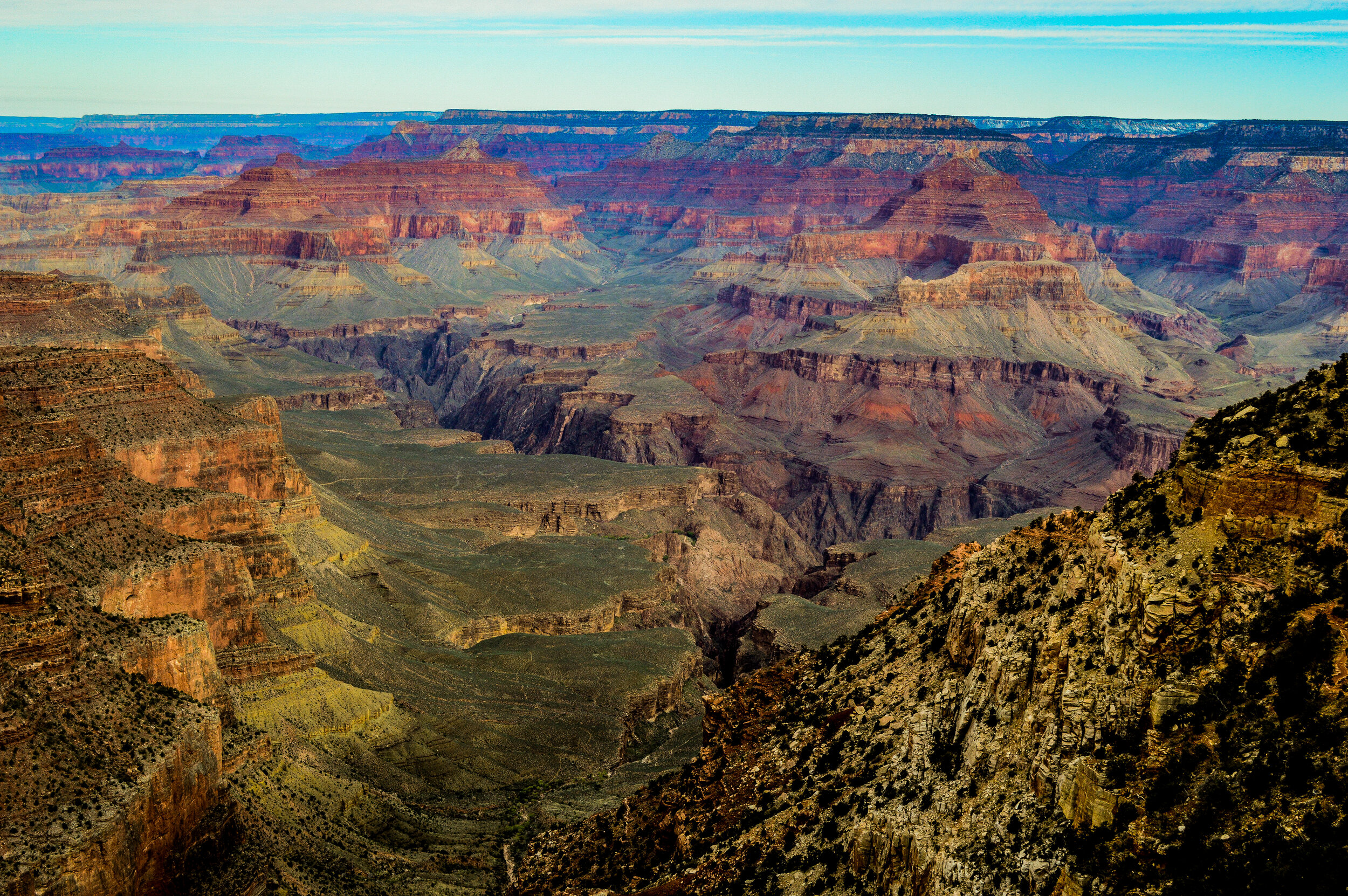
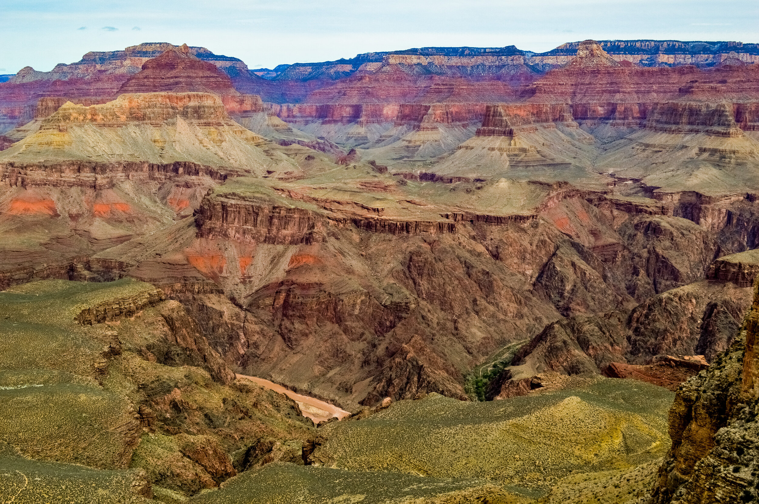
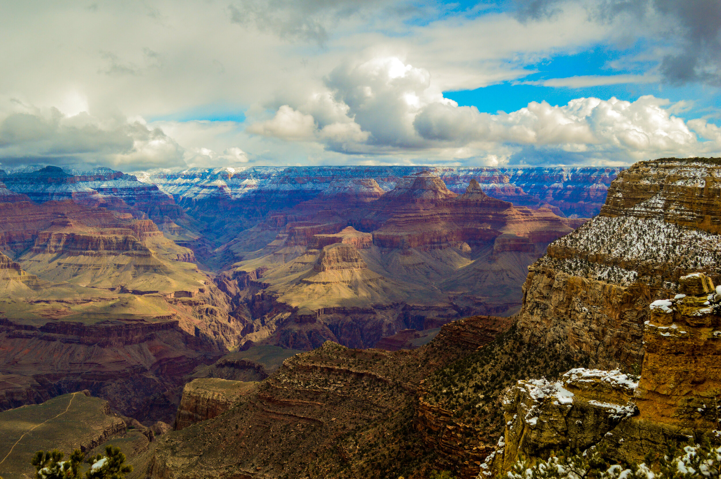
The Grand Canyon NP encompasses 277 miles of the Colorado River and adjacent uplands. It is this very river and its tributaries that cut channels through layer and layer of rock as the Colorado Plateau was uplifted to create the masterpiece we now know as the Grand Canyon. Nearly two billion years of Earth’s geological history can be found within the layered bands of colorful rock, making this canyon one of the most complete geologic columns on the planet. While you can see these layers from almost any viewpoint, I highly recommend finding a quiet place to yourself on the South Rim at sunset - what were shades of green, brown, and orange during the day turn to a brilliant fiery red and blazing hues of yellow and orange as the last rays of sun reach out over the cliffs.
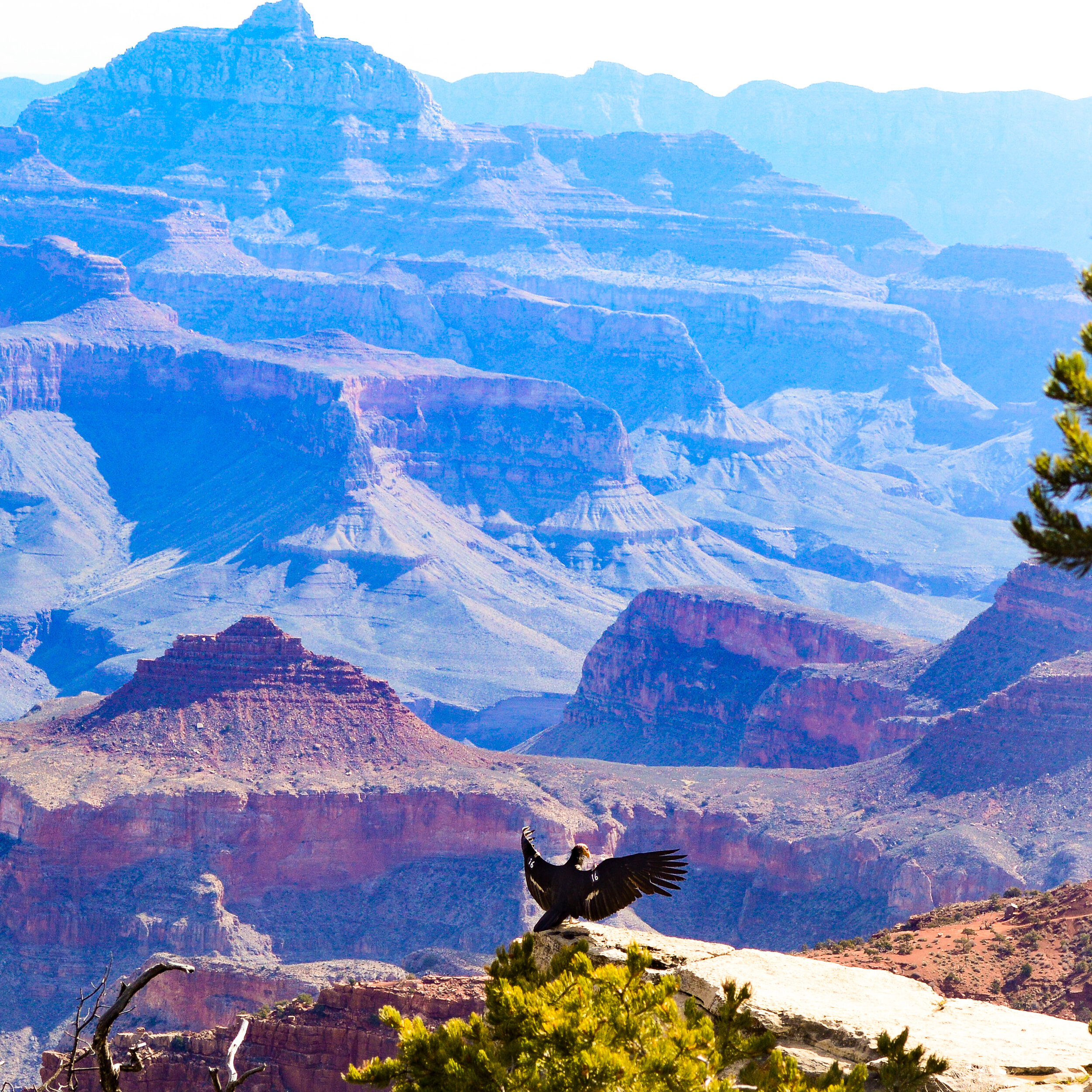
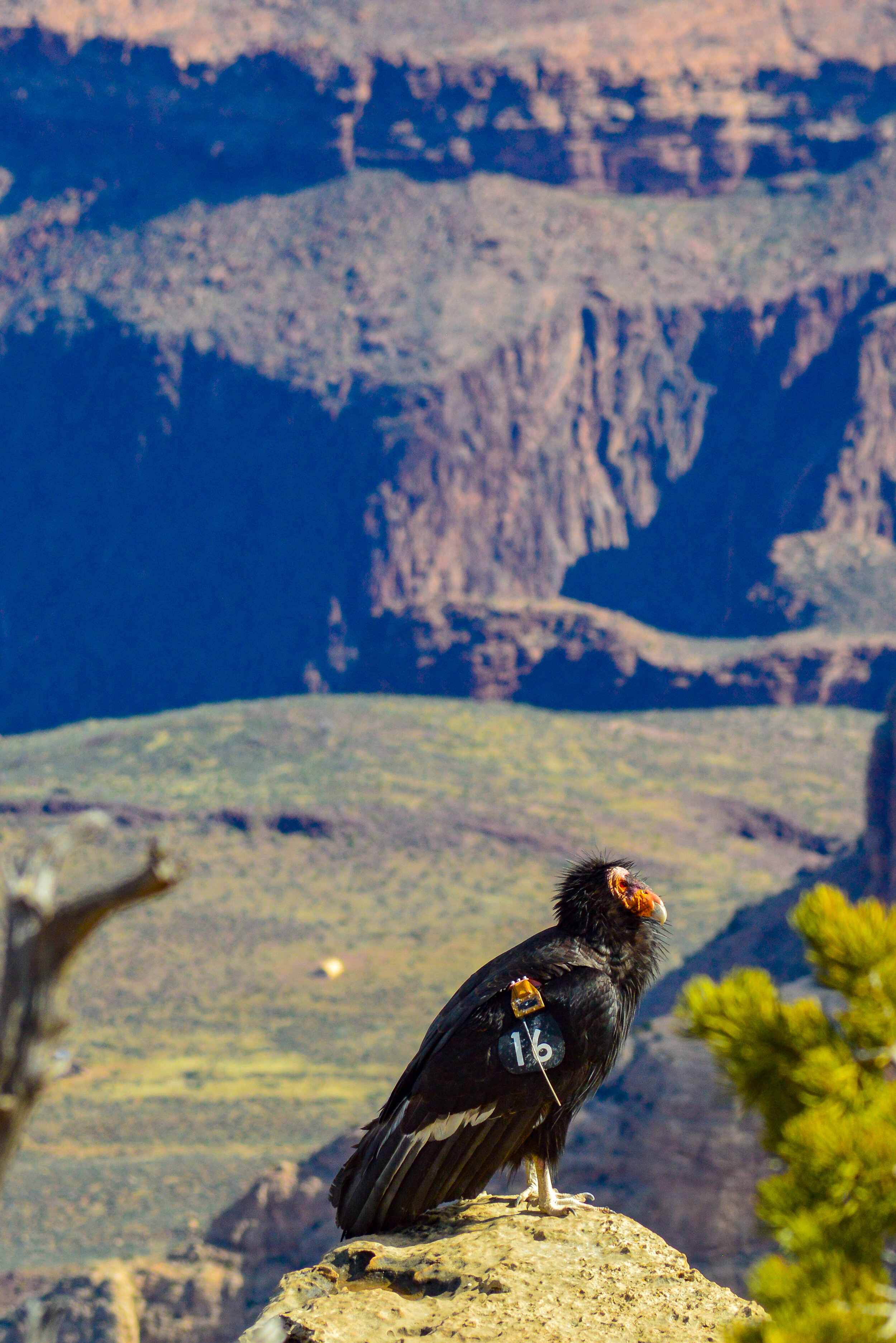
Given the enormity of the canyon, the biological diversity is simply awesome. The park contains several major ecosystems including three of the five life zones and three of the four desert types in North America. To put this in perspective, you would need to travel from Mexico to Canada to see each of those ecosystems separately. Given the extreme change in elevation and resulting climate changes in and around the canyon, the park contains 500 animal species and 129 different vegetation communities. Sixty-three plants found here have been given special status by the U.S Fish and Wildlife Service, and a dozen plants are endemic (known only within the park’s boundaries). It is easy to see why the Pueblo people considered the Grand Canyon a holy site and made pilgrimages to it.
We were lucky enough to make our own pilgrimages down into the canyon thru two different hikes – the Bright Angel trail and the South Kaibob Trail.
The Bright Angel trail is considered the park’s premier, and safest, hiking trail. By following the Bright Angel Fault and the natural breaks in the cliffs, this trail approximates a route used for millennia by the native peoples who populated this area. A variety of ancient pictograph panels and historic structures line this trail and give hikers a sense of the rich history of the area. Additionally, natural water sources along the trail mean more plant and animal life than what you would see on the South Kaibab trail (in addition to more water for hikers!), making the Bright Angel trail certainly more popular than South Kaibab. After a few miles of ice at the beginning of the trail, we descended thru several miles of switchbacks to the Tonto Platform which seemed to flatten out as we approached the Indian Gardens rest point. Indian Gardens is an oasis in the canyon that has been used by native peoples up to modern times and can be used for camping on the way to Phantom Ranch at the bottom of the canyon. We only made it as far as the Indian Gardens before climbing the 3,051 ft back the way we came.
South Kaibab is a bit more of a beastly trail, with no water along the way, longer mileage, and a larger elevation gain (4,780 ft of elevation gain is a REAL booty buster). The rangers will warn against hiking from the rim to the river and back in one day, but I can assure you with the right frame of mind, it can be done! To be fair, rangers rescue an average of 250 dehydrated and heat-exhausted hikers each year. Believe it or not, we met several hikers who had traversed down Bright Angel, hiked east along the riverbanks, and climbed up the canyon via South Kaibab! Surprisingly, it would be less overall mileage to go that route than to simply hike down and back up South Kaibab. If only we had chosen that route...
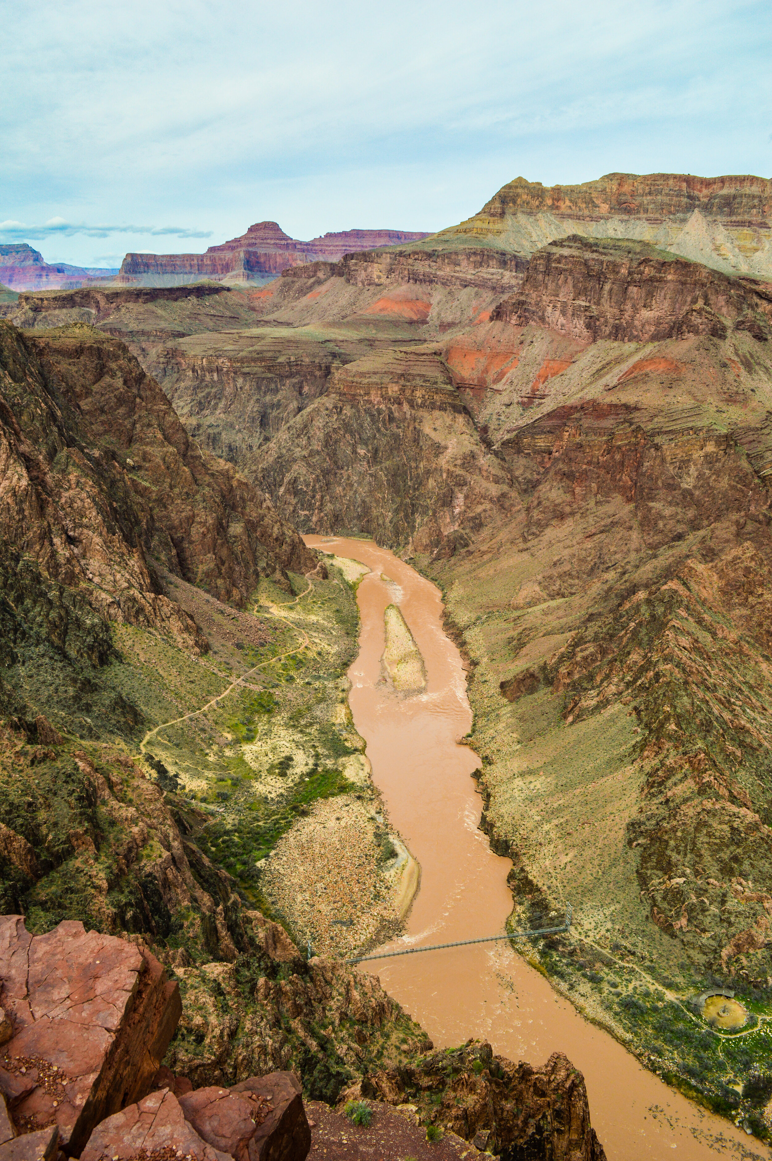
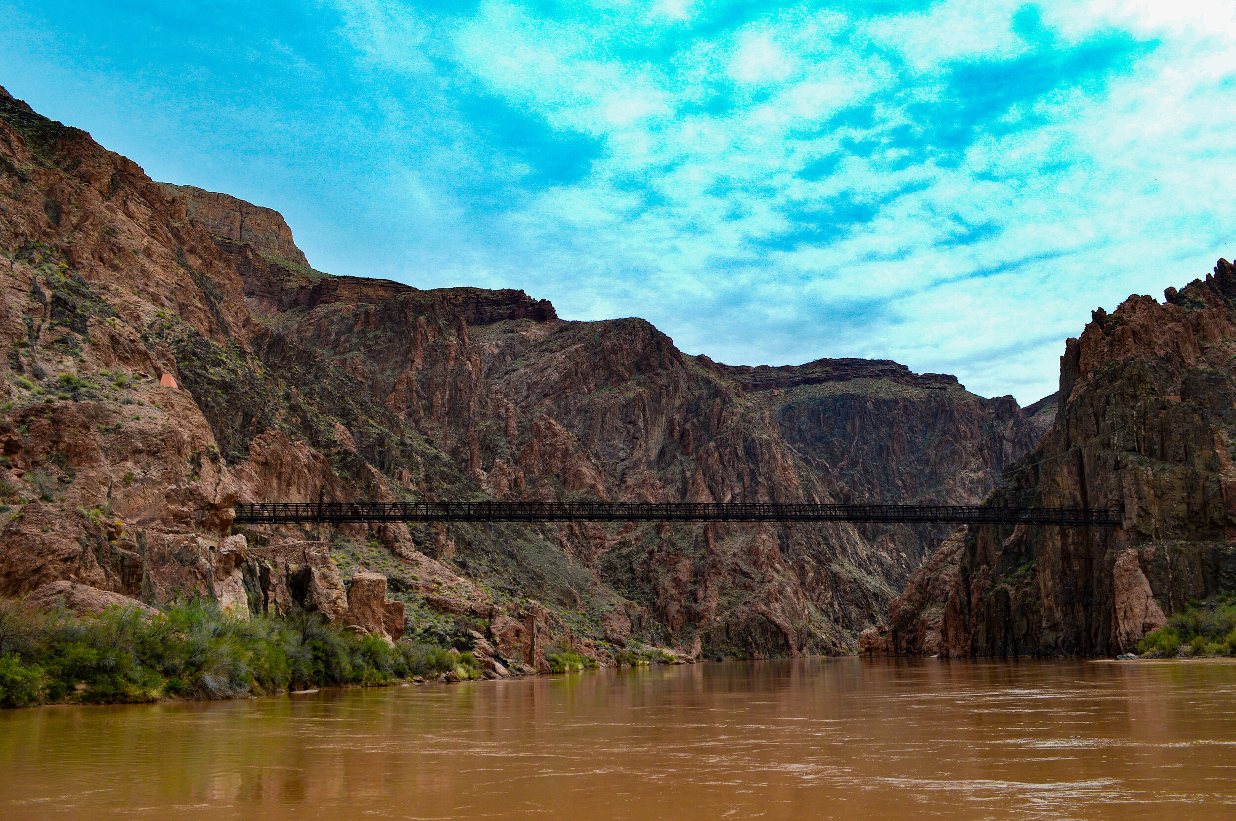
Of course, getting down to the bottom of the canyon is the easy part; it was easy to lose track of how far we had hiked with the wonderful views along the way and the excitement of reaching the sandy banks of the Colorado River – coming back up was another matter. After a quick lunch on the riverbank, we refilled our water at one of the campsites and started the trek back up. The ascent up the canyon on South Kaibob was strenuous, hot (mind you it was only March and had snowed on the rim just the day before), and at times felt never ending. It certainly did not help to see some parties taking mules down and back up South Kaibob, with a smile on their face as they passed us and our sweat drenched muddy faces (don’t worry, we smiled back). And while mules are great, the total body feeling of elation upon reaching the top of the rim is something that we will take with us for the rest of our hiking days.

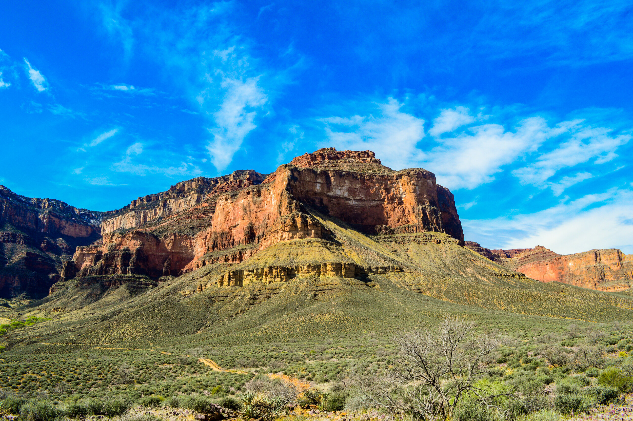
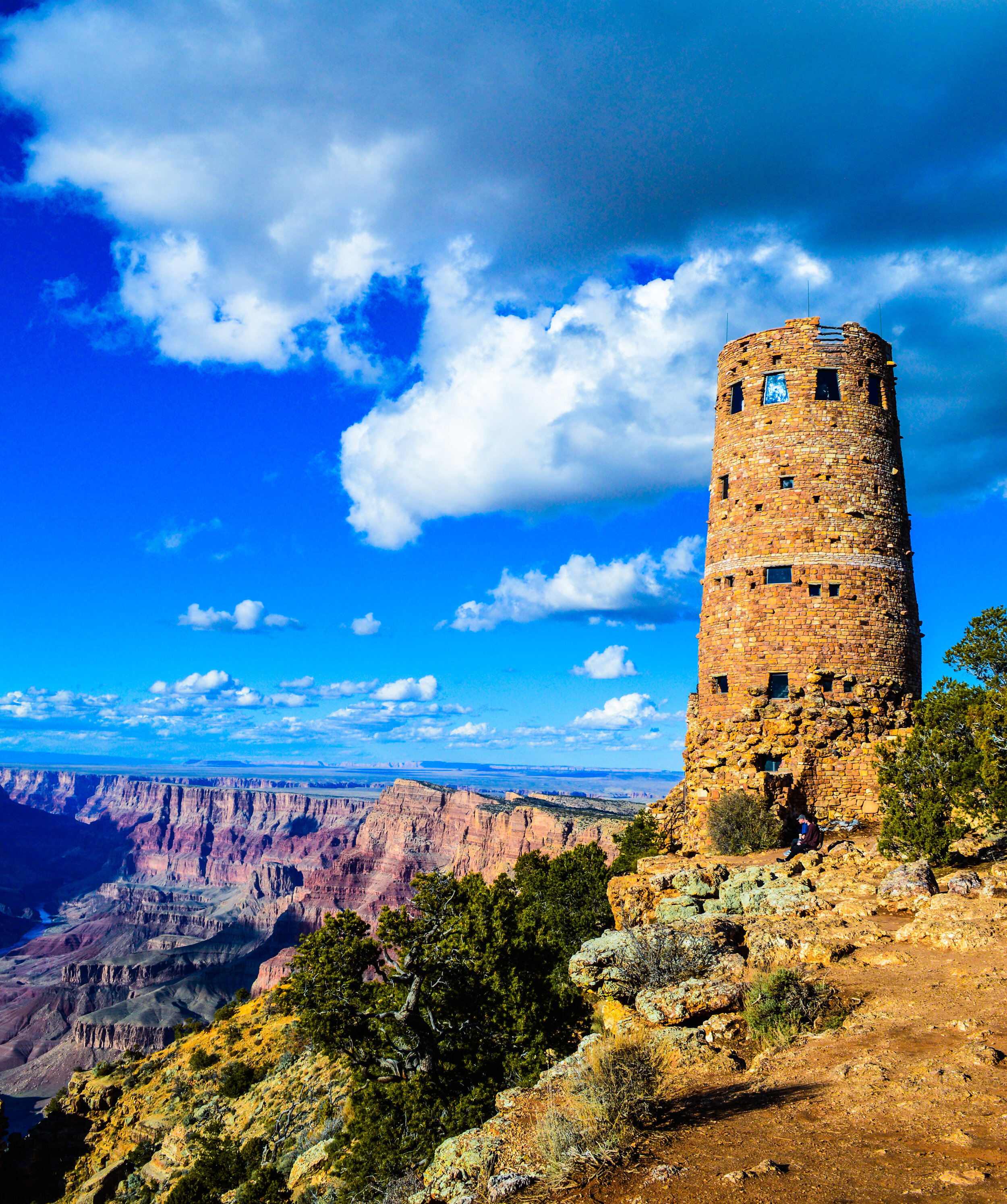
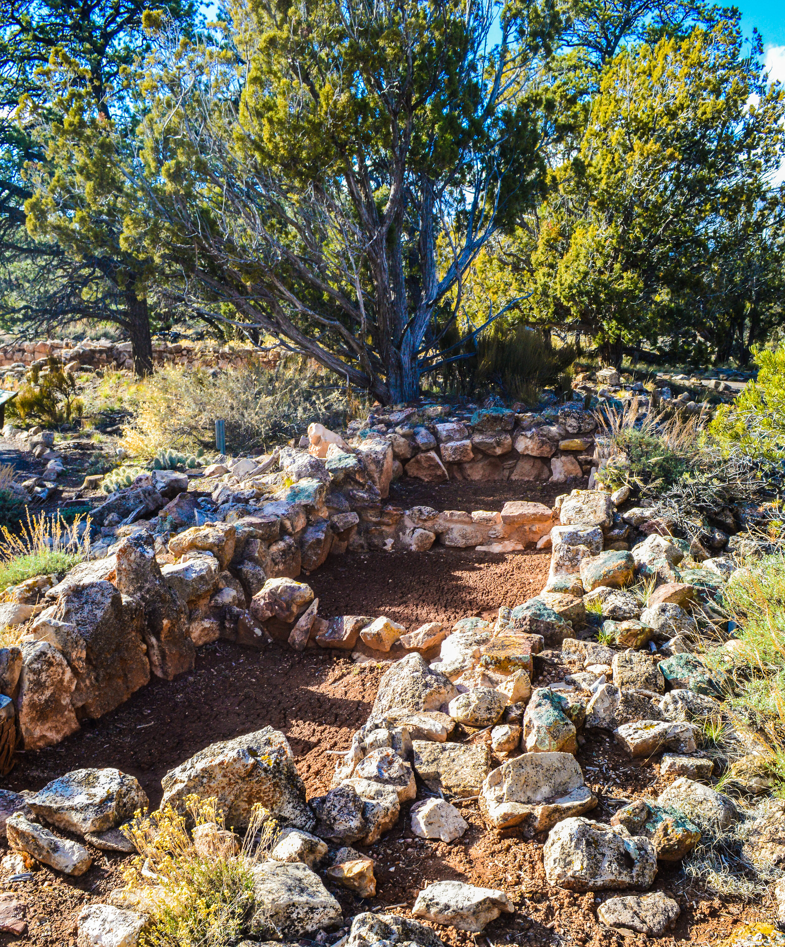
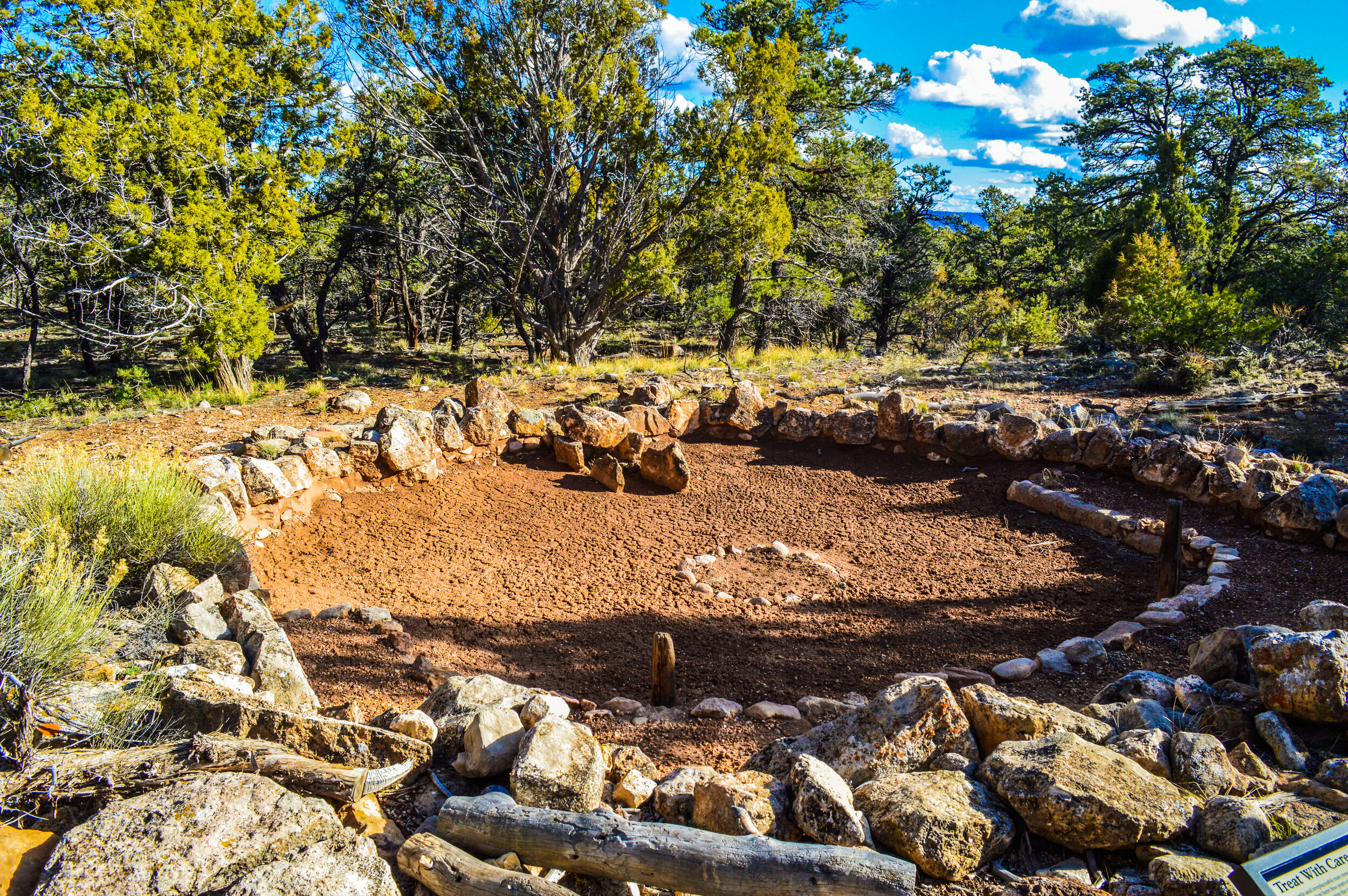
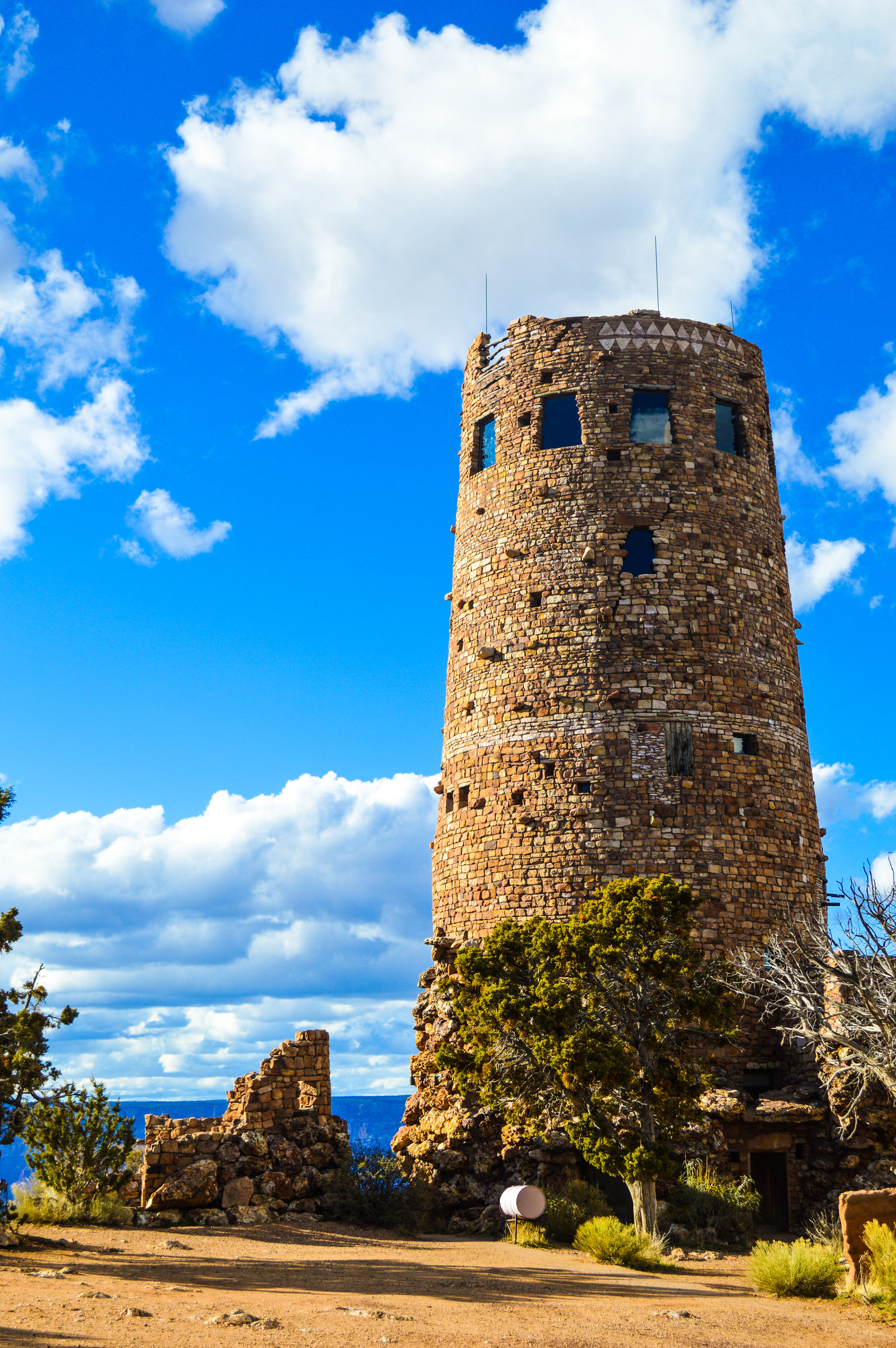
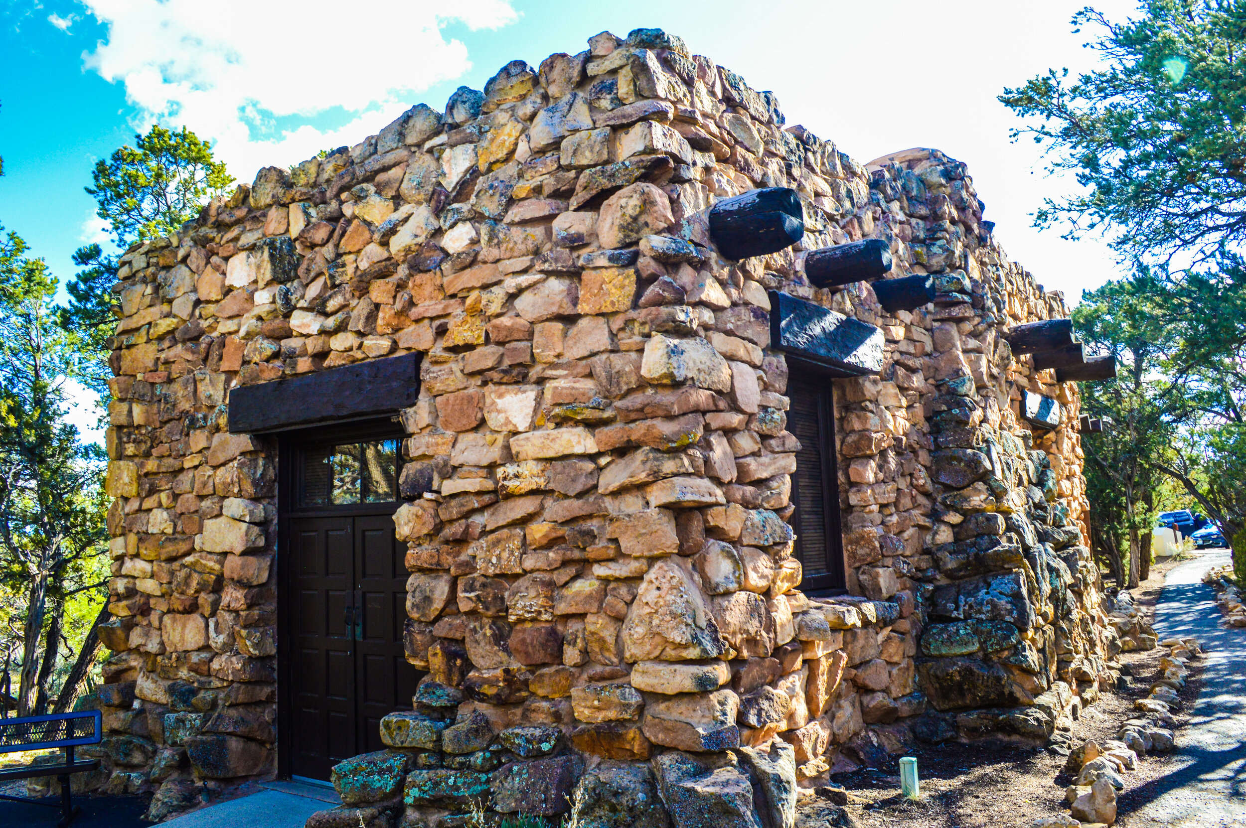
Not all trails are this extreme; we were pleasantly surprised with the plethora of paved trails along the rim and up to Hermits Rest offering plenty of opportunities to hike with the kids or go for a bike ride. The Tusayan Ruins were easy to access and offered views of the San Francisco peaks in addition to providing interesting information on the small community of ancestral Puebloans who used to occupy the plaza, kivas, and storage rooms that are still present. One of our favorite family outings was to Desert View Watchtower, just outside of the East Entrance to the park. This four-story watchtower is one of the several visitor concession structures designed by Mary Colter found throughout the park. While it is not an authentic building from the native peoples, the architecture of the ancestral Puebloan people and towers found in Mesa Verde served as Colter’s model. From various points in the tower, you can see the Colorado River head westward, the North Rim more than 10 miles away, and on a clear day, panoramic views of the canyon for over 100 miles. Inside, the tower is decorated with petroglyph-style decorations by Fred Geary and murals by Fred Kabotie. While I wish we could have visited some of the native dwellings and prehistoric trails of the Puebloan people, this tower was an accessible way for us to enjoy some of the history of the area as a family.
It’s all fun and games until a pandemic hits. It was clear throughout our stay that while we were isolated and relatively alone in the Grand Canyon, the world around us was falling apart. Up until our stay in the Grand Canyon, the only real effects we had felt of the pandemic were fewer people in the national parks (win!), and a lack of access to toilet paper and baby wipes (thanks for hording America, real classy). By the end of our stay, the National Parks were closing, small towns were not accepting outside visitors, and we found ourselves suddenly without a plan for the rest of the spring/summer as many campsites were auto-cancelling reservations.
Knowing that our next destination was extremely remote and with low infection rates, we decided to continue on and see how the virus and the US response developed. No better way to social distance than move to the middle of nowhere, right?

On our way out of The Grand Canyon


