
Ouray - Scenic Drives

As spring started to turn to summer, we found that more of the passes and off-roading that Ouray had to offer were beginning to open. With COVID still in full force, it felt like scenic drives to hidden mountain towns and time spending off-roading would be an excellent way to stay safe and enjoy the outdoors. Besides, Ouray is known among jeepers as the “Jeeping Capitol of the World” - how could we resist??
Alpine Loop and Animas Forks
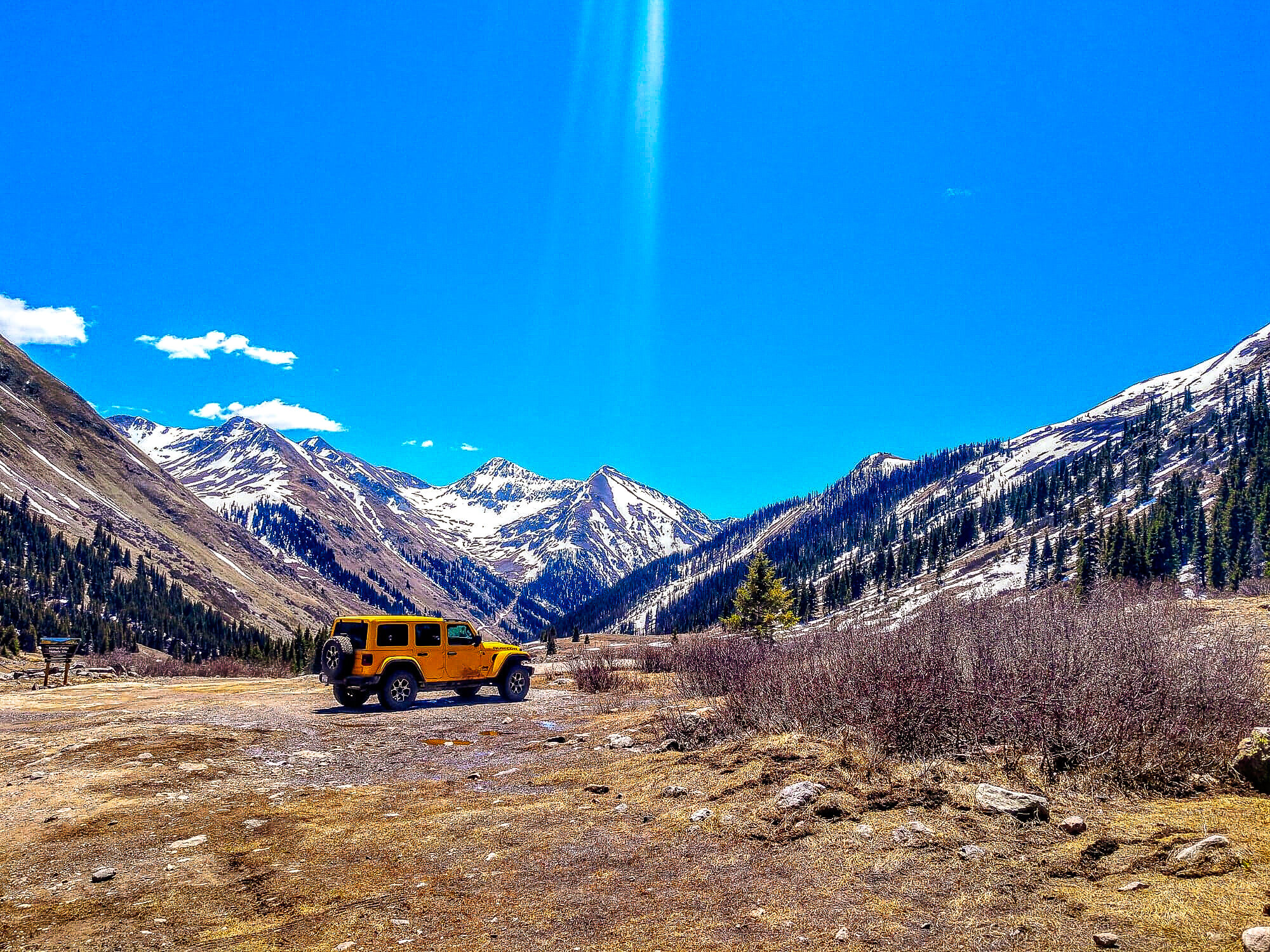
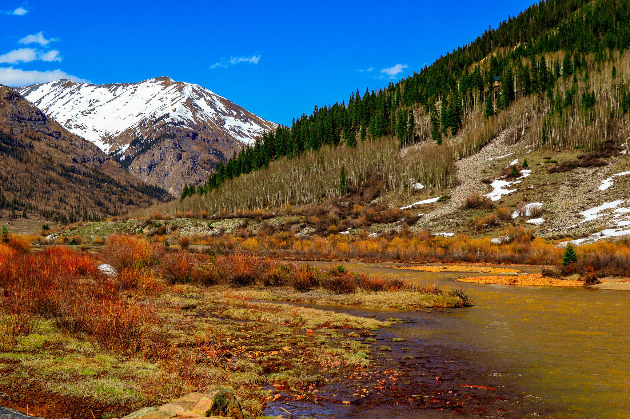
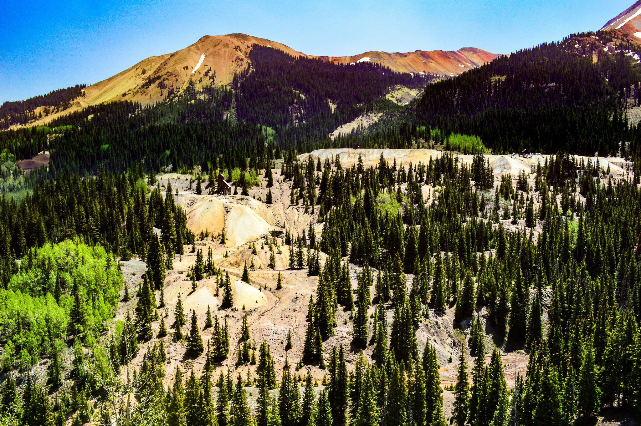
Ouray sits within a mountain range filled with mining history. While the Ute Indian tribe had long known about the beauty and abundance of natural resources within the San Juans, it wasn’t until the 1800s that minors came in search of silver, gold, lead and zinc. These early mining communities carved networks of roads through the rough and rugged terrain, enabling them to transport ore and supplies by mule-drawn wagons from Silverton, Lake City, and you guessed it, Ouray. While the mines and mills closed long ago, the roads still remain – it is this network of roads that form the Alpine Loop National Backcountry Byway (one of the nation’s first backcountry byways!). Unlike most scenic byways, backcountry byways focus on historic sites found only via gravel and dirt roads. This 65-mile scenic drive travels through treeless tundra and mountains that have seemingly been painted red and yellow by nature’s artistry.

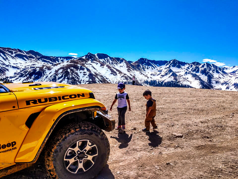
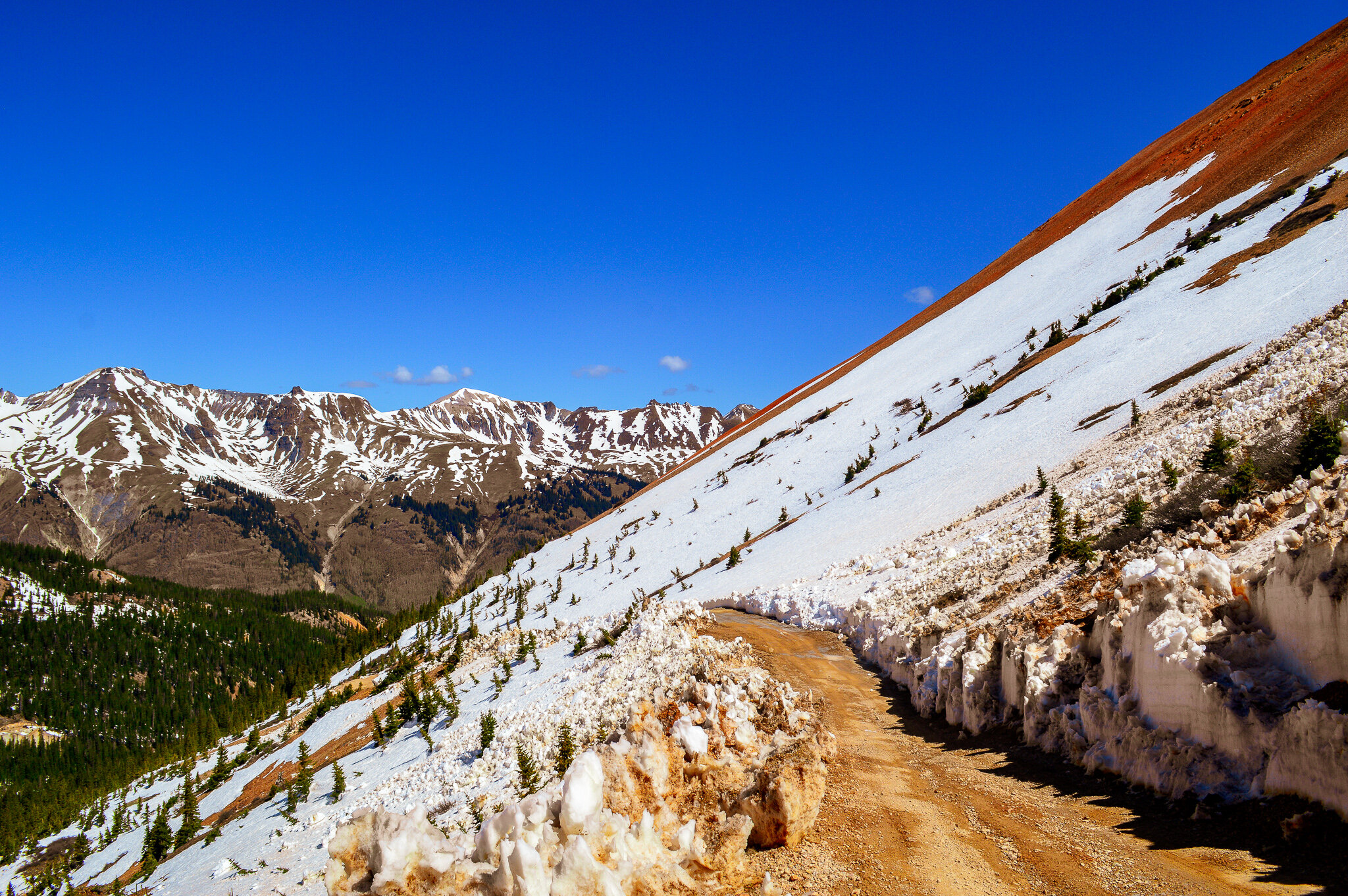
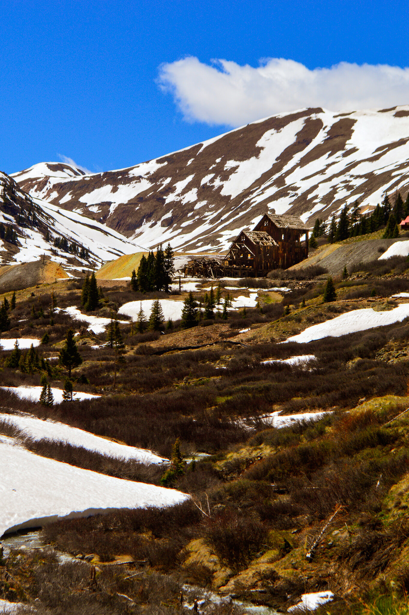
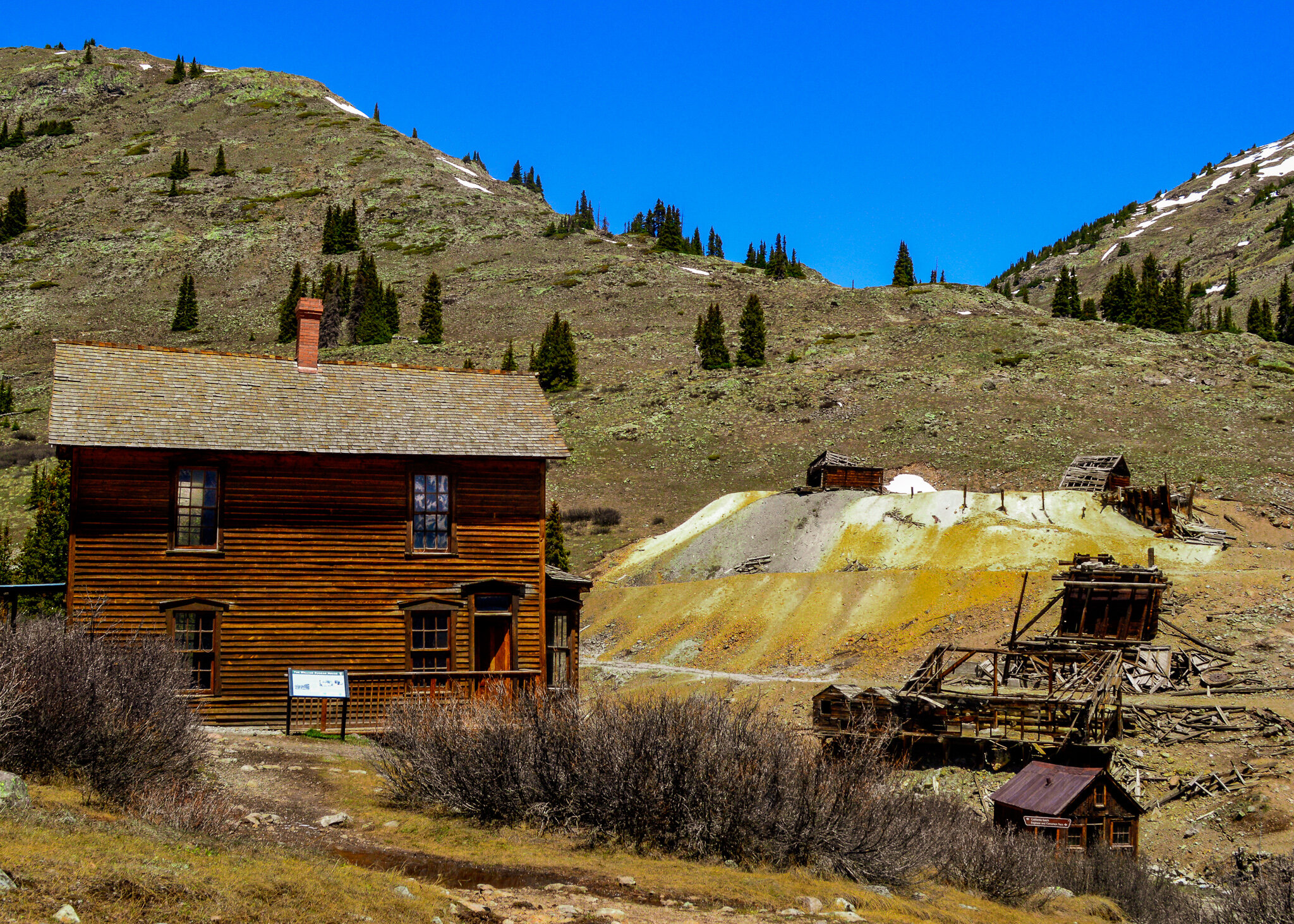
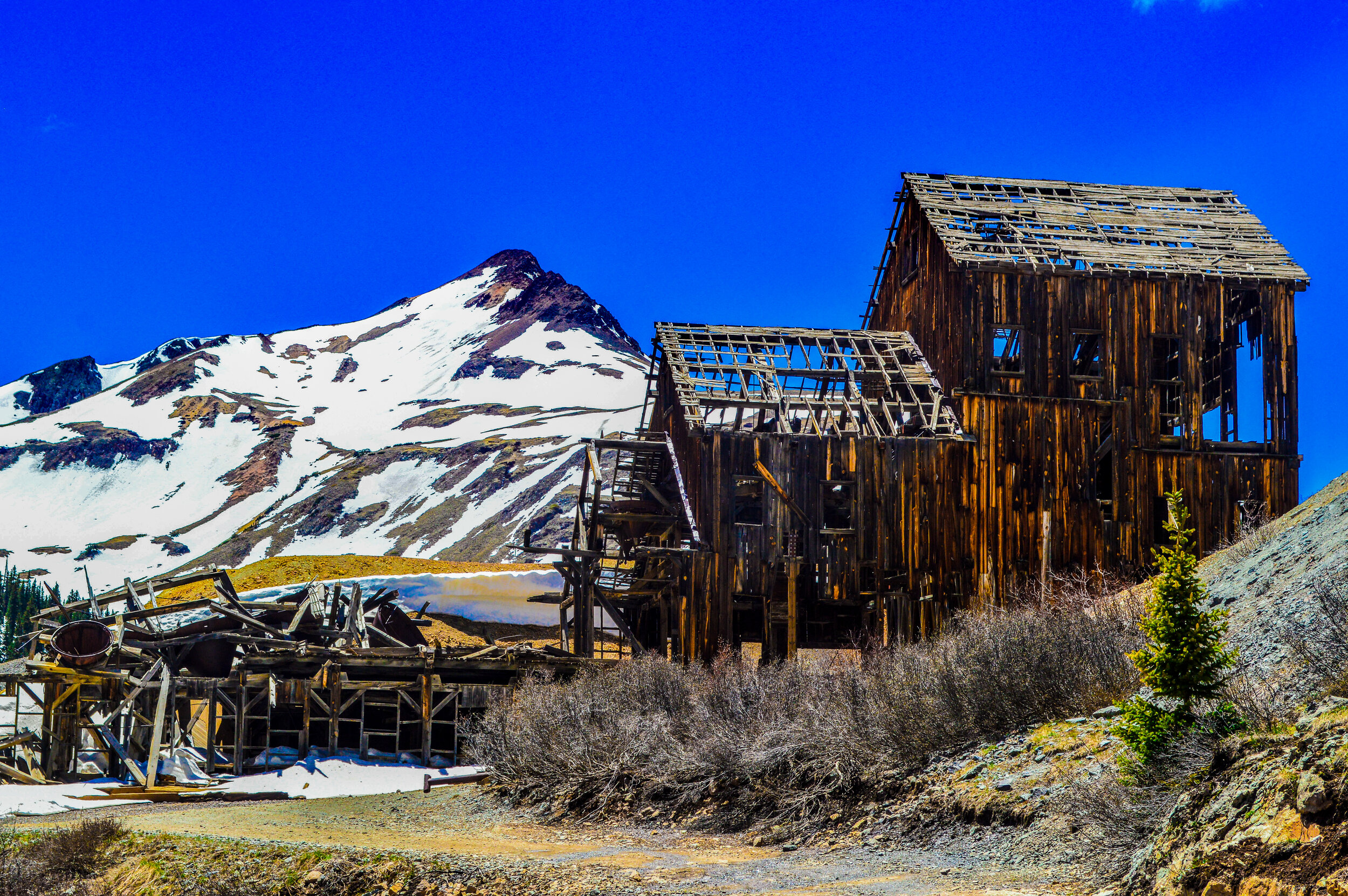
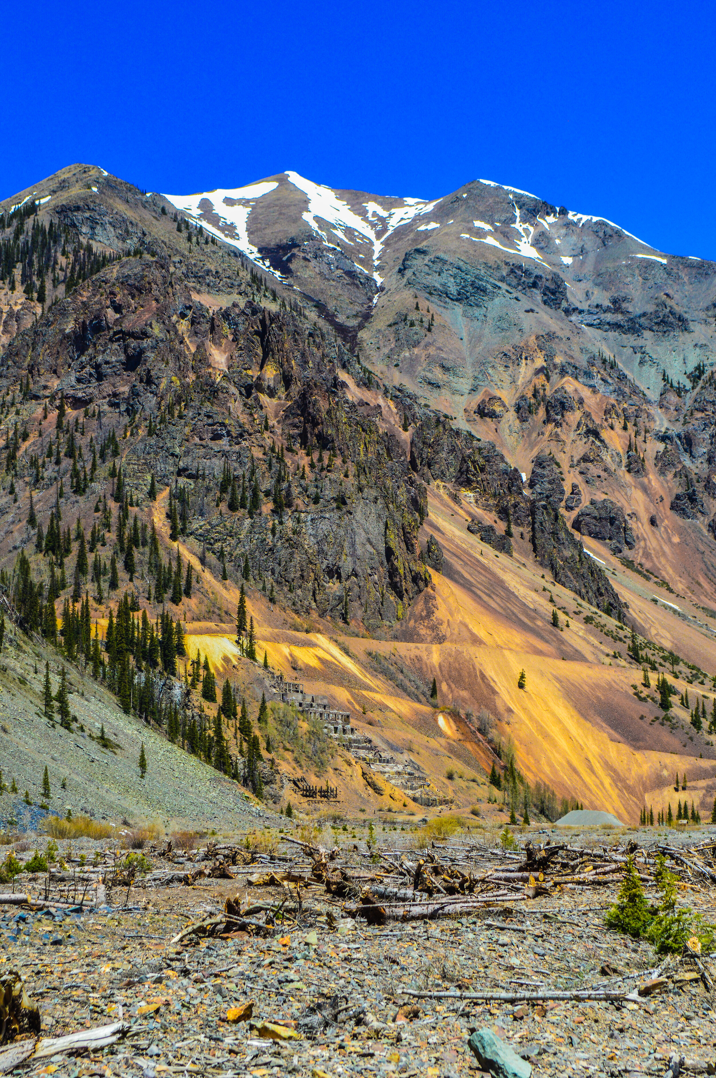
Unfortunately, this loop has a narrow window in which it’s snow-free, and we caught the tail end of snow limiting how far we could go. Engineer Pass was closed, but that didn’t deter us from making our way to Animas Forks and stopping at several ghost towns and abandoned mines along the way! With a borrowed Rubicon, we made our way through Ironton (abandoned mining town that was active up until the 1960’s) and up and over Corkscrew Gulch Pass. Situated at 12,244’, this section of road takes you thru the iconic Red Mountains (who get their color from the high concentrations of iron oxide in the soil) before descending to California Gulch and into Animas Forks.
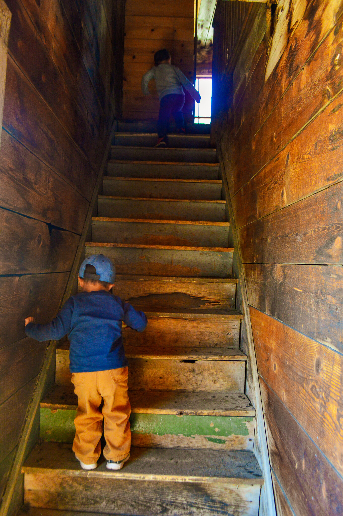
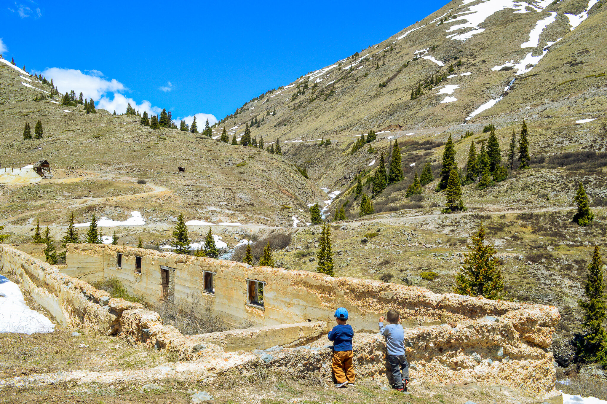
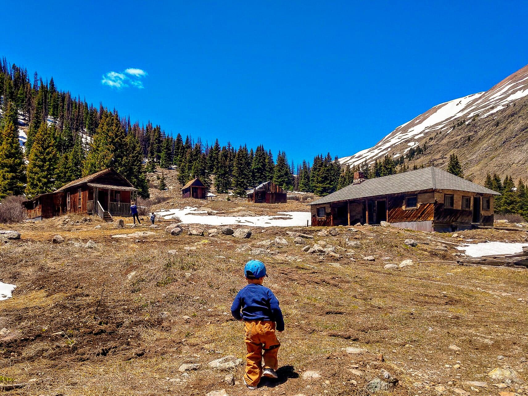
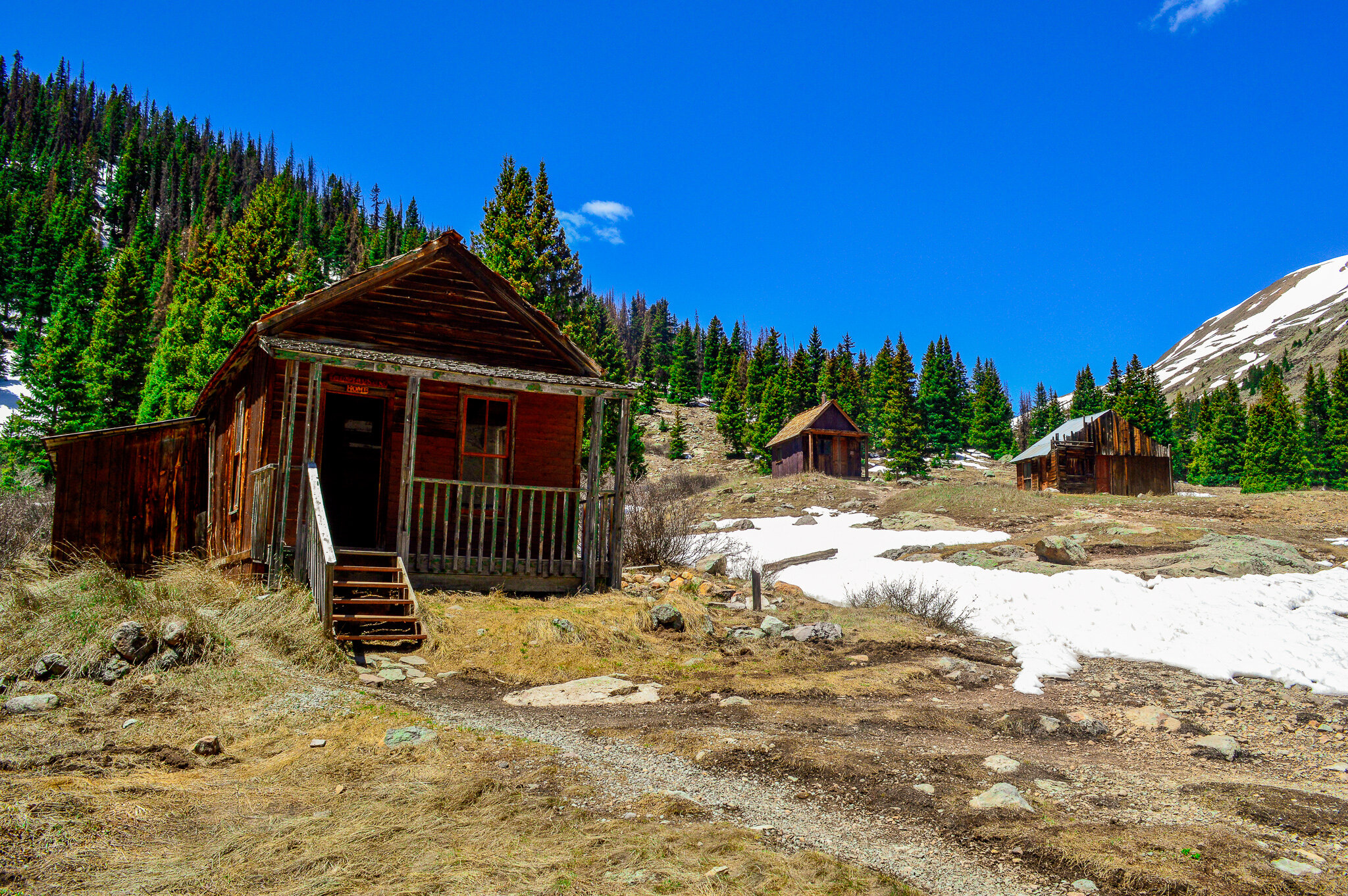
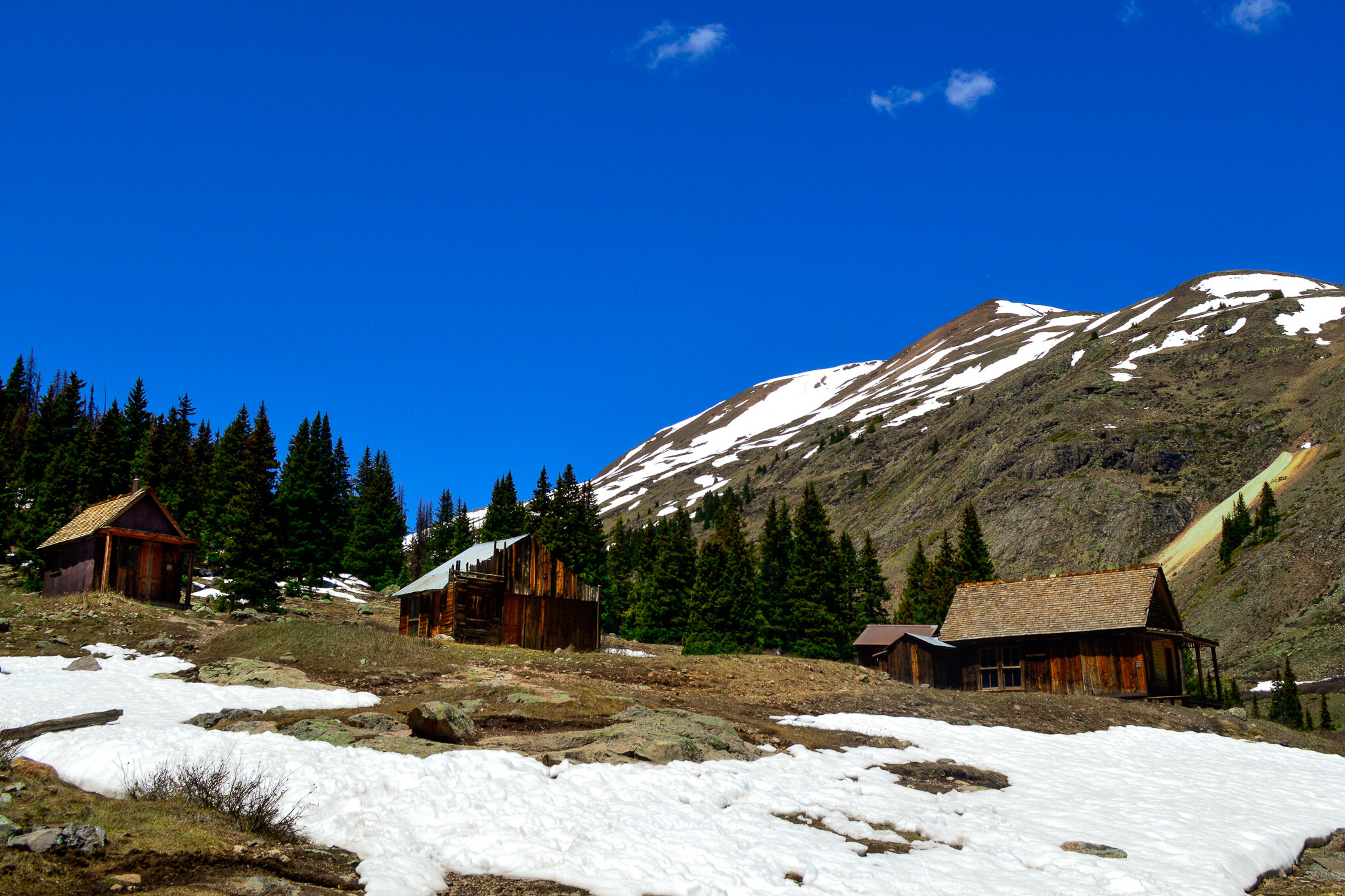
Animas Forks was by far the best-preserved ghost town we visited. Sitting at 11,200 ft’, the first log cabin was built here in 1873. By 1876, Animas Forks had become a bustling mining community, boasting 30 cabins, a hotel, a general store, a saloon, and even a post office. By 1880, the population was at 114 and grew to 450 over the next few years. So what happened? Ghosts of the native Ute tribes cursed the early pioneers who had stolen their lands and scared everyone away - thus the title of “ghost town”.....no, not really 😊, but the real story is still pretty incredible! In 1884, a blizzard inundated the town with 25 ft of snow, forcing residents to dig tunnels to get from building to building. These conditions lasted for 23 days, with residents being cut off from any source of supplies. Combine this with a devastating fire that resulted in the destruction of the hotel and 14 other buildings a few years later, and it’s easy to see why most residents moved away. In 2011, Animas Forks was listed on the National Register of Historic Places and remains one of the highest mining camps in the nation. Nine buildings remain standing and are open to exploration for those willing to make the trek up – something the kids absolutely loved.
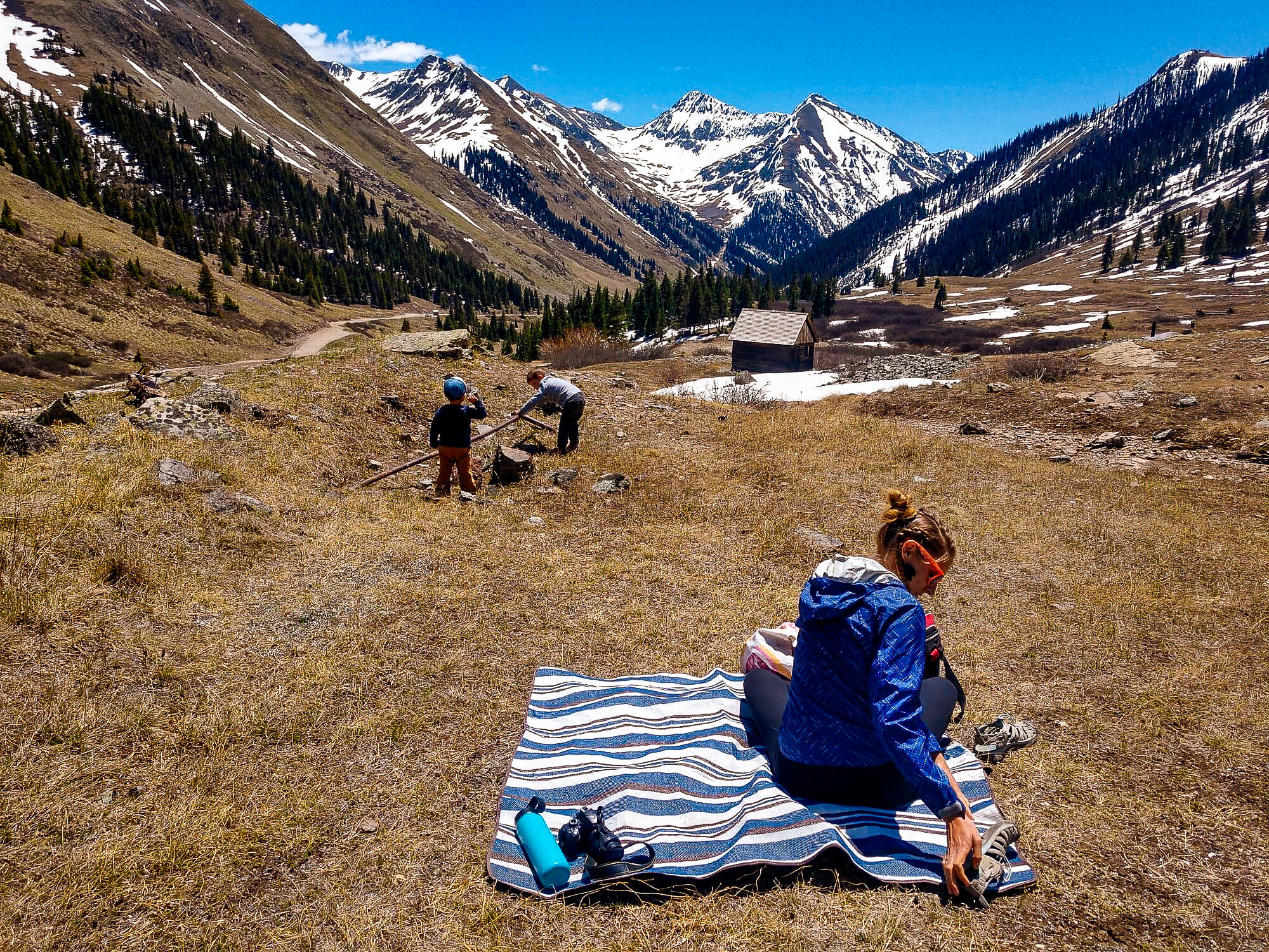

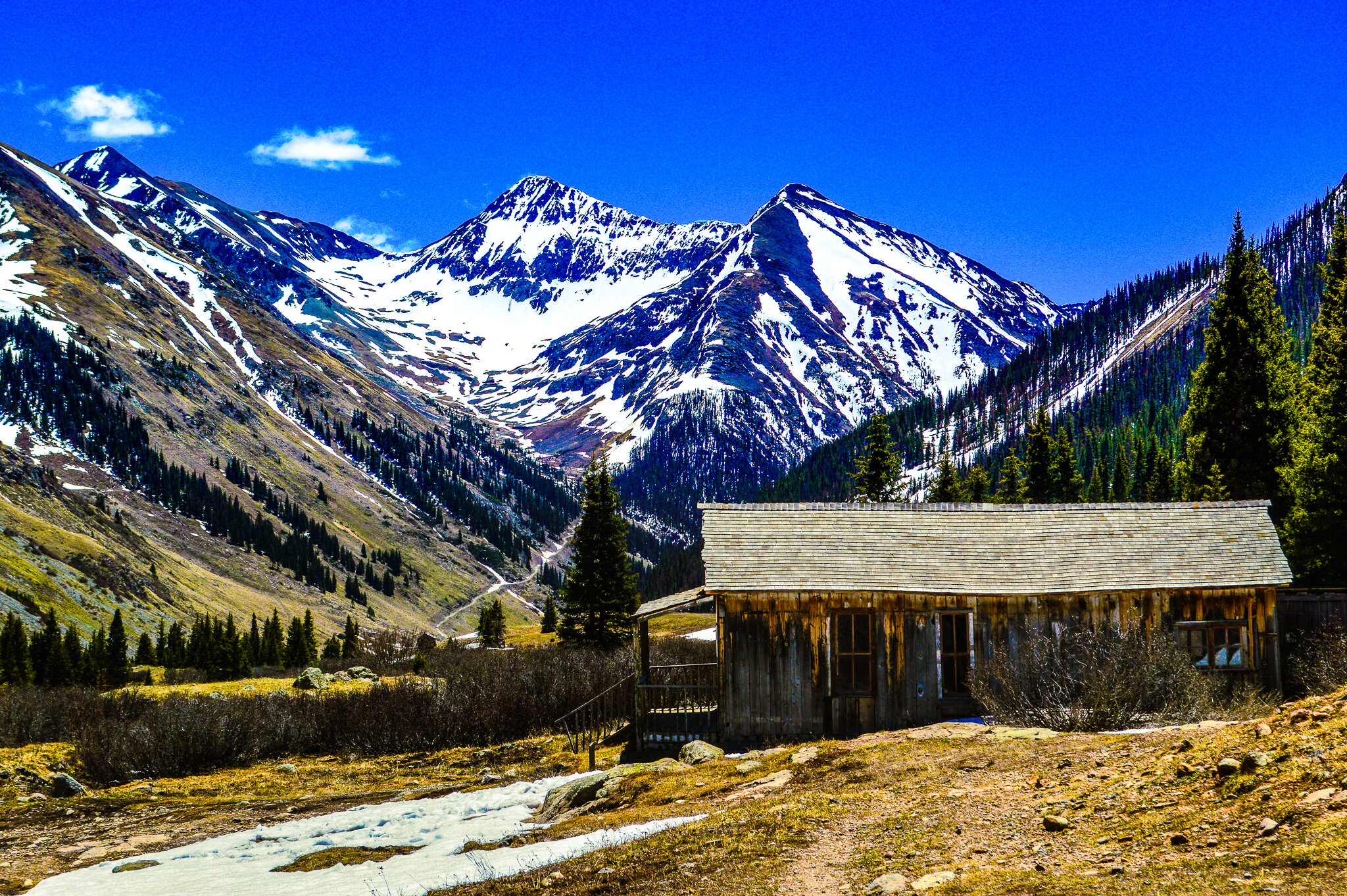
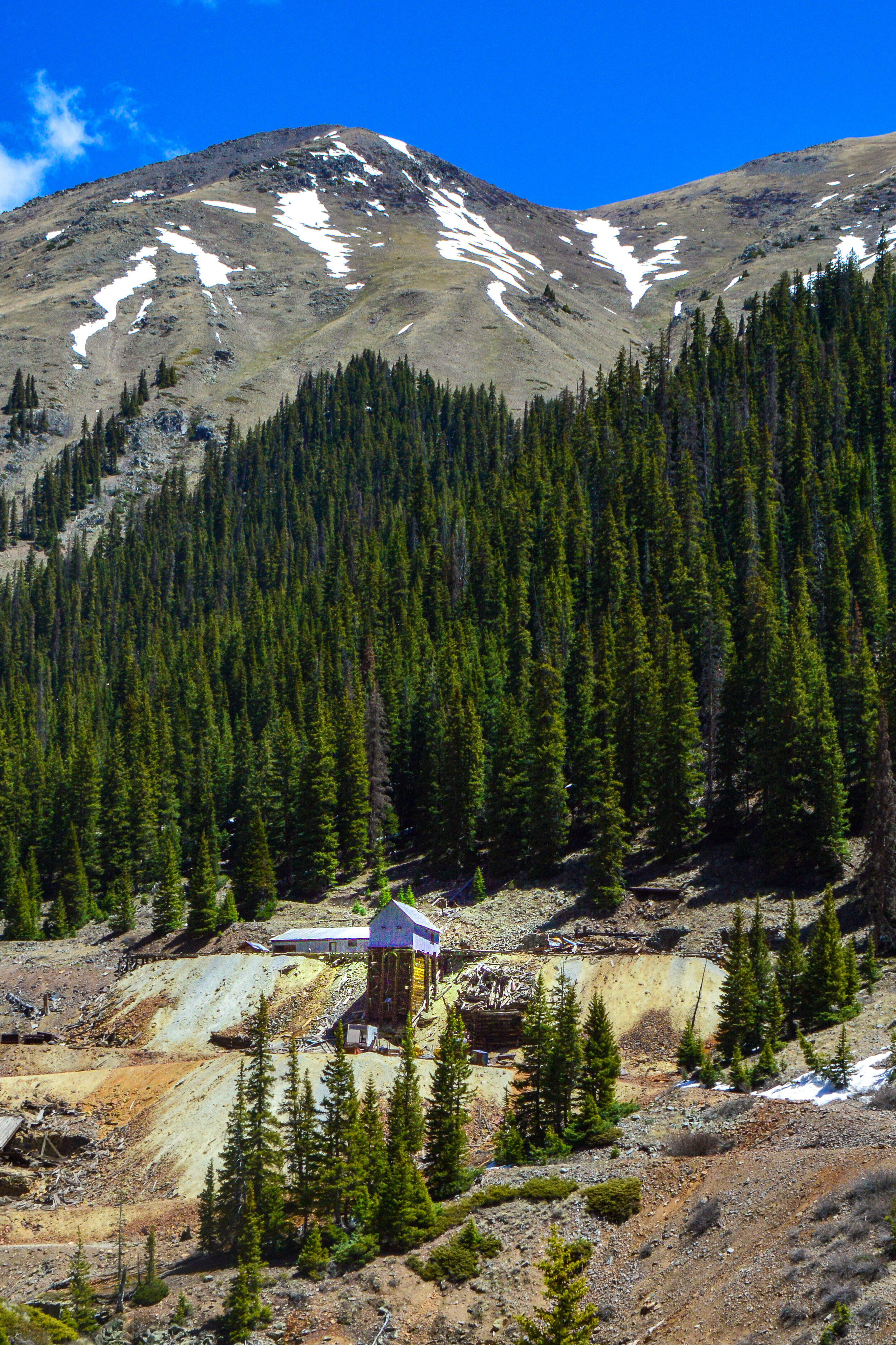
After a picnic near one of the 70 abandoned mines on this loop, we got back in the Jeep, drove past a few of the other 7 ghost towns, and circled back towards Silverton to end our version of the loop.

San Juan Skyway

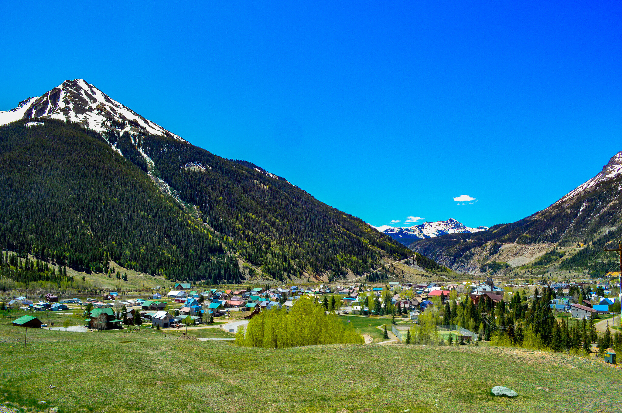
Another drive that was highly enjoyable was completing the San Juan Skyway loop. We were unable to complete this loop in one drive, however spread it out over a month so we could enjoy several of the destinations along the way. Connecting the towns of Durango, Silverton, Telluride and Ouray, the 235-mile San Juan Skyway Scenic and Historic Byway is certainly considered an essential drive for visiting historic mountain mining towns. In fact, Travel + Leisure named the San Juan Skyway one of “America’s Best Spring Drives” for it’s million-dollar views. Indeed, the canyon-clinging stretch of highway between Ouray and Silverton is called “The Million Dollar Highway,” though there is debate on if this title comes from the “million dollar” views, or the amount of gold ore that remains in the roadway’s fill. Regardless, the Million Dollar highway clings to the steep canyon walls of Uncompahgre Gorge as it makes its way up and over Red Mountain Pass (which has a summit of 11,075’) before heading down into Silverton. Silverton is a former mining camp and is a designated National Historic Landmark District. While mine pollution eventually led to mine and mill closures, the town subsides on tourism and in my opinion, delicious beer.

Durango-Silverton Narrow Gauge Railroad
Silverton is connected to our next destination, Durango, by the Durango-Silverton Narrow Gauge Railroad; known both as a national historic landmark and a historic civil engineering landmark. The line has run continuously between Silverton and Durango since 1881 – while originally designed to transport silver and gold ore mined from the San Juans, it is now a tourist/heritage line and is one of the few places in the US which has relied solely on steam to power the line. While we would have loved to ride as a family, COVID ensured all operations were suspended. Instead we drove alongside the tracks when possible, chatted about its history, and made our way over Molas Pass (10,899’) and Coal Bank Pass (10,660’) into Durango.
Admittedly, we did not spend much time in Durango. Much of the town was shut down due to COVID, and while hiking is always an option, many of the other outdoor activities Durango has to offer felt out of the range of our toddlers. As such, Durango was more of an overnight stop as we explored the nearby Mesa Verde National Park and Canyon of the Ancients (which will be detailed in a future post).
The loop continues to the southeastern tip of the state with stops in Mancos, Cortez, and Dolores – all small railroad/mining towns, but well preserved, offering a taste of the “Old West” and a glimpse into some of the living traditions of the Native Peoples of the area. With more time, spending a week exploring not only Mesa Verde and Canyon of the Ancients, but the Anasazi Heritage Center, Hovenweep National Monument, Aztec National Monument, and Crow Canyon would be well worth the trip.

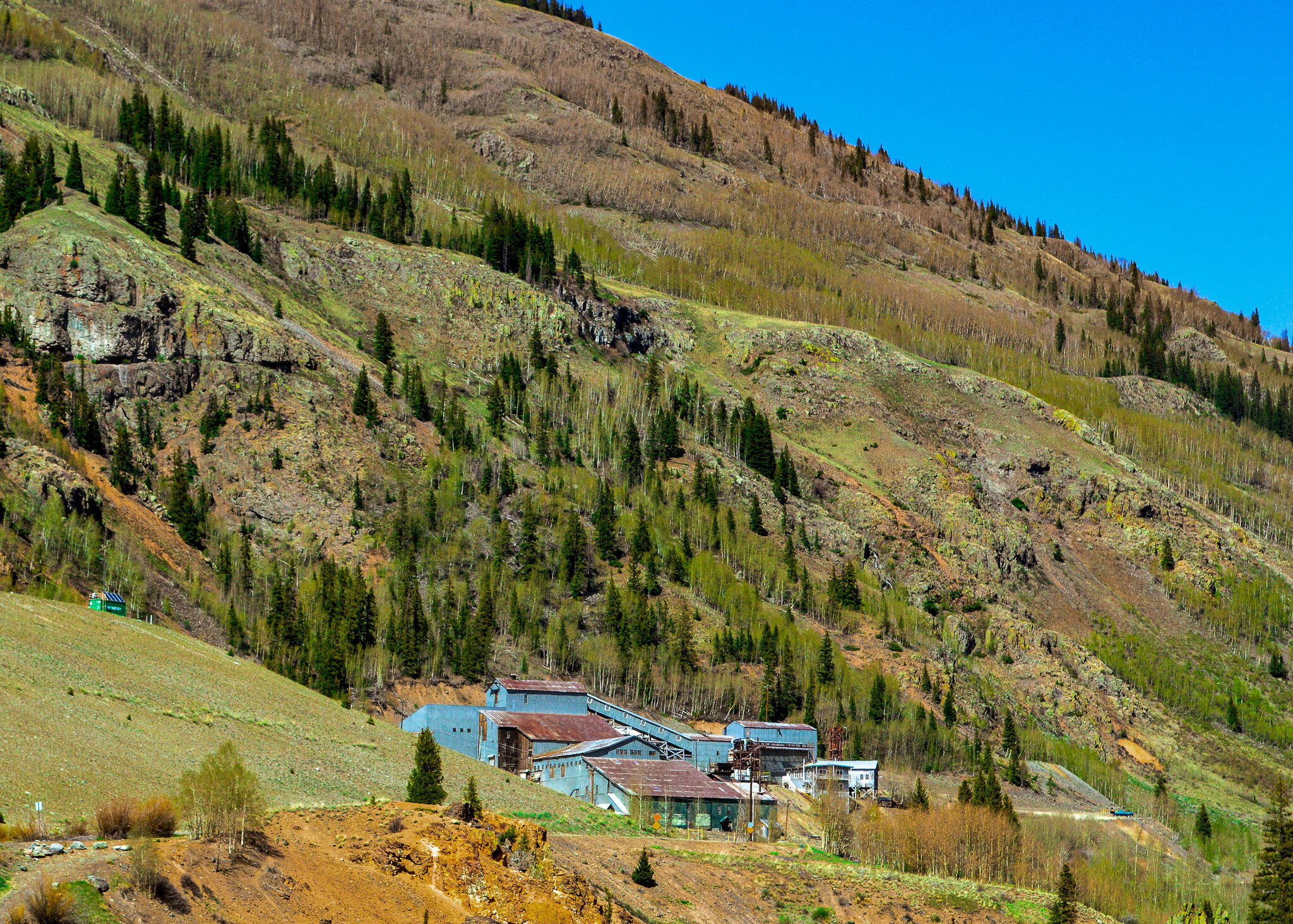
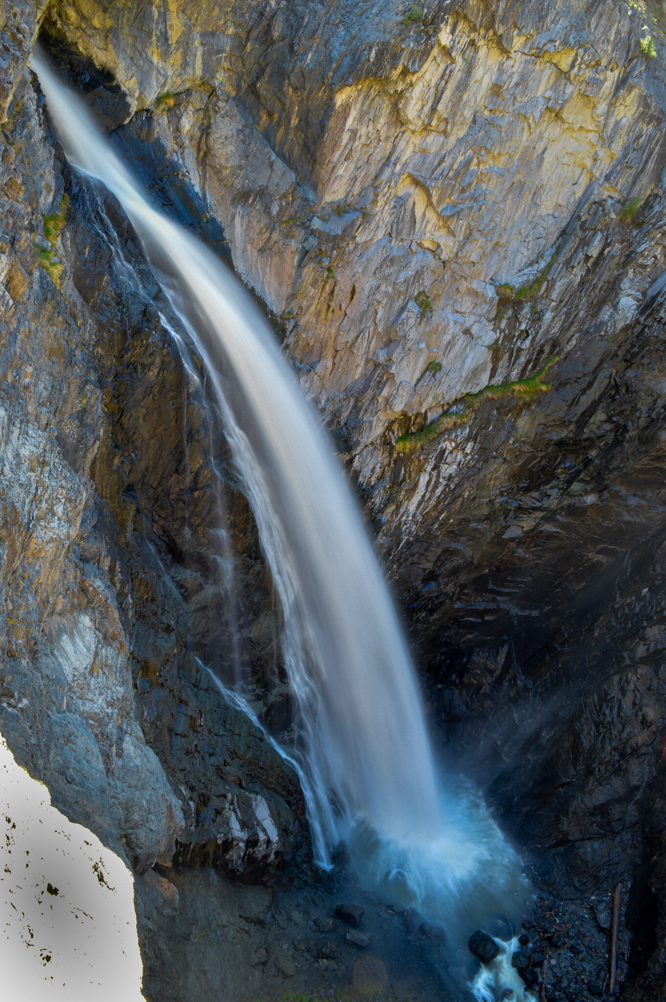
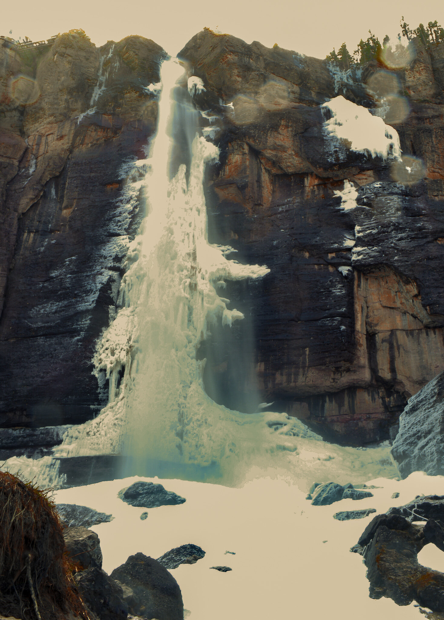
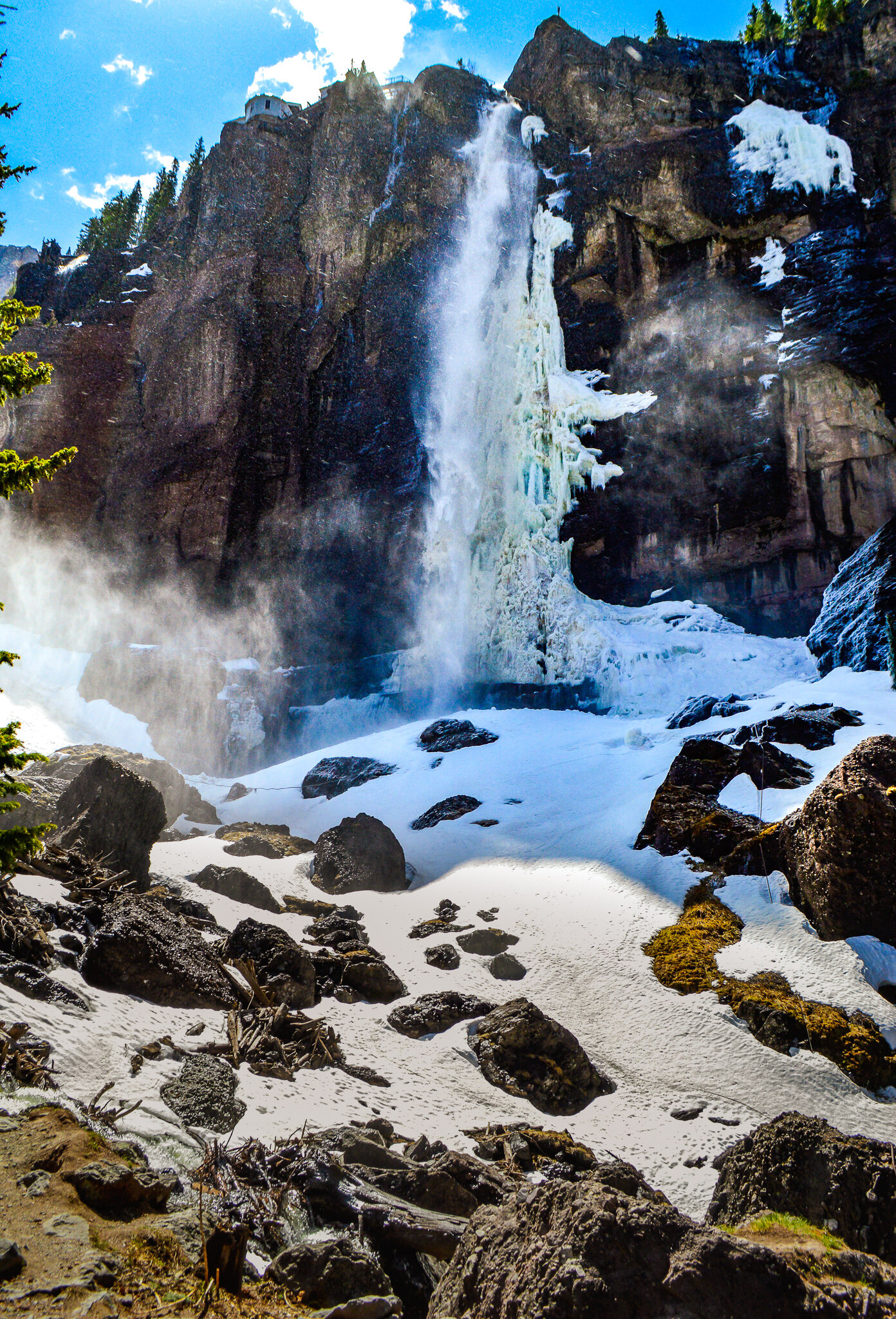
The loop then circles back north to Telluride. Once a mining camp, now turned high-end vacation destination, Telluride was a particular favorite for our family. Its national historic district downtown is well preserved, though it was Bridal Veil Falls that really appealed to us (big surprise). At 365 ft in height, Bridal Veil Falls is the tallest free-falling falls in Colorado! We visited in late spring, which meant most of the falls were frozen over – truly a spectacular site that was difficult to fully capture on my camera. The falls sit at the end of a box canyon that overlooks not only Telluride, but an old mill for the Pandora Mine. Driving past this impressively preserved mill, you are reminded once again why Telluride (and many of the small towns on this loop) exists. The mining industry certainly has its faults, but without flourishing throughout the San Juan Mountains, there would be no Telluride, no historic district, and likely significantly fewer people living along the Western Slopes.
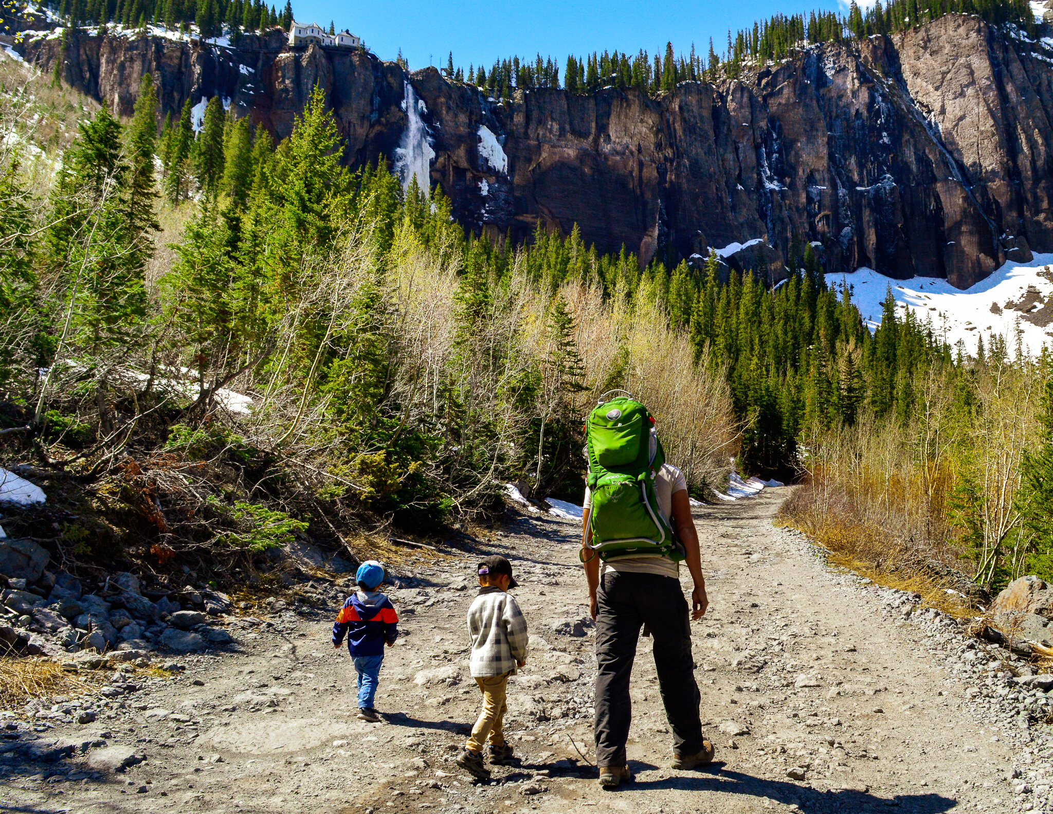
Once past the mill, the road turns into steep switchbacks as it climbs to the base of the falls. Our family choose to park near the start of these switchbacks and hike into the falls. Between the beauty of the canyon walls, and the lingering late spring snow, we were totally isolated and felt as though we were climbing thru an enchanted forest (complete with “Earth Giants” as my children would say). After a quick dip in the frozen waters and a nice picnic to round out the morning, we got back on the road towards home.
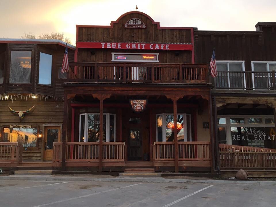
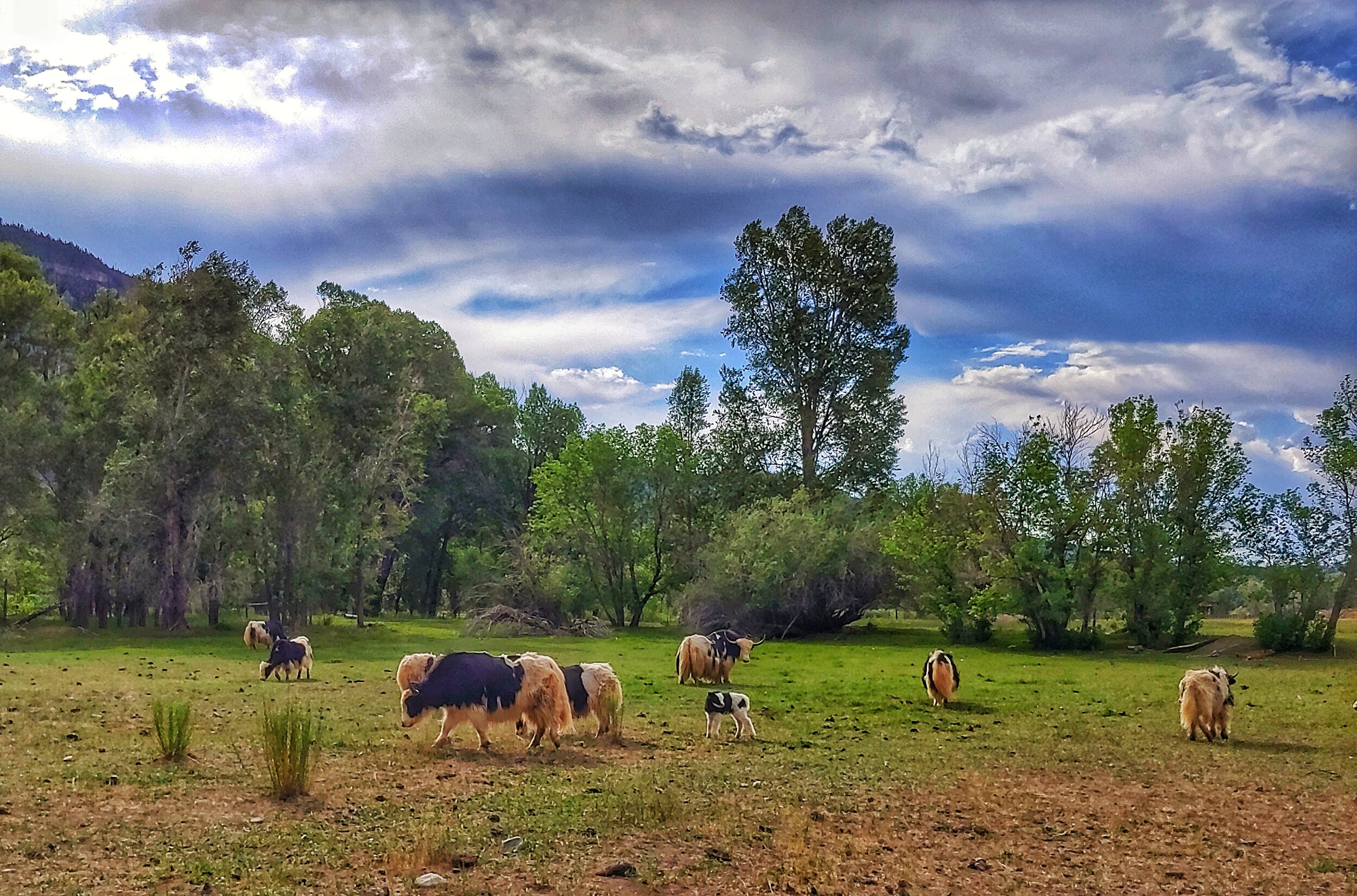
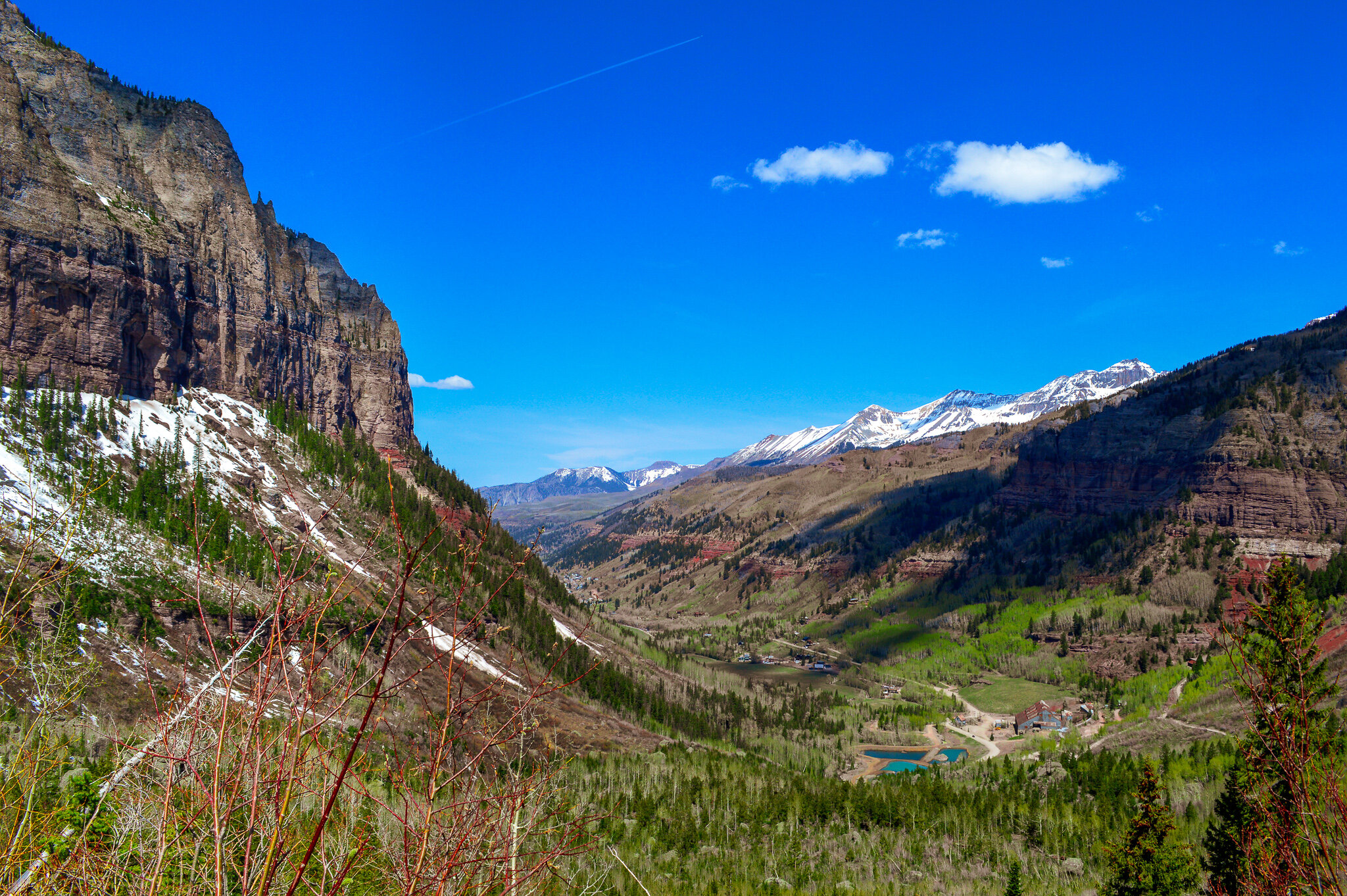
The drive from Telluride to Ouray winds through ranches, over the Dallas Divide, and by Mt Sneffels. From the top of the divide the byway descends into the small town of Ridgway. The rugged peaks, steep canyons, and preserved mines and ghost towns of this area remind us of the “American Frontier” - in fact more than 100 films have been made here! The John Wayne movie True Grit is likely the most recognizable in this area, with films sites, buildings and props still found within Ridgway. While this valley is featured in many classic western movies, Ridgway’s real ranching heritage dates back to the late 1880s and can still be seen today as you drive between Ridgway and Ouray. The large ranch plots are still functional and play a strong role in Ouray County’s economy. Since we were staying between Ouray and Ridgway, our family got to take in the beauty of this area daily, as well as meet some interesting livestock, like Tibetan yaks.
Reservoirs worth seeing
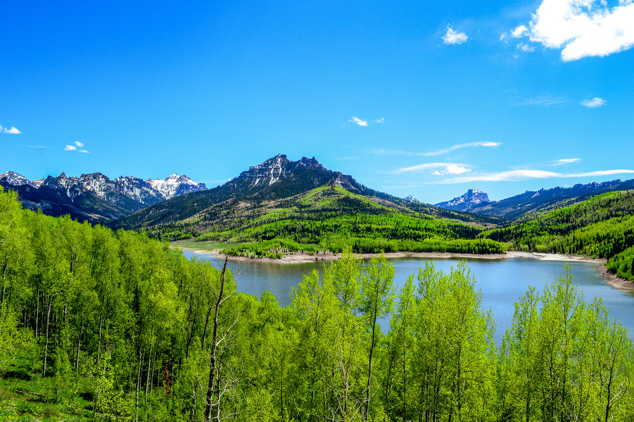
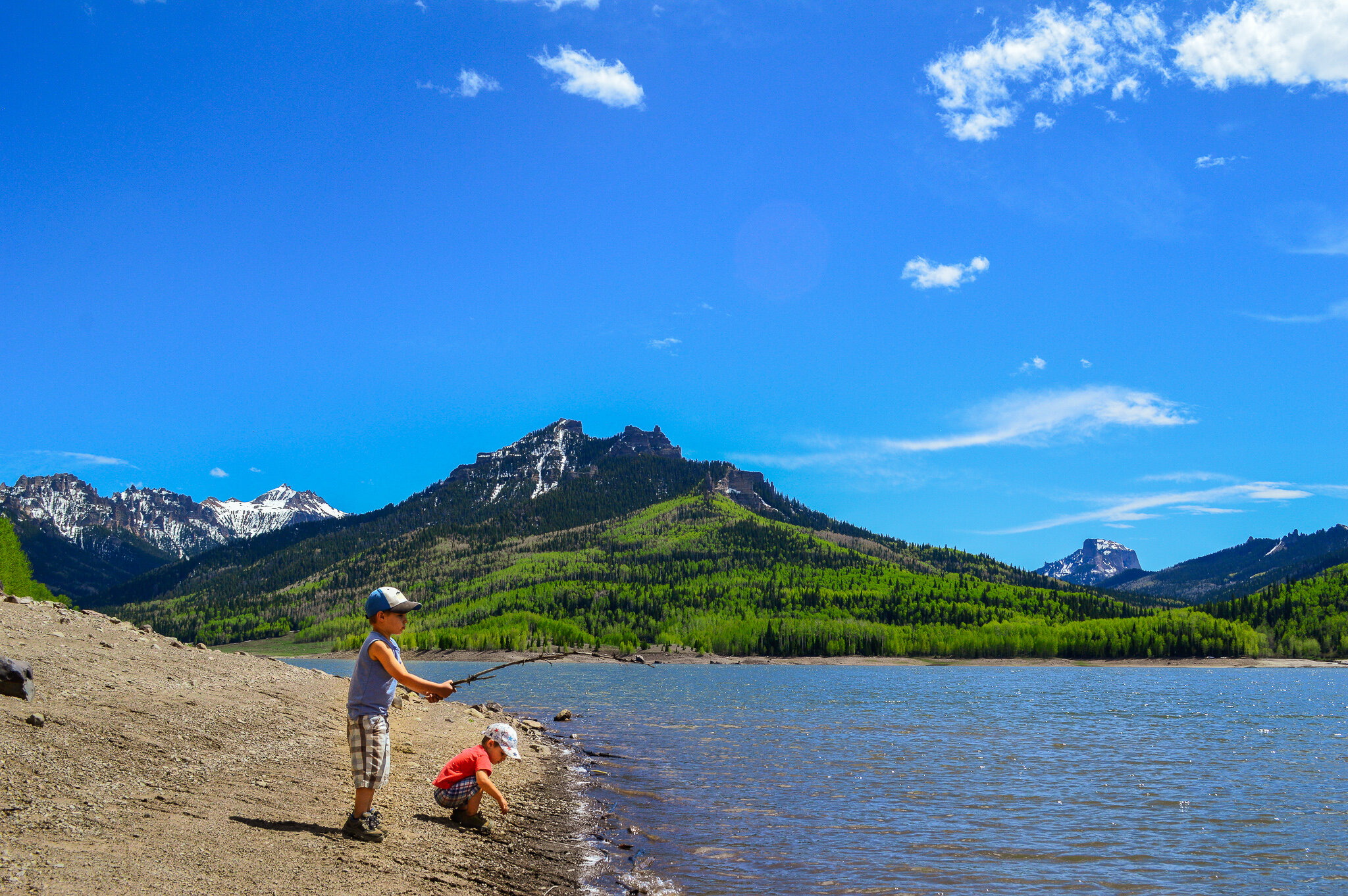
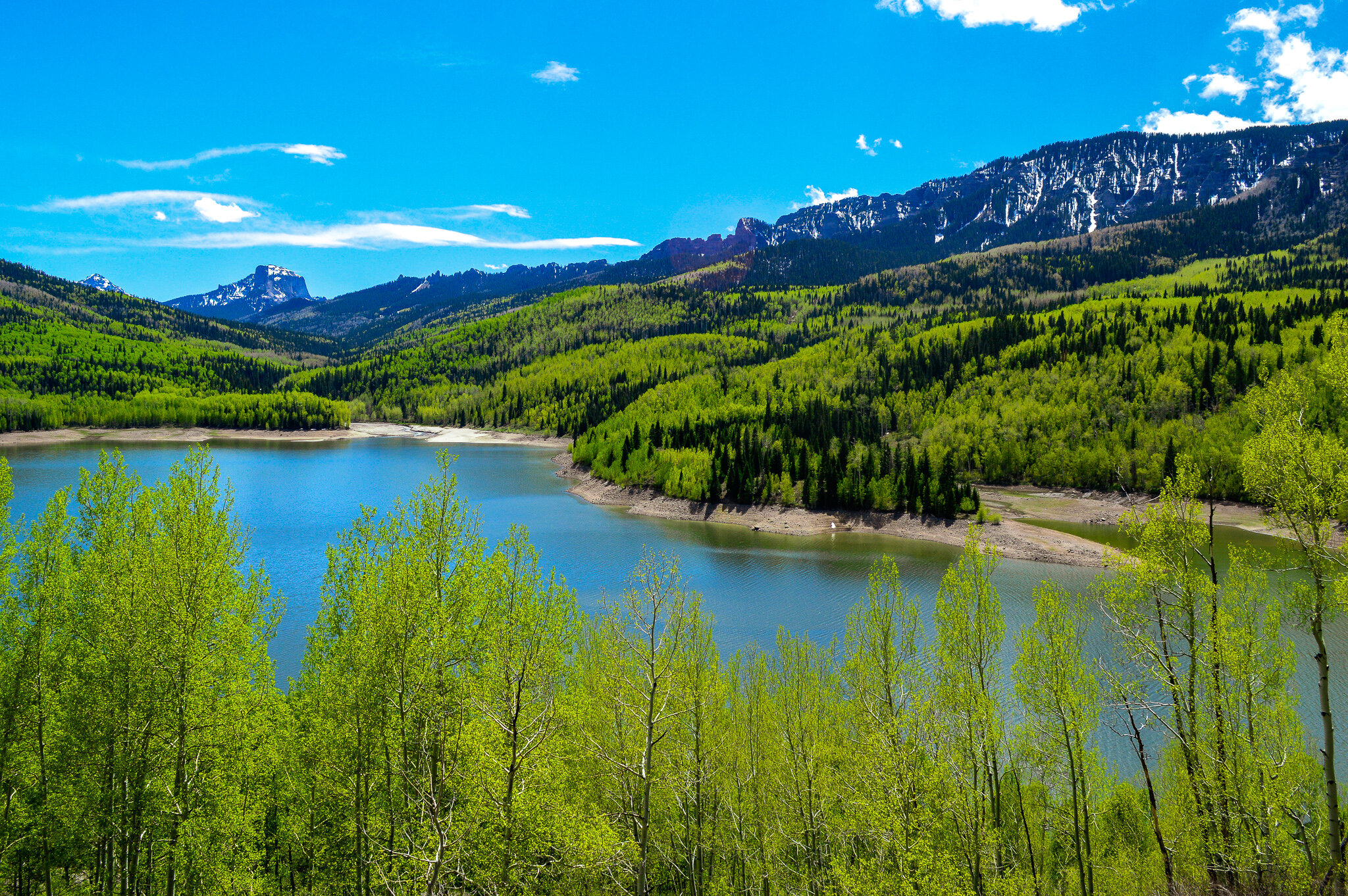
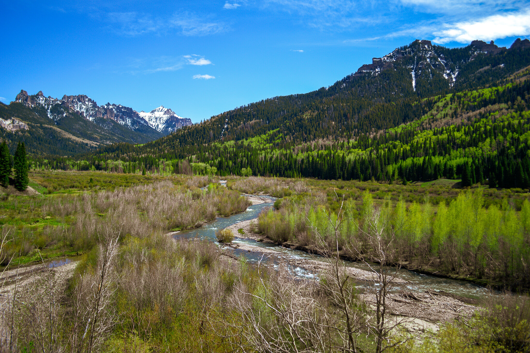
I would be dismayed if I did not mention two additional reservoirs that provided some highly entertaining half-day adventures – Silver Jack Reservoir via Owl Creek Pass and Blue Mesa Reservoir in the Curecanti National Recreation Area.
The road to Silver Jack Reservoir offers stunning views of Chimney Rock and Courthouse Mountain as you drive along an 1885 cattle-drive trail set among tall white-barked aspens, spruce and fir, and beautiful winding rivers. With five miles of shoreline and many scenic trails along the reservoir, we found Silver Jack to be a delightful picnic spot that was just far enough away from town to provide solitude for our family outing.

Blue Mesa Reservoir
Blue Mesa Reservoir is Colorado’s largest lake, spanning 20 miles in length and boasts over 96 miles of shoreline. Dotted with pinyons and patches of high-mountain desert, the talus-sloped hills and sparkling blue water feel like an oasis as you wind up and over US Hwy 50 thru the very small town of Sapinero. While Blue Mesa is the largest lake trout and Kokanee salmon fishery in Colorado (I.e. excellent fishing spot!), the Dillon Pinnacles (remnants of lava flow from volcanoes that were active 30-35 million years ago) are a site to behold and make the drive absolutely worth it!

Dillon Pinnacles
Completing these scenic drives and historic byways/loops offered an interesting journey through mining history, breath-taking trips through steep mountain passes, and a really enjoyable way for our family to safely explore the area.


