
Ouray - Hikes

As you might have guessed by now, Ouray was a pretty special place for us! We arrived in this area at a very strange time – most businesses were closed, many RV parks were not accepting out of state visitors, and there was (and still is) so much unknown with COVID-19. I mention this because these factors helped to influence our decision to stay in Ouray for several months. For those who follow us regularly, a several month stay feels very static; we normally travel every 2-4 weeks. As such, we had an awesome opportunity to immerse ourselves into everything that Ouray and the Western Slopes had to offer. This is the last post on Ouray (I promise!) before we move onto new destinations and several new national parks, despite COVID restrictions.
Given how much time we had here, there were MANY hikes that felt filled with beauty and solitude; too many to sum up in a single blog post. As such, the below are our all-time favorites - hikes that we would do again in a heartbeat; some that we had to try several times to complete; and some that were just too beautiful not to mention.
Ouray Perimeter Hike


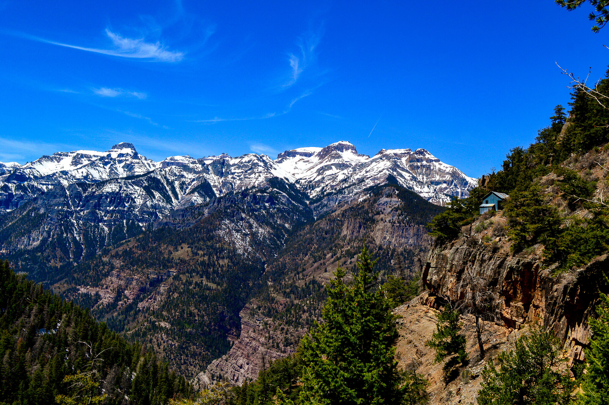
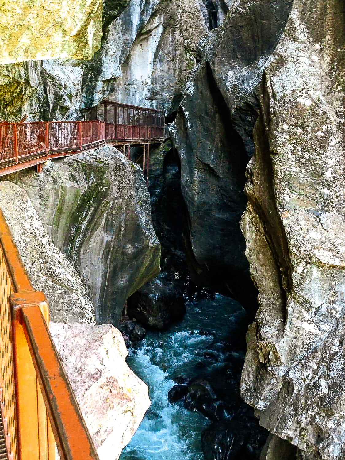
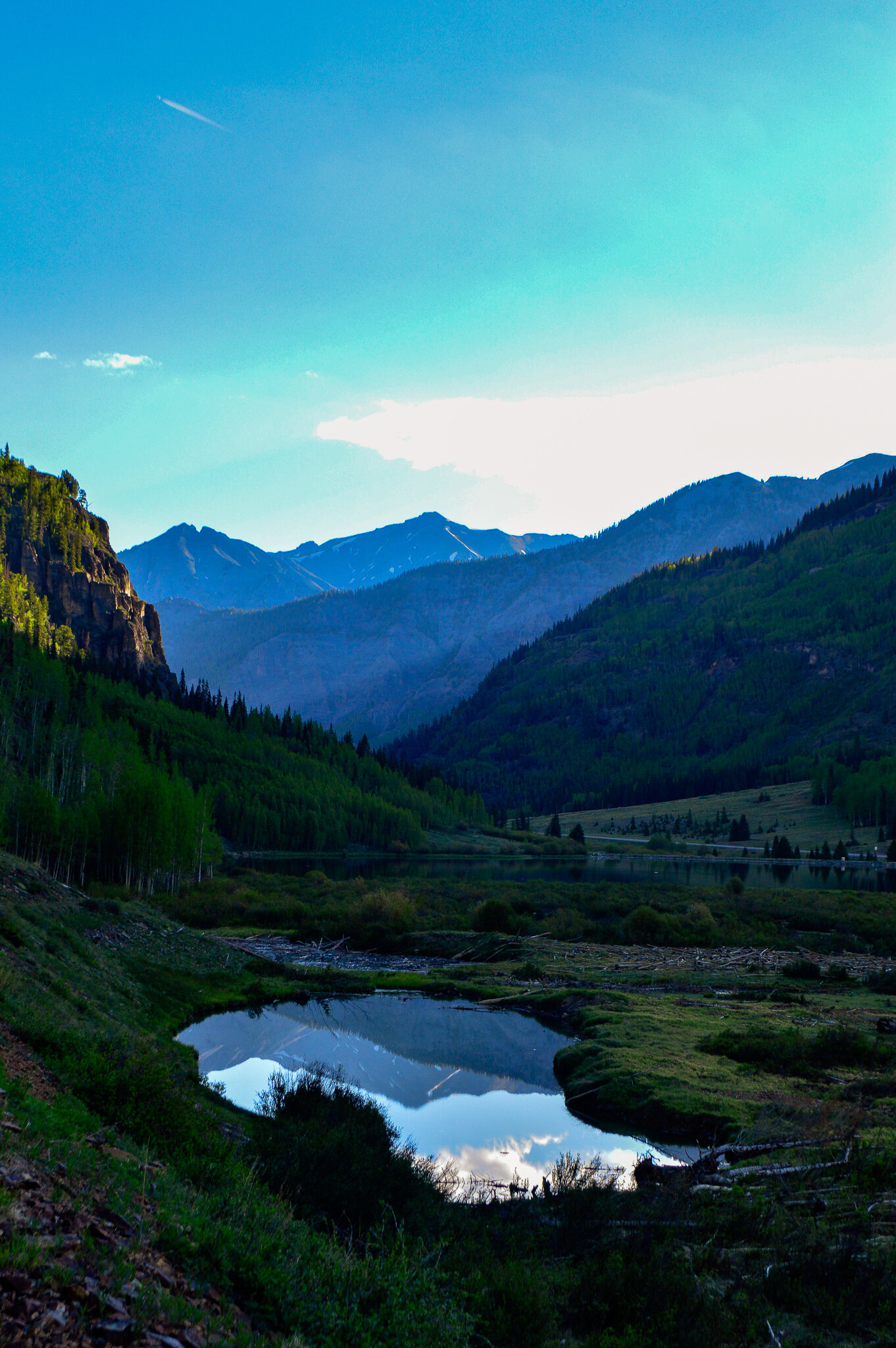
If you find yourself in Ouray, this is absolutely the first hike you should do. The milage is reasonable, the elevation gain is relatively minimal, and you get wonderful views of Ouray and a history lesson of the area. On top of that, you cross 5 bridges, view 4 waterfalls, and if you are lucky enough, might even find a hidden troll. This is also a great hike for families that are building up their hiking muscles as you are never more than 500 ft vertically or ½ mile horizontally from Ouray’s City limits, which means you can leave the trail and return to town without having to hike the entire length.
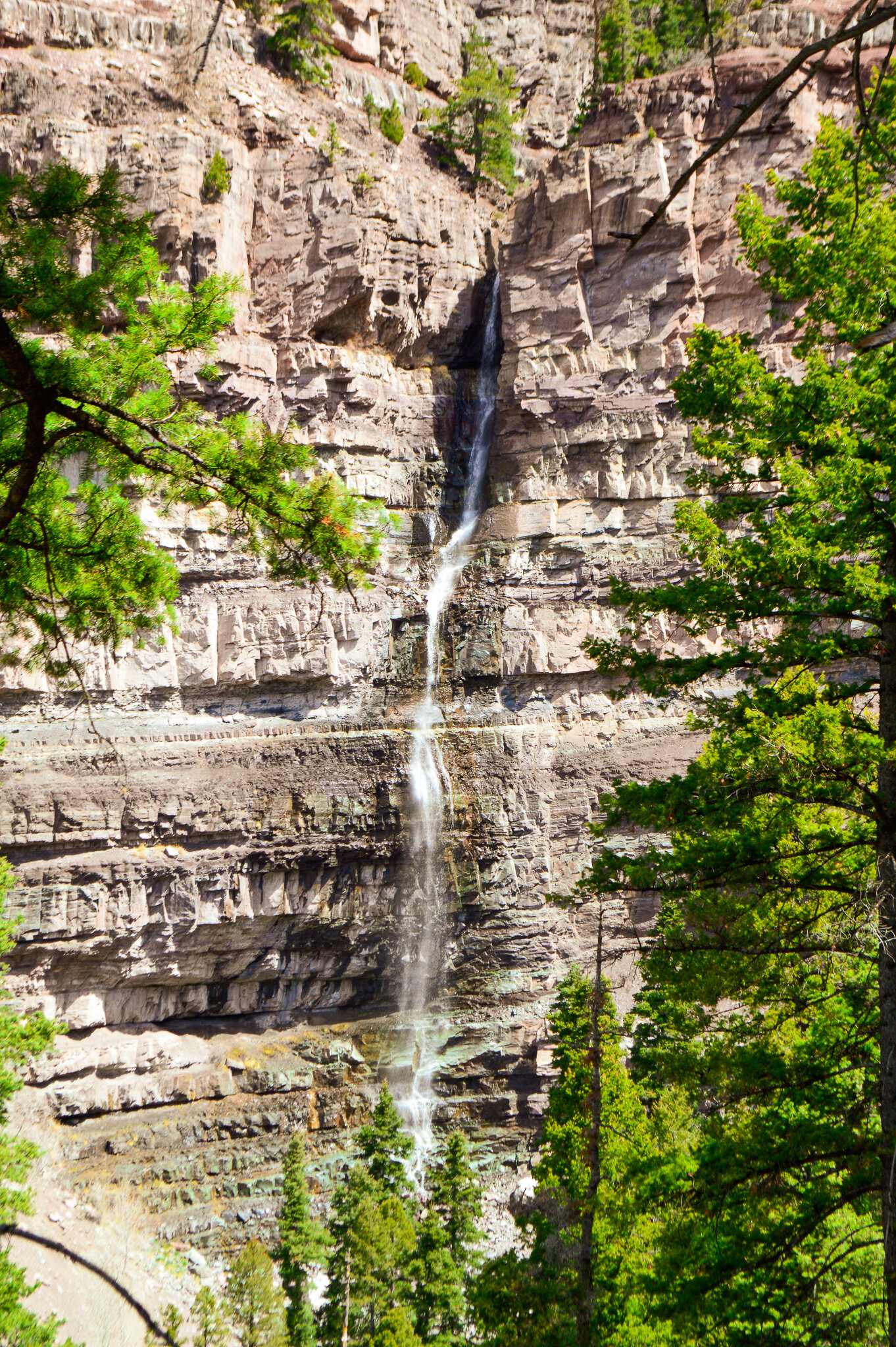
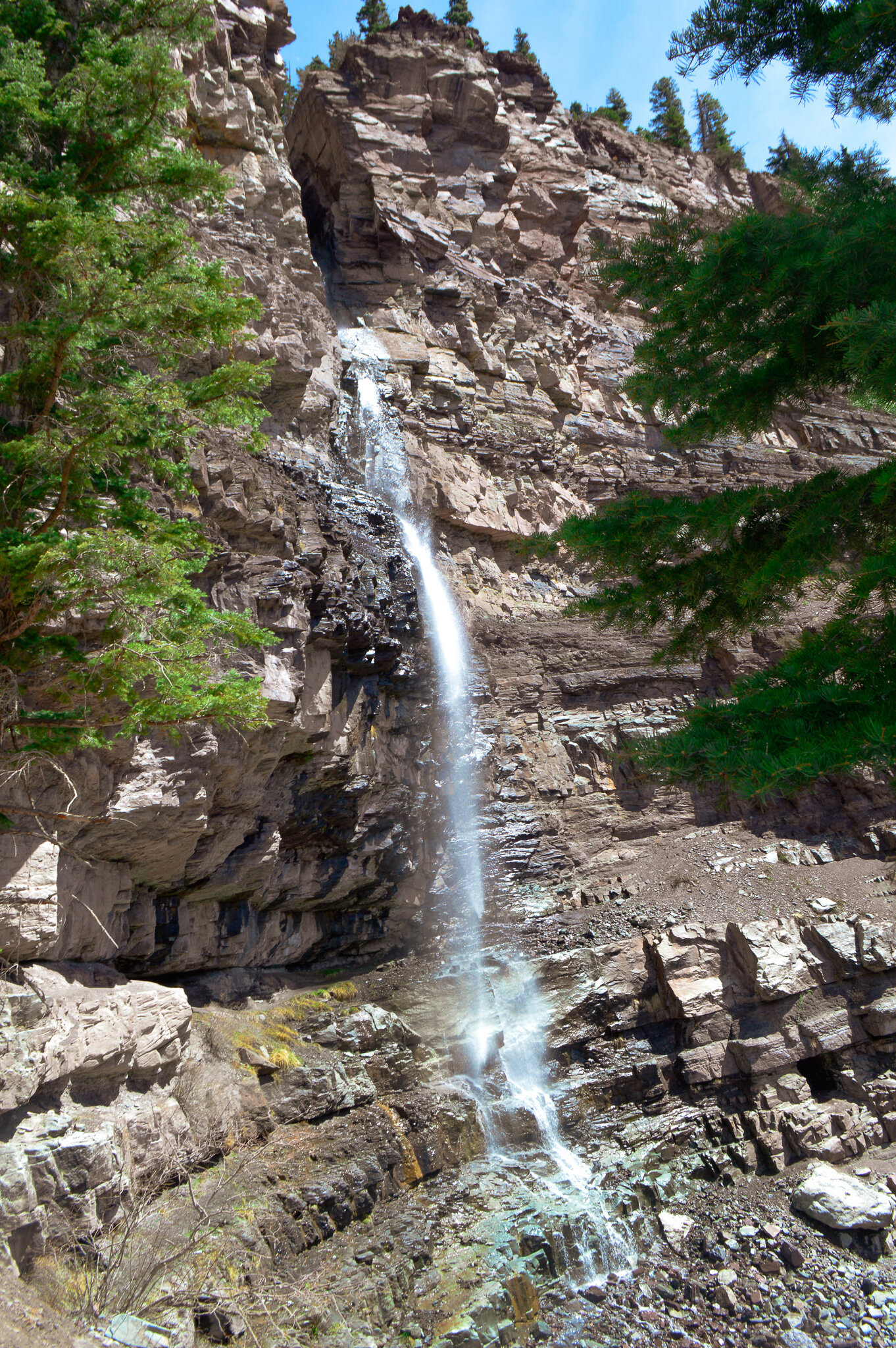
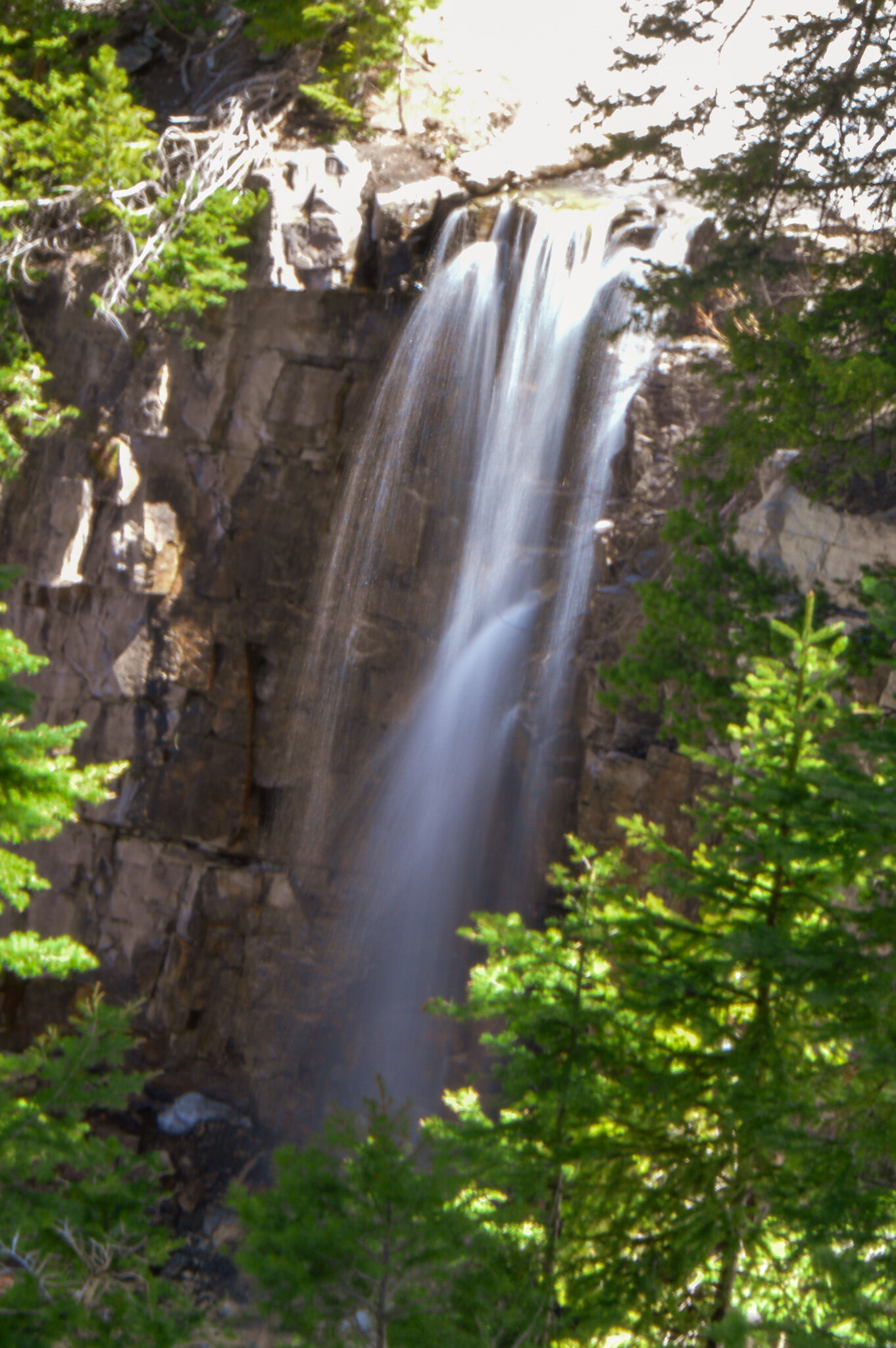
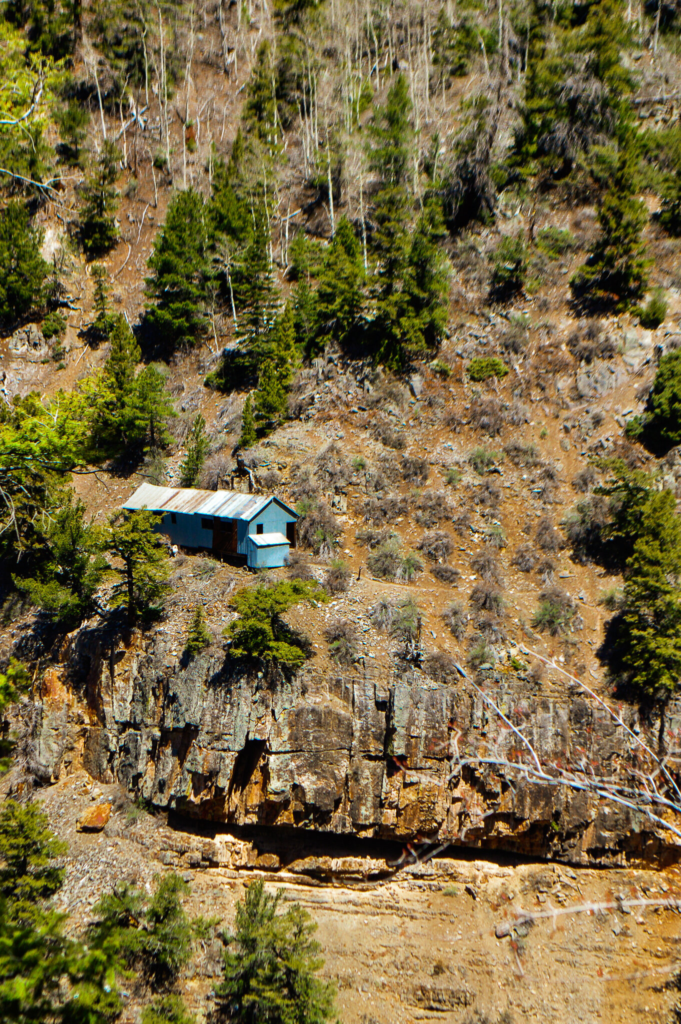
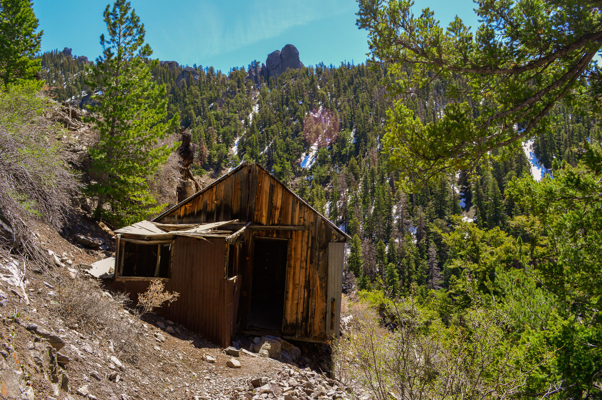
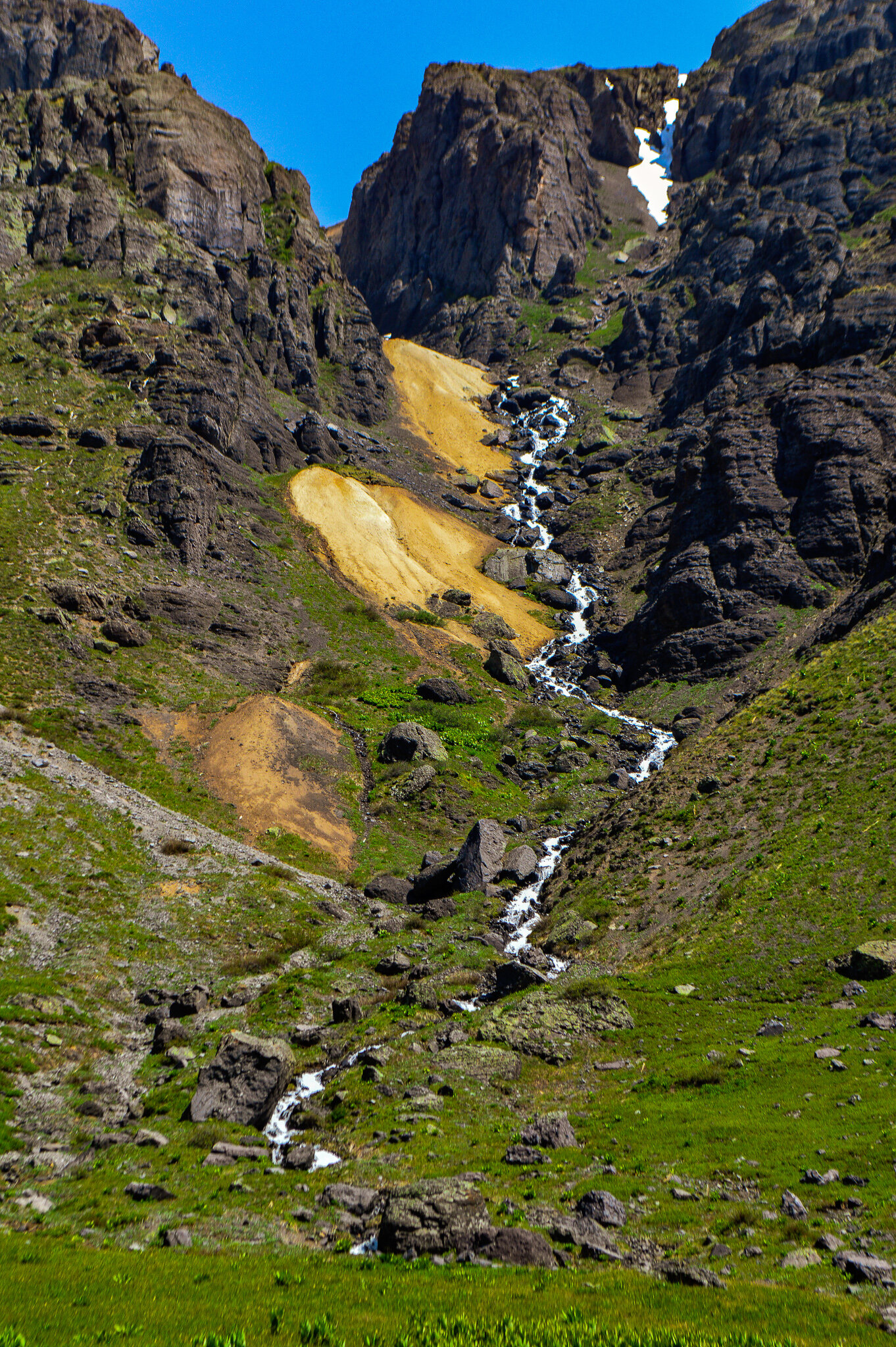
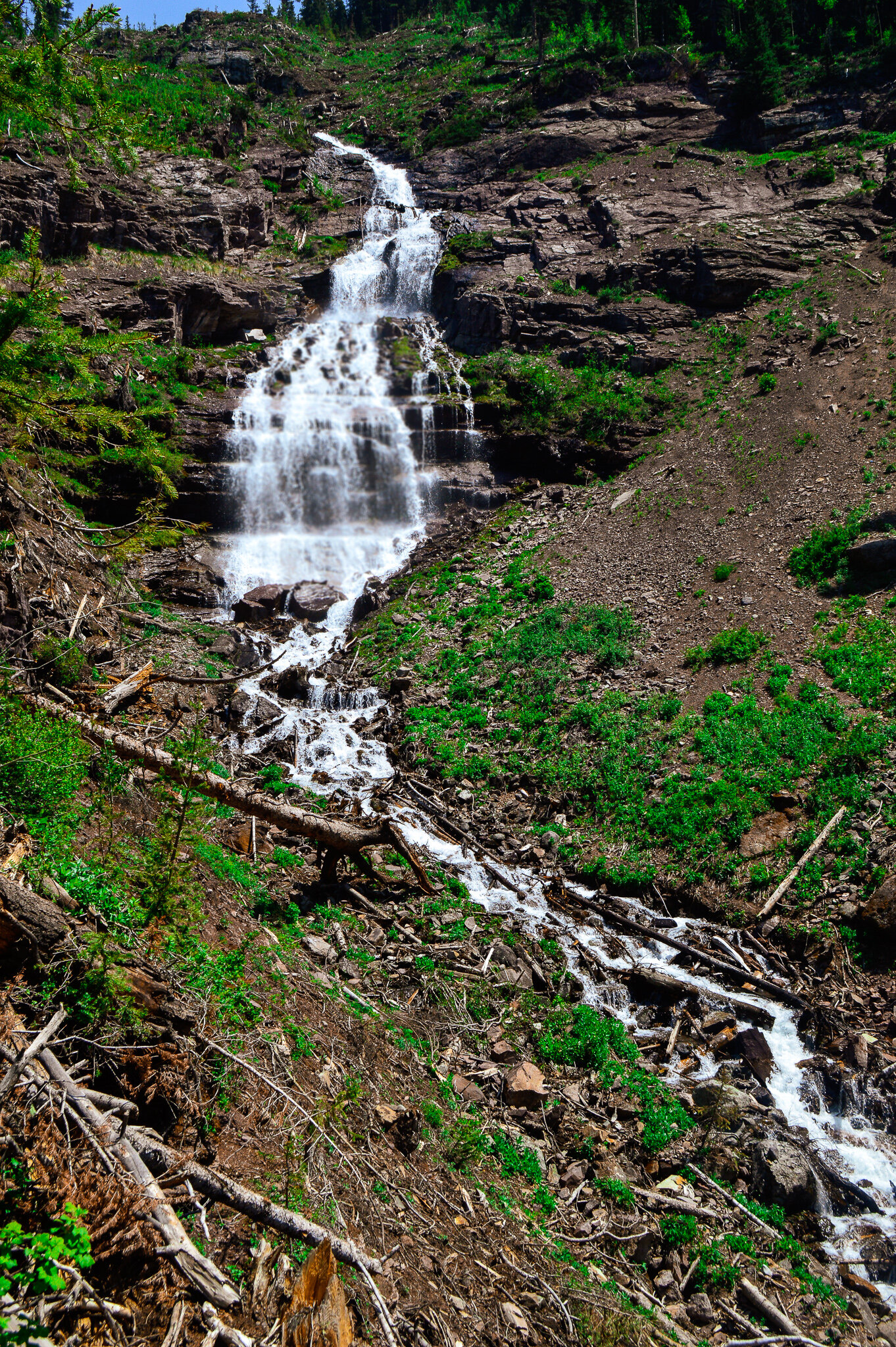
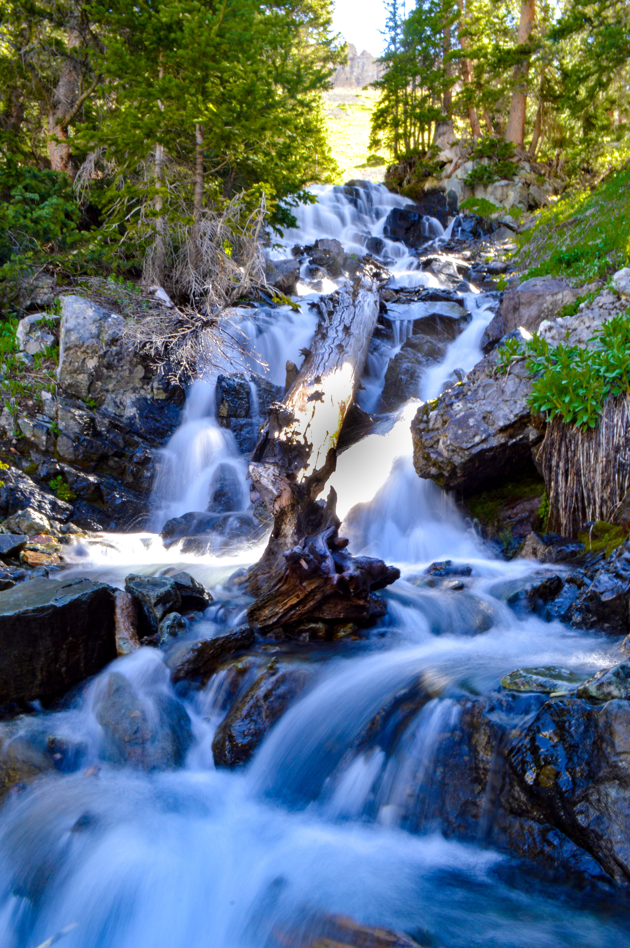
This trail is also a great launching point for several other trails or attractions in the Ouray area, making it the perfect place to sample larger hikes without the full commitment. Our family certainly took advantage of this! Cascade Falls is by far one of our favorite hiking destinations in Ouray, taking hikers to the base of a series of seven waterfalls that carry snowmelt off the mountains and down to one of two flumes through Ouray. While the lower section of falls is situated on the Perimeter trail, you can hike to the upper falls from a side trail that gains over 1,100 ft in just under a mile (aka, STEEP!). But once at the upper falls, you can cross the falls themselves and head to the remnants of Chief Ouray Mine.
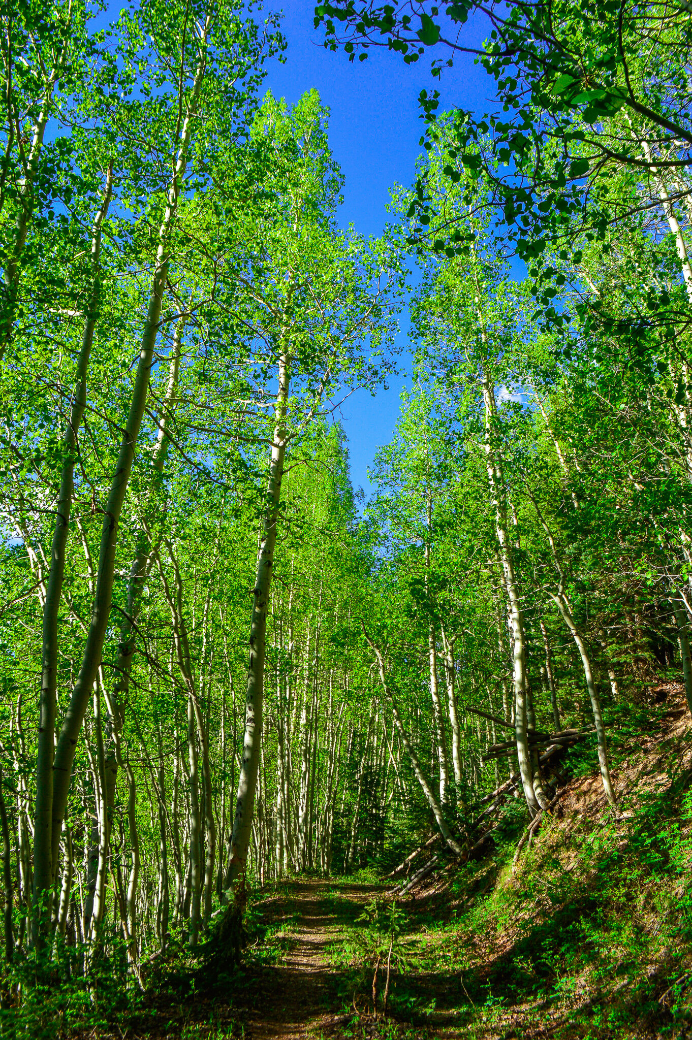
The Baby Bathtubs trail also makes up a section of the Perimeter trail, and was a perfect size section for the kids to enjoy as a day hike. The hike itself is easy, as it wanders thru the forest and along Little Portland Creek. With lots of rock formations that look like “bathtubs” this section was great on a warm day for the kids to frolic in the stream and find their own little tub to play in.
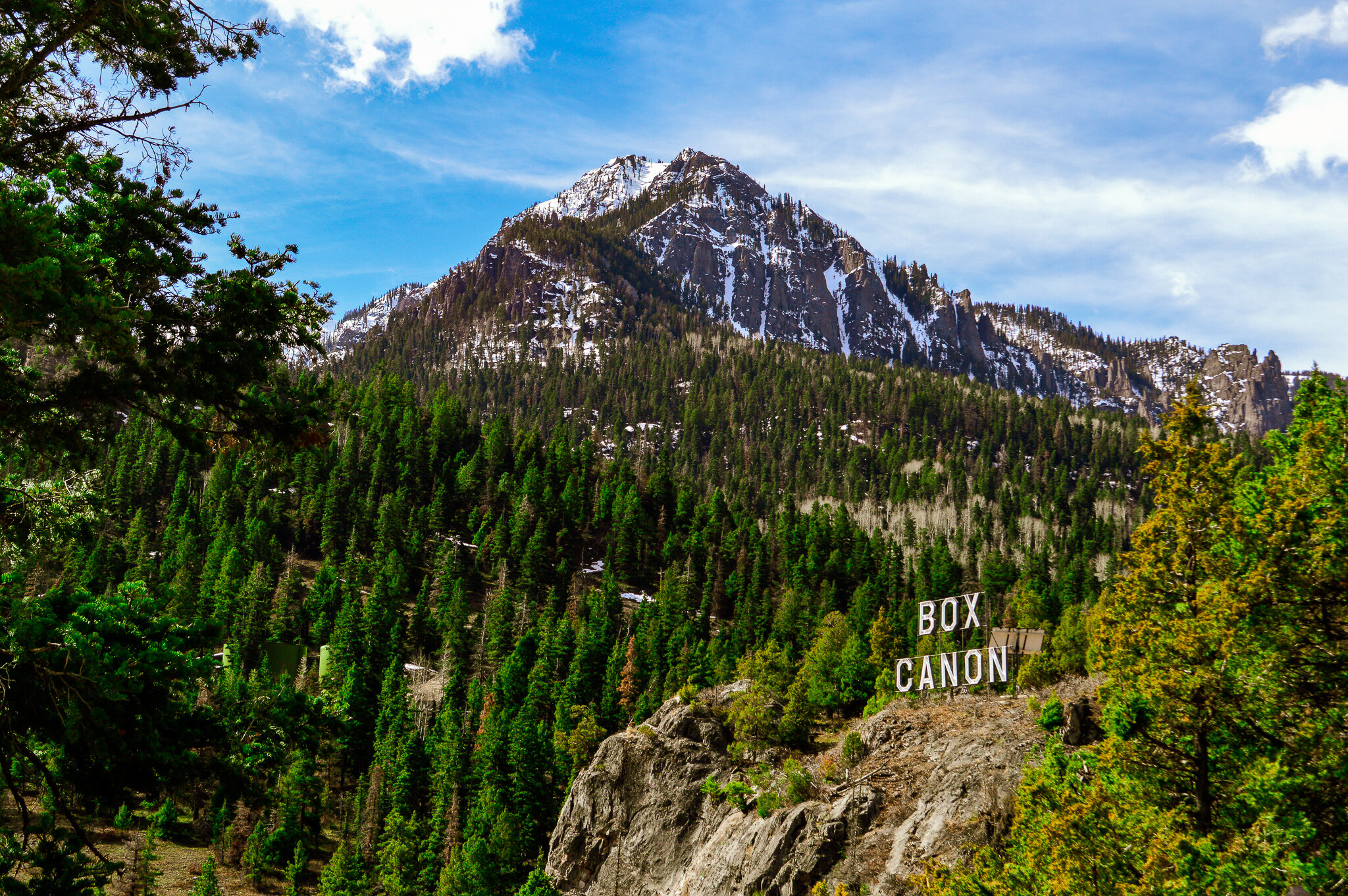
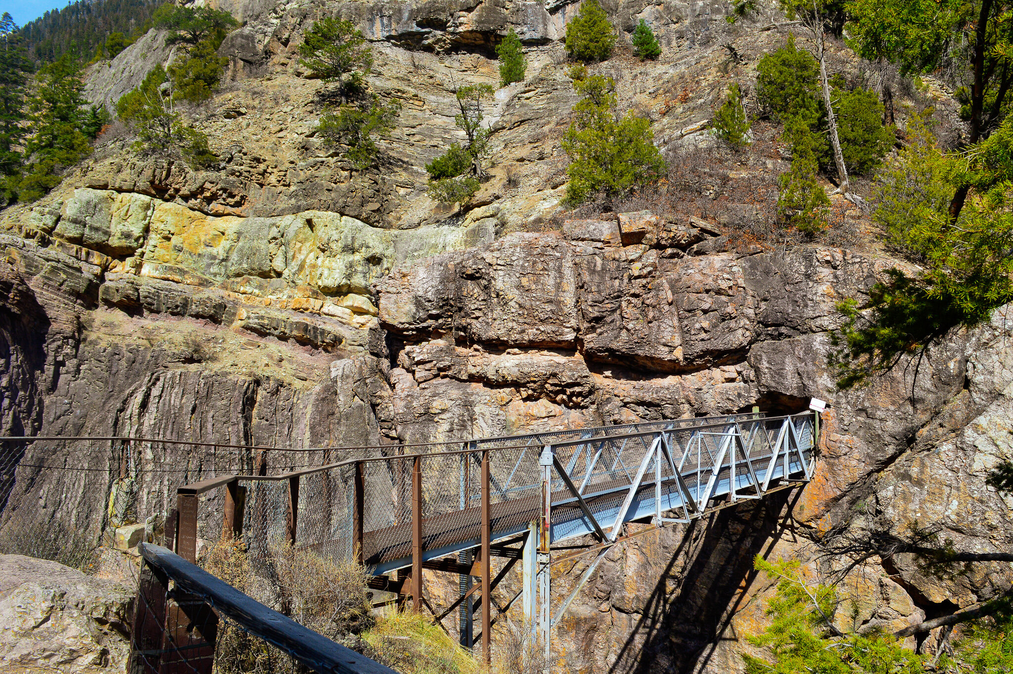
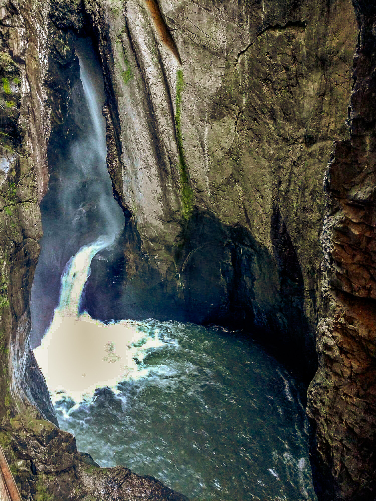
Just past the highest elevation on the Perimeter trail (8,500 ft), you descend down into a natural gorge that follows the Uncompahgre River. Here you will find access to Ouray’s world-famous Ice Park, a non-profit ice climbing park that that hosts yearly ice climbing festivals for the world’s best ice and mixed climbing talent. While our family did not visit this park (I hear ice climbing is a bit advanced for a 2 yr old), you can still see the incredible walls of ice from the trail. Just beyond the ice park is Box Canyon high bridge – a suspension bridge that sits over 200 ft above Canyon Creek's spectacular gorge. The bridge and tunnel are worth the climb, though our family enjoyed visiting Box Canyon Park from the lower section of the canyon where you can access Box Canyon Falls, a 285 ft waterfall with quartzite walls that extend almost 100-ft past the falls.
While we completed the full Perimeter Trail the first week we arrived, it felt like our family kept returning to sections of the Perimeter trail on a weekly basis. This was the trail we took any family and friends who came up for a visit and is also the trail we would take to get a bit of solitude as the sun was setting over the San Juans. If you do one thing in Ouray, hike this trail!
Ice Lakes

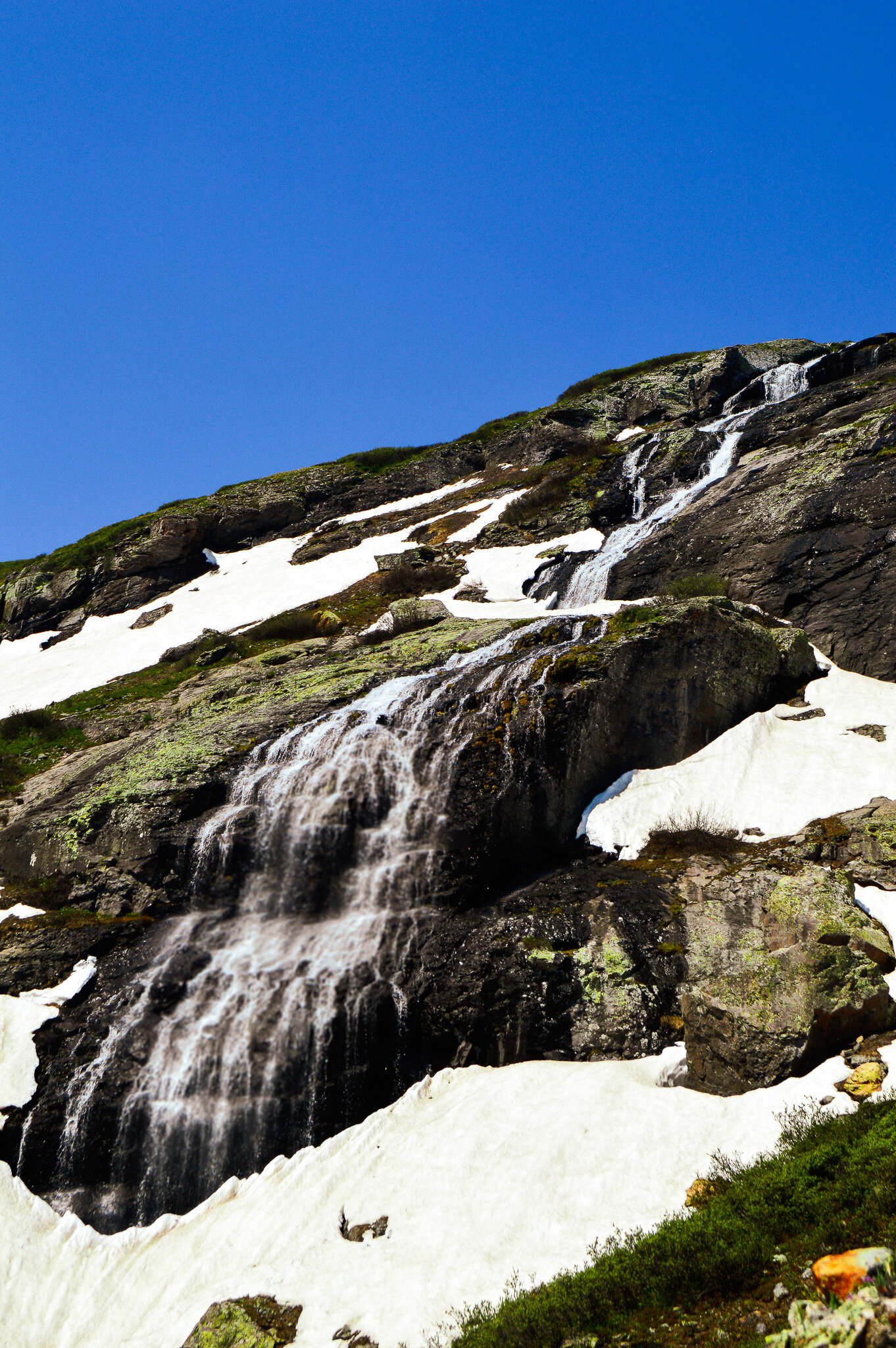
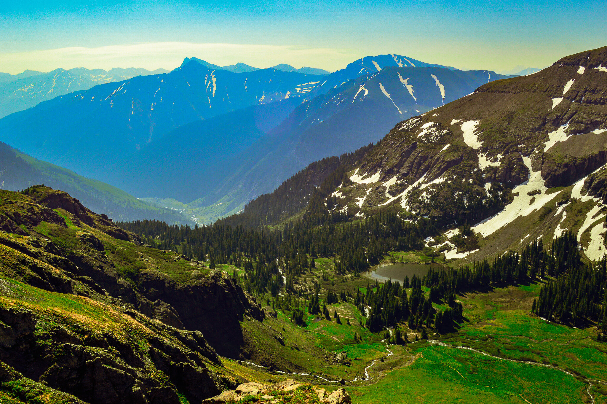
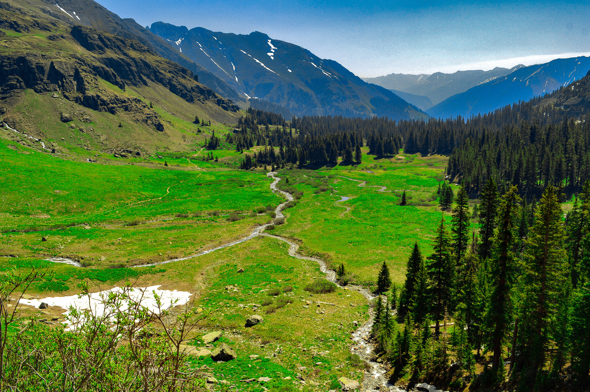
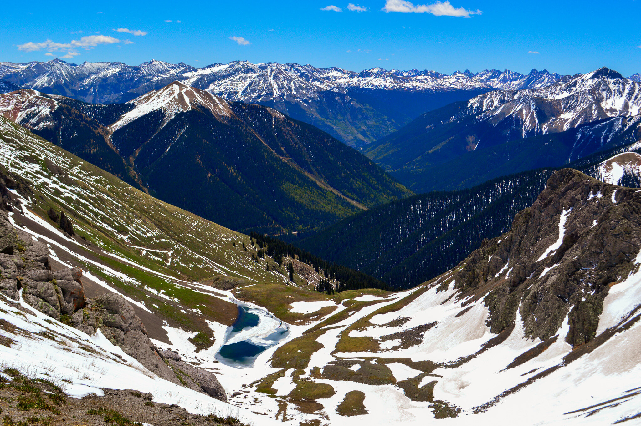
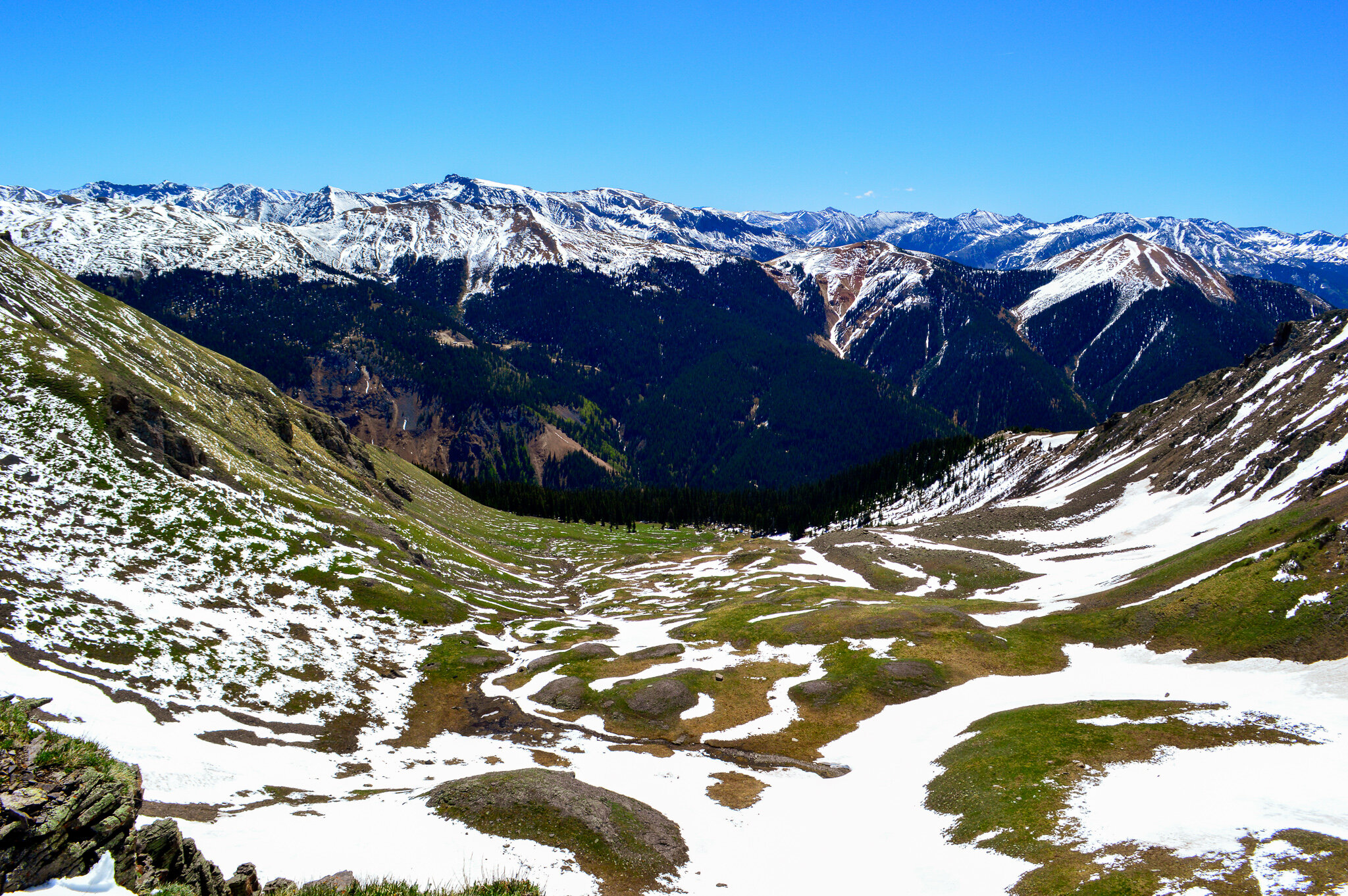
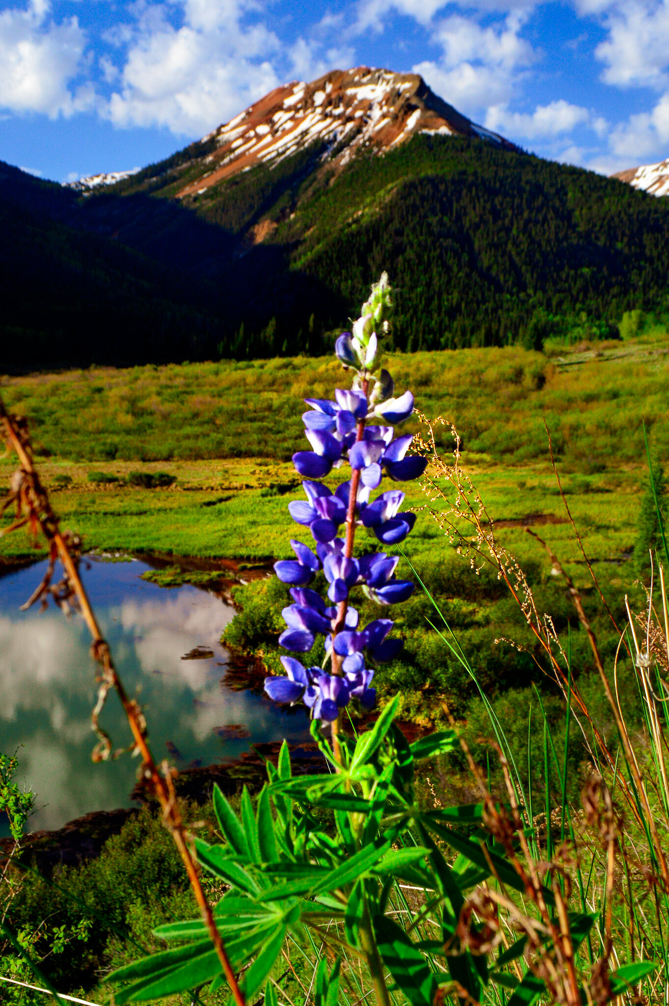
The aptly named Ice Lake is one of those hikes that at first seems like your average forest hike – sweeping canopies of thick conifer forest and switchbacks along a moderate grade. However, you quickly leave the forest behind for Lower Ice Lake Basin - a wildflower filled alpine meadow that is surrounded by waterfalls!! I counted 10 visible waterfalls from the middle of the meadow, and more varieties of wildflowers than I have ever seen. Truly breathtaking. Keep in mind, this basin sits at 11,400 ft, putting the actual Ice Lake at 12,274 ft – the trail is a total of 2430 ft of elevation gain over 12 miles, but this stretch between the basin (about mid-way thru the hike) and the lake is strenuous to say the least. But the work is worth it! Even in late June, the lake was still frozen over. There are trails from this lake to Island Lake and Fuller lake, for those looking to extend the hike, though in my opinion Ice Lake is unparalleled in beauty. Sitting in a valley of 13ers (Fuller Peak-13,761; Vermillion Peak-13,894ft; Golden Horn-13,780; Pilot Knob-13,738; and US Grant Peak-13,767ft), this extraordinary alpine lake should be on everyone’s bucket list that visits the Ouray area.
Blue Lakes

Lower Blue Lake
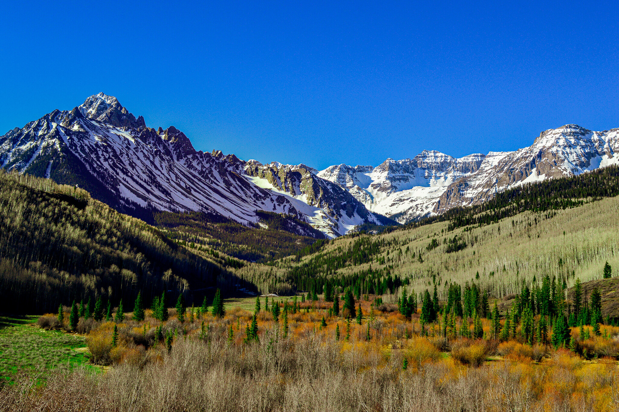
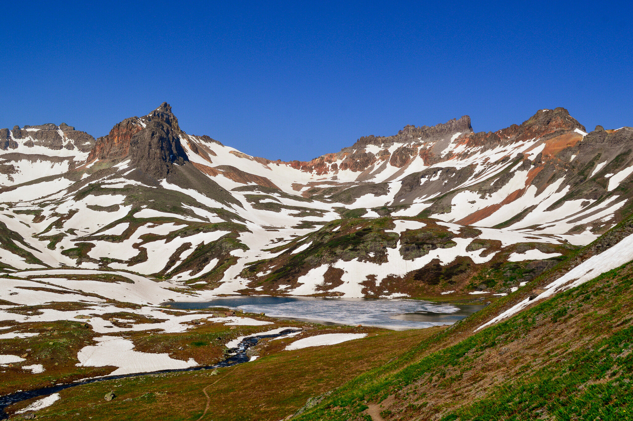
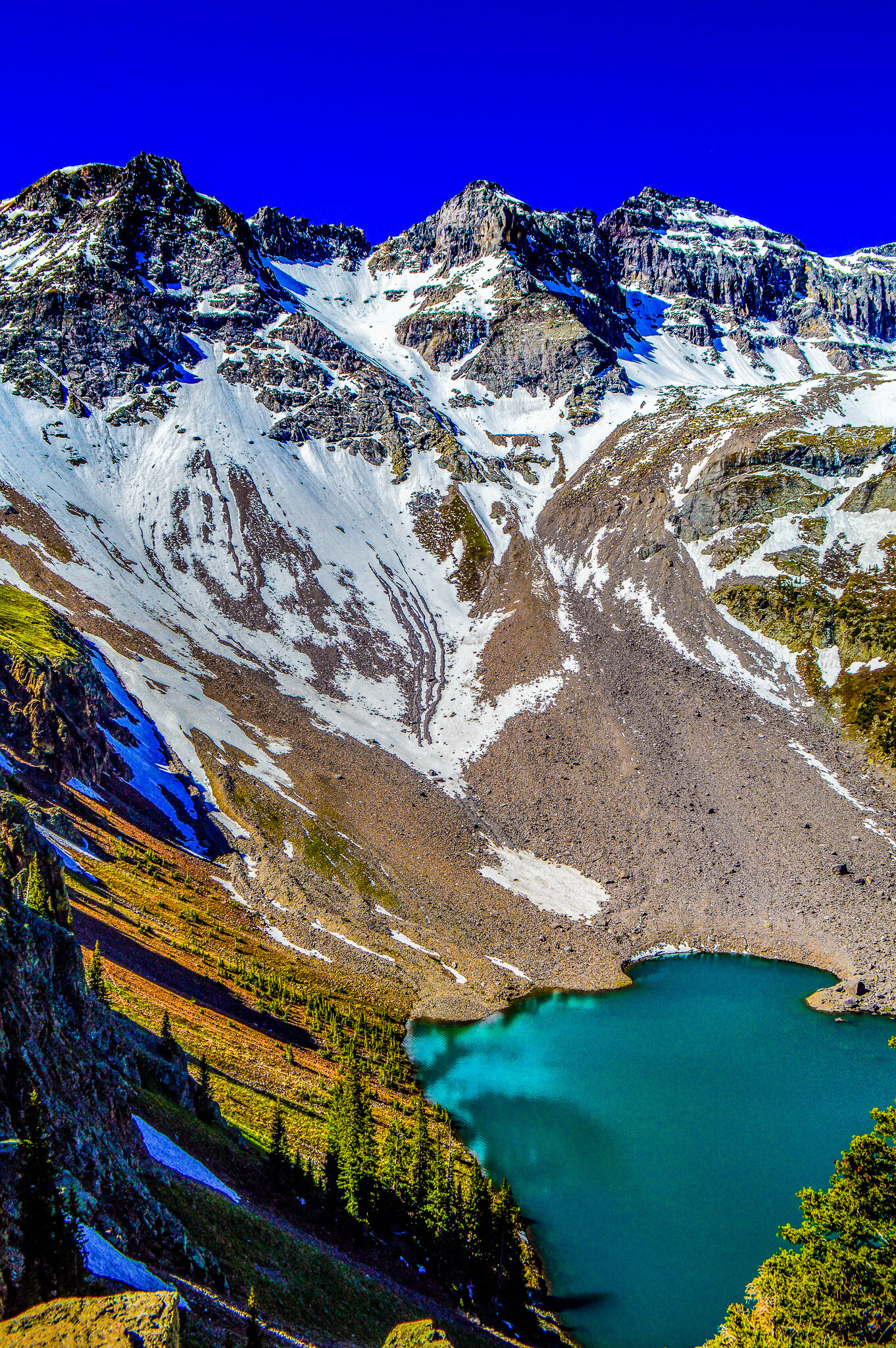
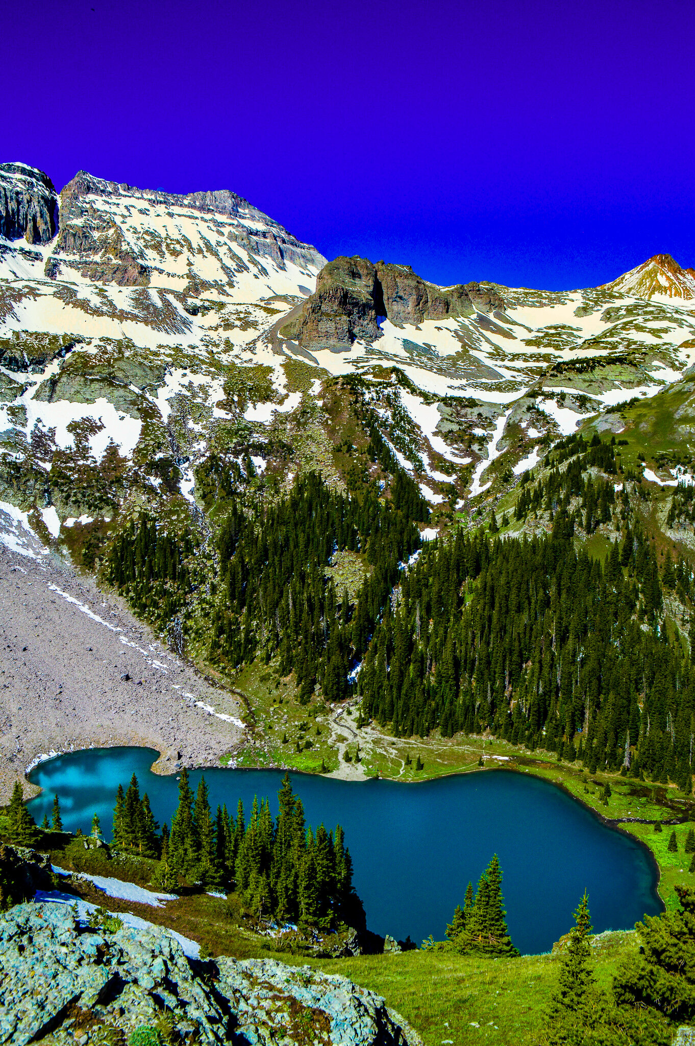
The Blue Lakes are another absolutely spectacular alpine hike for those wishing to see a color blue that is only found in nature. These lakes are in an extremely scenic glacial basin within the 16,566-acre Mt. Sneffels Wilderness area of the Uncompahgre National Forest. The drive to the trailhead is quite beautiful, though if you are like me, you are likely driving early enough in the morning that it is still dark! Just past the entrance gate, you pass the Blaine Basin Trail junction – I mention this as the trail for Blue Lakes is a small offshoot of this junction that is easy to miss. It is even easier to miss when there is still 2-3 ft of packed snow covering the trail and any signage. I discovered this on my first attempt, when I hiked for MILES and HOURS in the wrong direction into Blaine Basin....at least hiking into the Dallas Creek drainage area is still beautiful. After getting myself turned back around and on the right trail, I found snowshoeing thru recent avalanche fall out was both exhausting and totally awesome on my way up to Blue Lakes. With temps in the 65-degree range, surrounded by feet of snow, and being totally isolated (not even a footprint to guide me!), I found this first attempt to still be an enjoyable day of snowshoeing.
Attempt number two came almost a month later, when the snow had melted and been replaced by seas of sub-alpine and alpine wildflowers. When there is no snow, the hike feels quick and relatively easy – I even saw a family with young kids make it to the lower lake. Lower Blue Lake sits at an elevation of 10,980 ft and is the largest of the three lakes. The lake itself is one of the most incredible colors I have ever seen – truly something that could only be created from nature’s artistry. From the western shore, you have an exquisite view of Mt. Sneffels, towering above the lake.
I wrote about summitting Mt Sneffels in our first Ouray post, and since then a few folks have asked about the origins of the name “Sneffels.” From what I can tell, it was named by Frederic Endlich during the 1874 Hayden Expedition because he thought it looked like Mount Snaefell in Jules Verne’s “Journey to the Center of the Earth.”
In his novel, Jules Verne describes how professor Otto Lidenbrock’s expedition travels to a volcano in Iceland (Iceland’s Snæfellsjökull), which he believes will lead to the center of the Earth:
“We were now beginning to scale the steep sides of Snæfell. Its snowy summit, by an optical illusion not infrequent in mountains, seemed close to us, and yet how many weary hours it took to reach it! The stones, adhering by no soil or fibrous roots of vegetation, rolled away from under our feet, and rushed down the precipice below with the swiftness of an avalanche.” —Journey to the Center of the Earth, Chapter XV, “Snæfell At Last”
If any of you read my earlier post about summitting Mt. Sneffels, you can certainly see how this description fits closely with what we experienced. Though I find the next quote just as fitting, and something I experienced when reaching the Blue Lakes:
“I was thus steeped in the marvelous ecstasy which all high summits develop in the mind; and now without giddiness, for I was beginning to be accustomed to these sublime aspects of nature. My dazzled eyes were bathed in the bright flood of the solar rays. I was forgetting where and who I was, to live the life of elves and sylphs, the fanciful creation of Scandinavian superstitions. I felt intoxicated…” —Journey to the Center of the Earth, Chapter XVI, “Boldly Down the Crater”
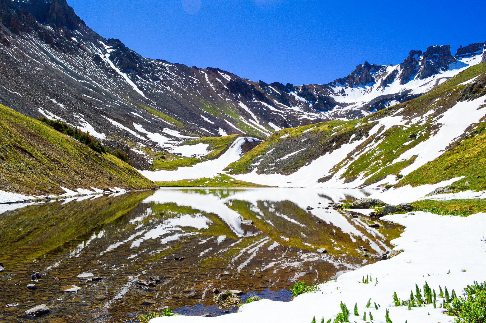
The upper lakes are a little over a half-mile from the lower lake, and given the steepness of the hike, attract far fewer hikers. However, the upper lakes provide more scenic panoramas of not only the glacial basin and Mt Sneffels, but of Dallas Peak-13,809ft and Gilpin Peak-13,694 ft.
Columbine Lake

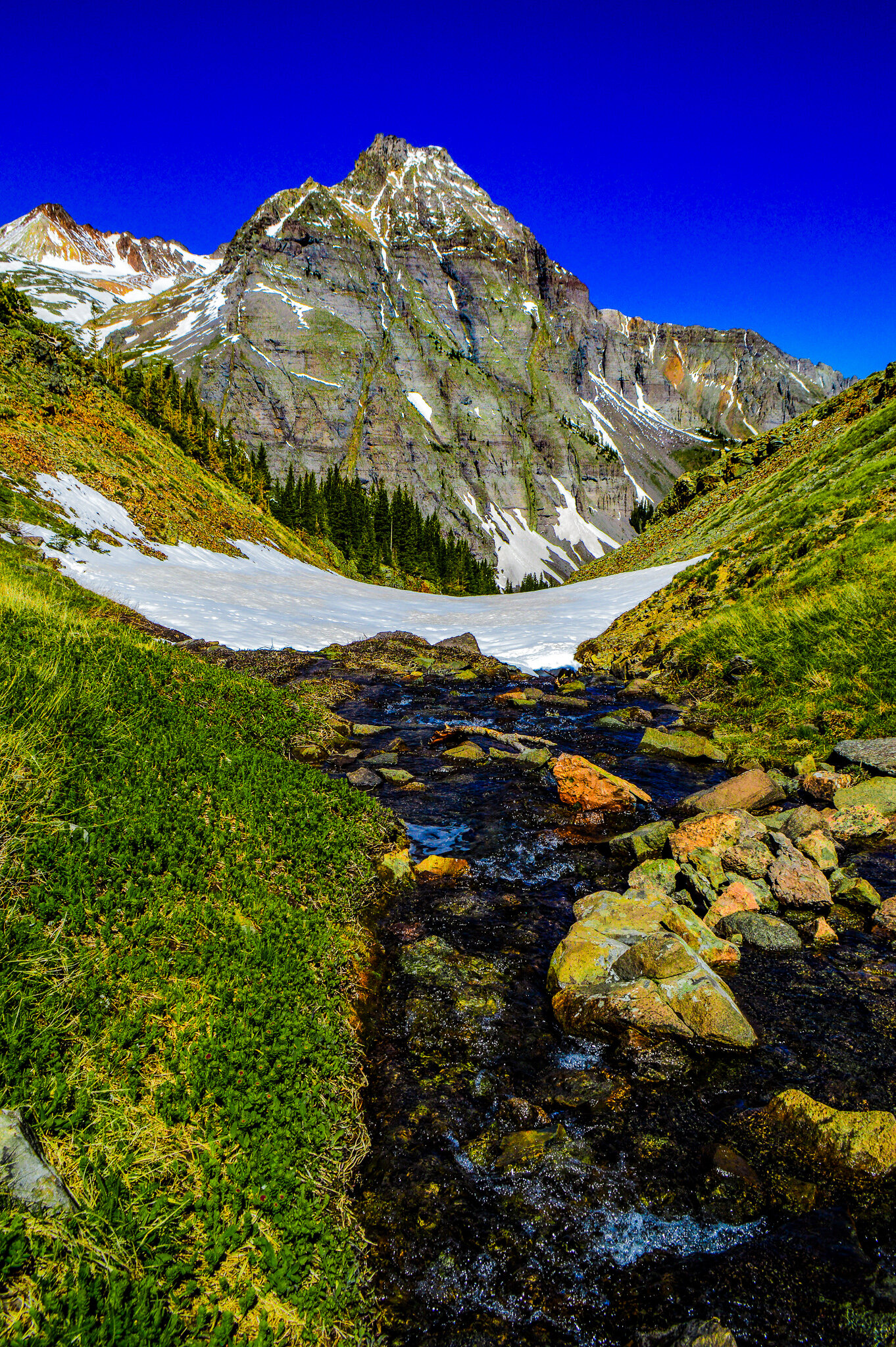
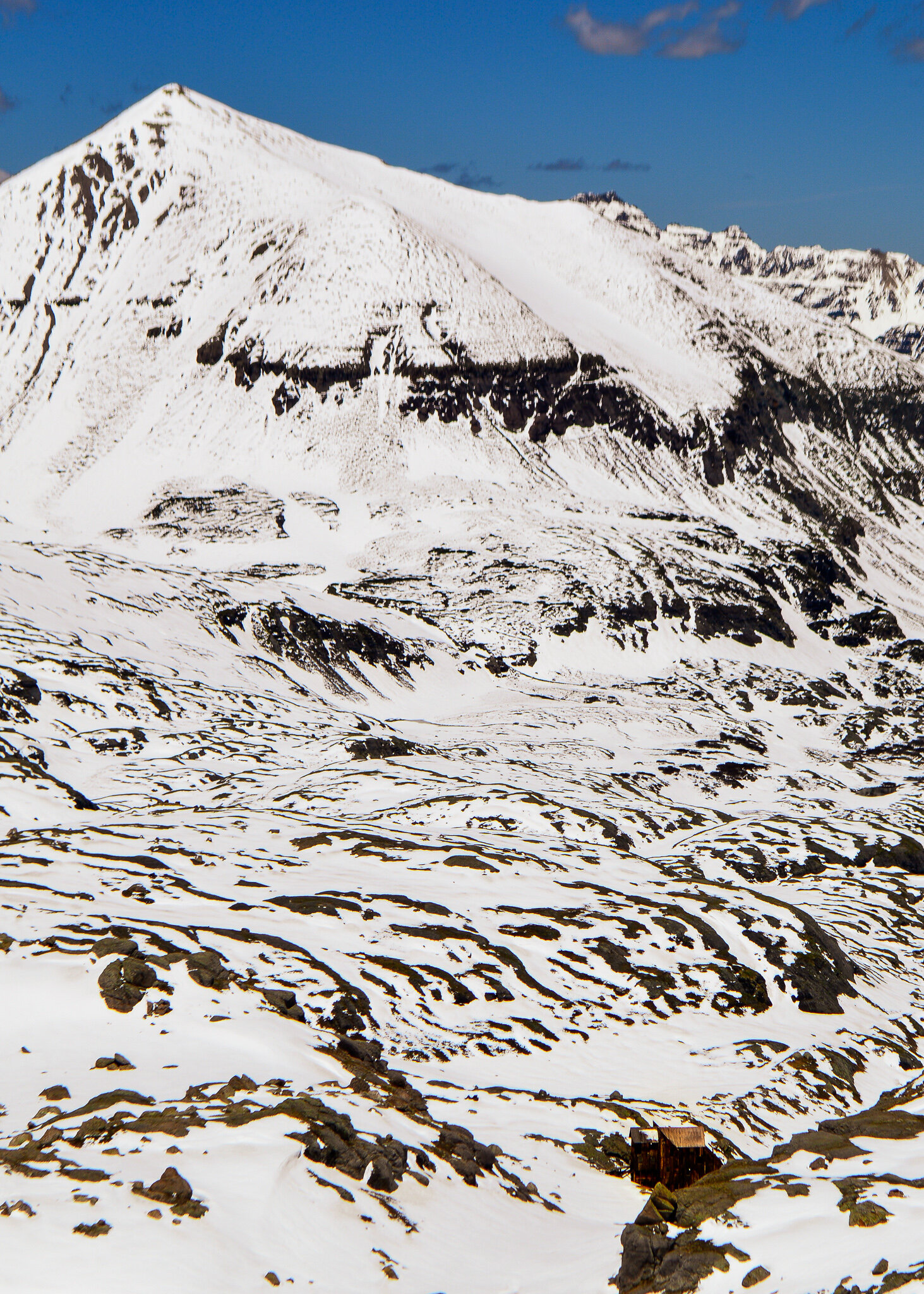
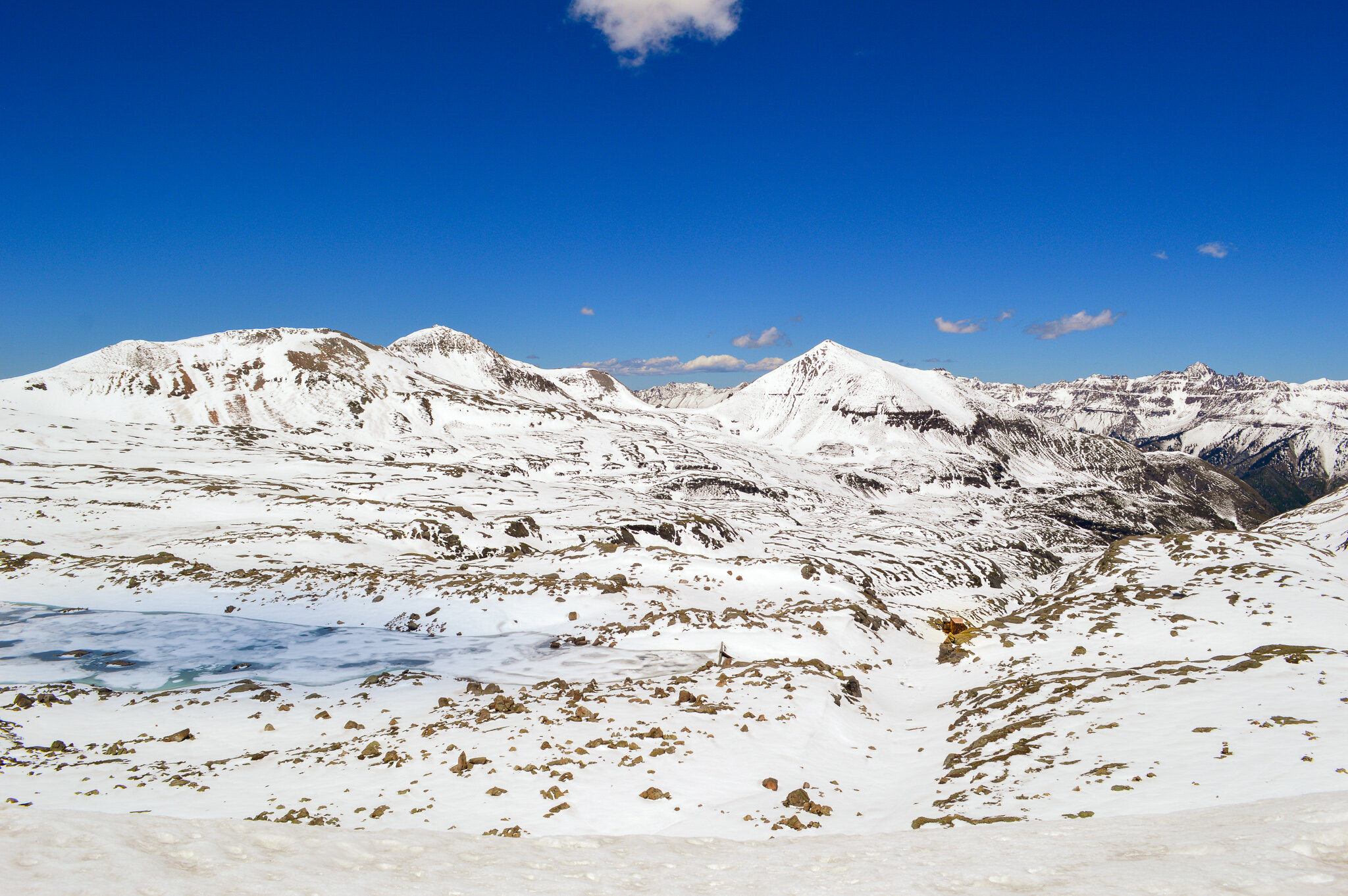
Columbine Lake was another lake that took a few attempts to conquer, but when achieved, felt like you were on your own private expedition thru a vast winter wilderness. After an initial climb up steep switchbacks, any human tracks had disappeared and only large animal tracks (I suspect bear!) were there as guidance. While this basin is typically sprinkled with wildflowers, snowshoeing was the only option as the basin and lake were covered in sheets of snow and ice, even in mid-June. After trekking thru the basin and leaving the last of the trees behind, the trail makes a wide arc to reach a saddle on the ridge, which sits at 12,541ft (that’s 2,195 ft of elevation gain from the trailhead!). Climbing down the saddle and into the Mill Creek drainage area, something rather magical happened – any remnants of the trail vanished, and while GPS ensured we weren’t completely lost, it became a “choose your own destiny” kind of hike. The kind of hike that is both alluring in your ability to be creative and feel like an “adventurer,” but also the kind of hike that can be dangerous. With enough snow to completely cover the lake, and rivers of cold glacial water that you can hear rapidly rushing beneath the ice you stand on, every step is measured and risk calculated as you explore the snowy glacial bowl ringed by peaks over 13,000ft. With a bit of exploring and additional climbing, we reached the slopes of Columbine Pass – if you look closely, you can even see Lewis Mine and Mill, a preserved 5-story structure located just beyond Bridal Veil Basin. The mill felt like the only signs of civilization along the miles of snow-covered valley and was a good reminder that we had our own slice of civilization to return to. The hike home was easier (you can follow your own tracks!) but filled with the same ecstasy that Jules Verne described above.
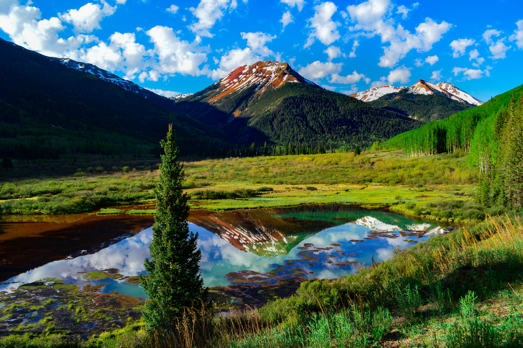
Mears Trail
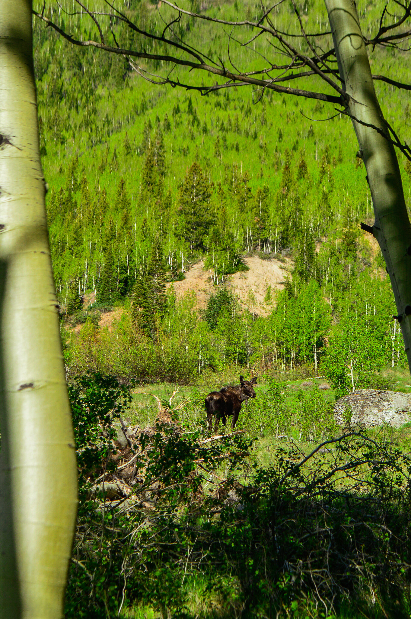
We found this trail on our drive between Ouray and Silverton as you pass the St. Germain Foundation stone building in Ironton Park. The stone building has quite the history; it’s worth a read. The hike itself is really nothing to write home about – easy, flat, short. What caught our eye however was the view of Crystal Lake and the Red Mountains from the Mears Dam. If you get to the dam before the sun comes over the crest of the mountains, you are provided with stunning reflective views of the mountains along the water’s surface. Talk about serenity!! Once again, I was hiking alone, with the beautiful birdsong to guide me thru the marshy wetland as I made my way thru groves of aspens and conifers. Well, I was alone until the moose came along! The moose clearly had eyes on me, and I can tell you after a moment of excitement at seeing my first moose, there was some added hustle in my step to ensure I made it safely back to the car.
Truly there are many more hikes we could recount. There are more beautiful pictures to show you and tales to relive of our wilderness adventures. Ouray is one of the most beautiful places we have ever been and narrowing our experience down to just these few posts was a challenge. But all good things must come to an end, so I will leave you with this: for many, the mountains are a spiritual place – native peoples have known this for centuries. Certainly, nature offers many benefits to a person, both mentally and physically. We have hiked all over the world (29 countries!!), and never have we felt more at home, more at peace, and more spiritually connected to Mother Earth as we did in Ouray.


